MyTopo
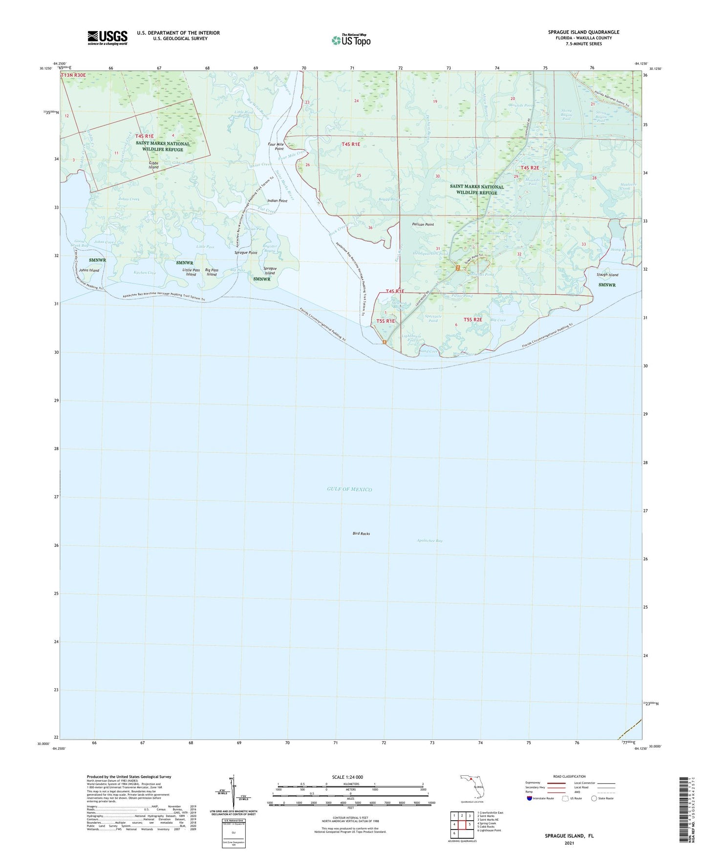
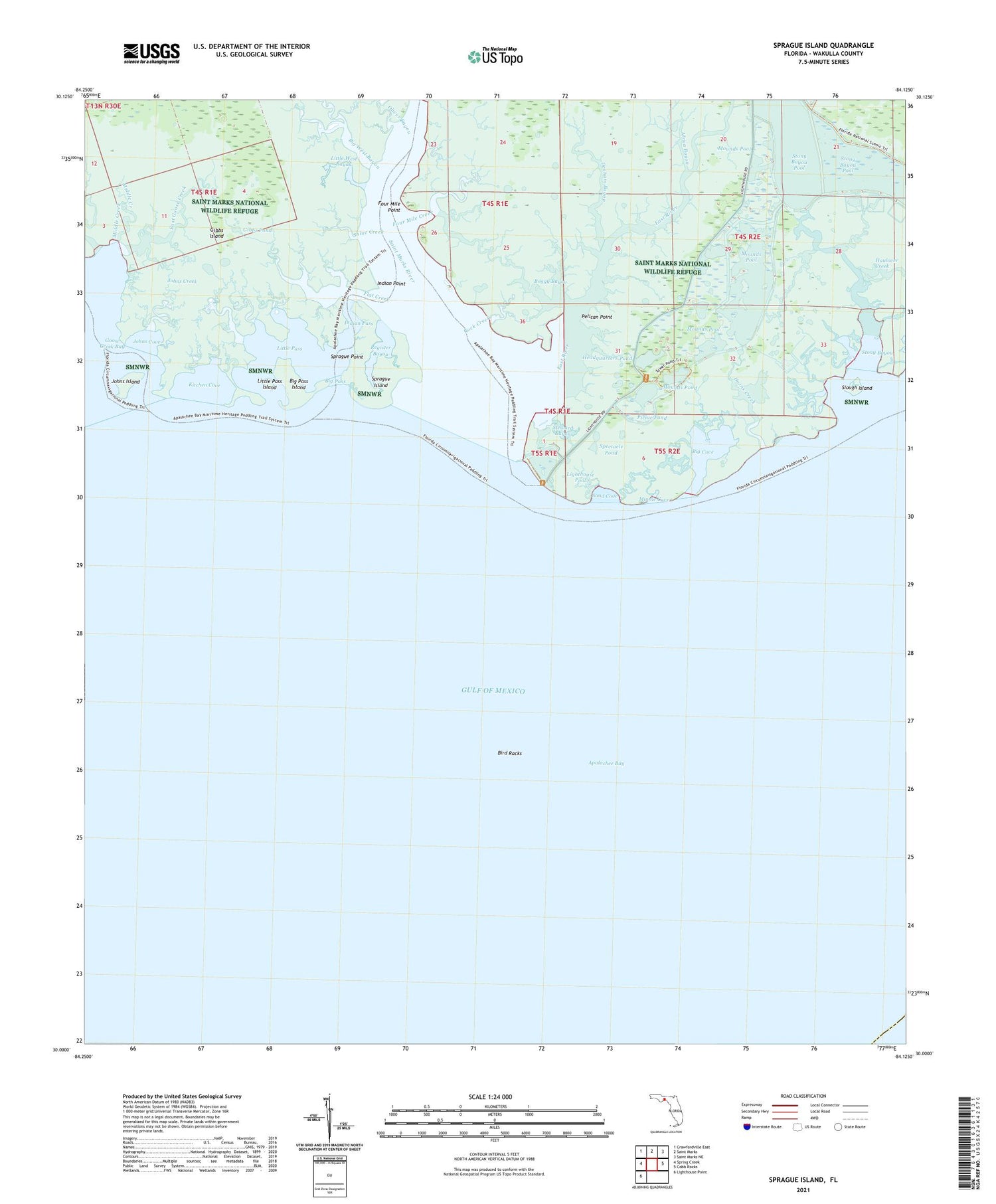
Sprague Island Florida US Topo Map
Couldn't load pickup availability
2025 topographic map quadrangle Sprague Island in the state of Florida. Scale: 1:24000. Based on the newly updated USGS 7.5' US Topo map series, this map is in the following counties: Wakulla. The map contains contour data, water features, and other items you are used to seeing on USGS maps, but also has updated roads and other features. This is the next generation of topographic maps. Printed on high-quality waterproof paper with UV fade-resistant inks.
Quads adjacent to this one:
West: Spring Creek
Northwest: Crawfordville East
North: Saint Marks
Northeast: Saint Marks NE
East: Cobb Rocks
Southwest: Lighthouse Point
This map covers the same area as the classic USGS quad with code o30084a2.
Contains the following named places: Africa Bayou, Apalachee Bay, Big Cove, Big Pass, Big Pass Island, Big West Bayou, Bird Racks, Boggy Bayou, Denham Bayou, East Goose Creek, East River, Flat Creek, Four Mile Creek, Four Mile Point, Gibbs Island, Gibbs Pond, Graves Creek, Haulover Creek, Headquarters Pond, Horns Creek, Indian Pass, Indian Point, Johns Cove, Johns Creek, Johns Island, Kitchen Cove, Lighthouse Pool, Little Denham Bayou, Little Pass, Little Pass Island, Little West Bayou, Middle Creek, Minnie Cove, Mound Lookout Tower, Mounds Pond, Mounds Pool, Oliver Bayou, Pelican Point, Picnic Pond, Register Bayou, Rock Creek, Saint Marks Light, Saint Marks National Wildlife Refuge, Saint Marks River, Sand Cove, Shine Creek, Slough Island, Spectacle Pond, Sprague Island, Sprague Point, Steward Bayou, Stony Bayou, Stony Bayou Pool