MyTopo
Cocoa Beach Florida US Topo Map
Couldn't load pickup availability
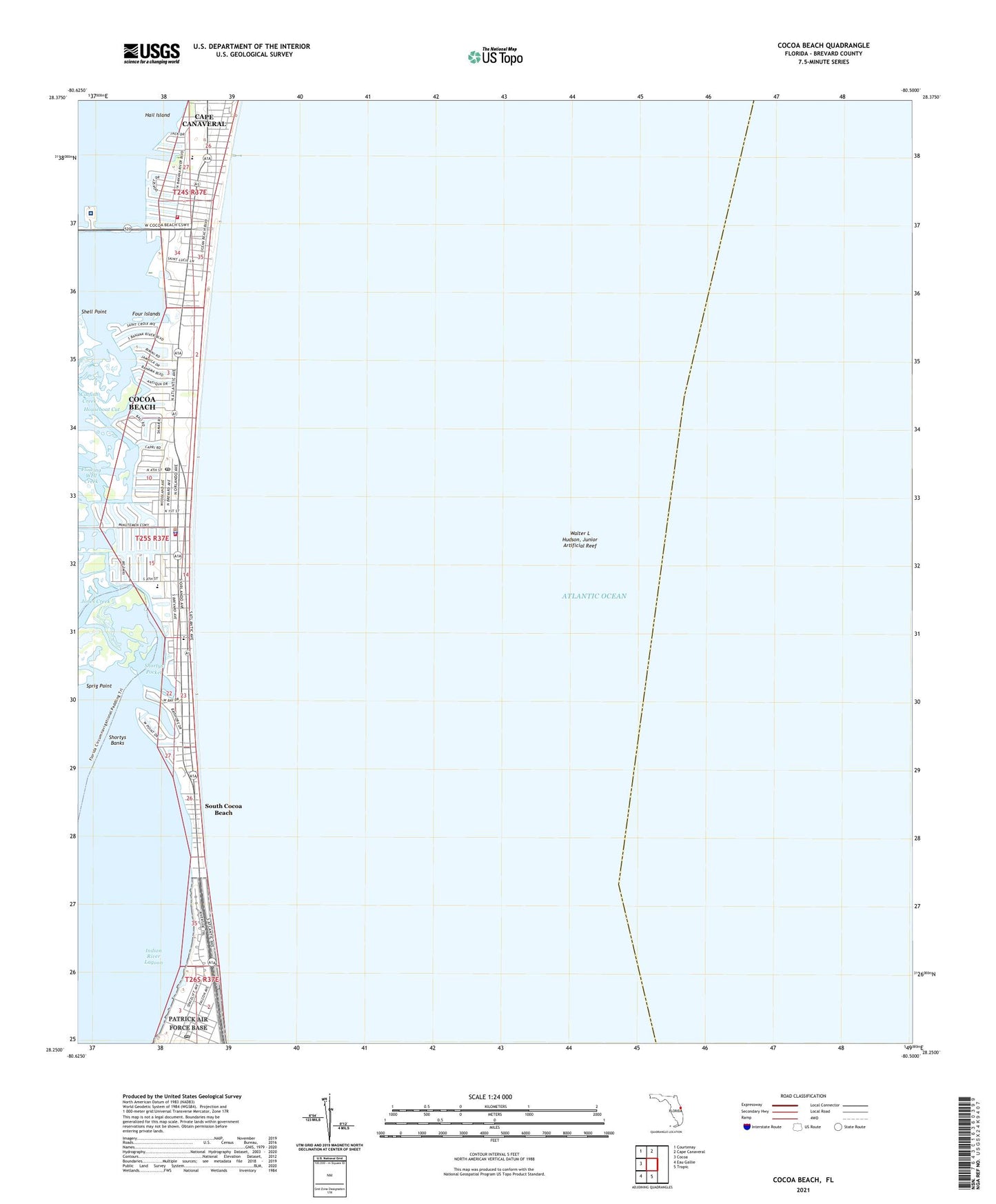
2024 topographic map quadrangle Cocoa Beach in the state of Florida. Scale: 1:24000. Based on the newly updated USGS 7.5' US Topo map series, this map is in the following counties: Brevard. The map contains contour data, water features, and other items you are used to seeing on USGS maps, but also has updated roads and other features. This is the next generation of topographic maps. Printed on high-quality waterproof paper with UV fade-resistant inks.
Quads adjacent to this one:
West: Cocoa
Northwest: Courtenay
North: Cape Canaveral
South: Tropic
Southwest: Eau Gallie
This map covers the same area as the classic USGS quad with code o28080c5.
Contains the following named places: Brevard County Fire Rescue Station 61 - Cocoa Beach Fire Department Station 1, Brevard County Rescue Station 61, Canaveral Plaza, Cape Canaveral Hospital, Catfish Creek, Cocoa Beach, Cocoa Beach Fire Department Station 1, Cocoa Beach Fire Department Station 2, Cocoa Beach Police Department, Cocoa Beach Post Office, Cocoa Beach Public Library, Cocoa Beach Trailer Park, Cocoa Beach-Cape Canaveral Division, Crescent Beach Trailer Court, Four Islands, Hail Island, Holy Trinity Episcopal School, Indian River Lagoon, Patrick Air Force Base Post Office, Shell Point, Shortys Banks, Shortys Pocket, South Cocoa Beach, Sprig Point, Walter L Hudson Junior Artificial Reef, ZIP Code: 32931