MyTopo
Courtenay Florida US Topo Map
Couldn't load pickup availability
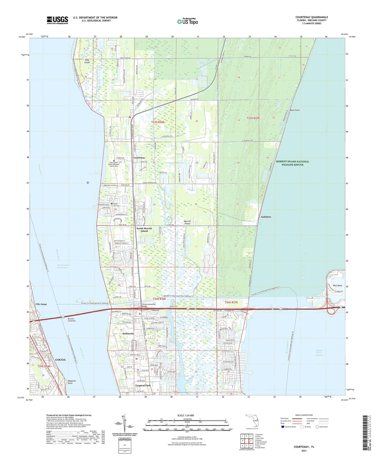
2024 topographic map quadrangle Courtenay in the state of Florida. Scale: 1:24000. Based on the newly updated USGS 7.5' US Topo map series, this map is in the following counties: Brevard. The map contains contour data, water features, and other items you are used to seeing on USGS maps, but also has updated roads and other features. This is the next generation of topographic maps. Printed on high-quality waterproof paper with UV fade-resistant inks.
Quads adjacent to this one:
West: Sharpes
Northwest: Titusville
North: Orsino
Northeast: False Cape
East: Cape Canaveral
Southeast: Cocoa Beach
South: Cocoa
Southwest: Lake Poinsett
This map covers the same area as the classic USGS quad with code o28080d6.
Contains the following named places: Audubon, Audubon Elementary School, Bennett Causeway, Brevard County Fire Rescue Station 40, Brevard County Fire Rescue Station 41, Brevard County Sheriff's Office East Precinct, Calvary Baptist Church, Canaveral Barge Canal, Canaveral Port Authority Cruise Terminal Number 10, Canaveral Port Authority Cruise Terminal Number 5 Wharf, Canaveral Port Authority Cruise Terminal Number 8 Wharf, Canaveral Port Authority Cruise Terminals Number 9, Central Church of Christ, Central Telemetry, Christa McAuliffe Bridge, Church of Christ of North Courtenay, Cocoa, Colony Park Mobile Home Village, Community Church of the Nazarene, Courtenay, Divine Mercy Catholic School, Duck Point, Exceptional Education Center, Faith Lutheran Preschool and Kindergarten, Flatboat Creek, Gardendale Elementary School, Harbor Square Marina, Harbortown Marina at Canaveral, Indianola, Island Lakes Mobile Home Park, Kars Park, Kelly Park, Kingdom Hall of Jehovahs Witnesses, Kings Park, Lewis Carroll Elementary School, Lighthouse Christian Church, Long Marsh Golf Club, Magnolia Point, Merritt Country Mobile Home Park, Merritt Island Christian School, Merritt Island High School, Merritt Island Post Office, Merritt Island Public Library, Merritt Island Volunteer Fire Department, Middle Banks, Mount Olive Church, Mount Tabor Church, Mount Zion Church, New Port Marina Pier, North Merritt Island, North Merritt Island Census Designated Place, North Merritt Island United Methodist Church, Orsino Baptist Church, Our Saviors School, Palm Chapel, Pine Island, Pine Island Creek, Saint Lukes Episcopal Church, Saint Luke's Parish Episcopal Church Cemetery, Saint Marks Episcopal Day School, Sykes Creek, Town and Country Trailer Park, Tropical Park, Tropical Park Census Designated Place, Unity Church of Central Brevard, West Basin, White Lily Cemetery, ZIP Code: 32953