
MyTopo
Corkscrew Florida US Topo Map
Couldn't load pickup availability
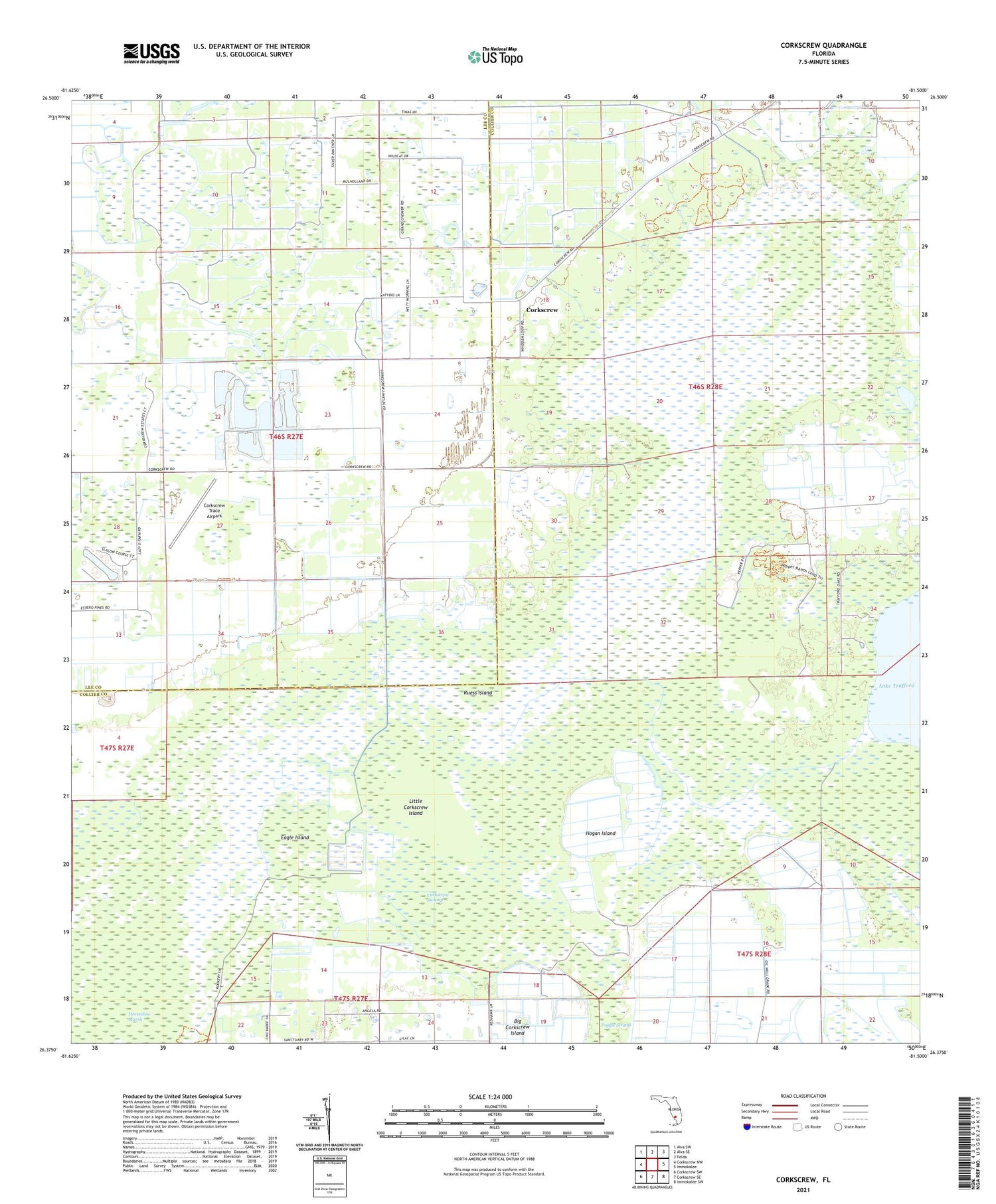
2024 topographic map quadrangle Corkscrew in the state of Florida. Scale: 1:24000. Based on the newly updated USGS 7.5' US Topo map series, this map is in the following counties: Collier, Lee. The map contains contour data, water features, and other items you are used to seeing on USGS maps, but also has updated roads and other features. This is the next generation of topographic maps. Printed on high-quality waterproof paper with UV fade-resistant inks.
Quads adjacent to this one:
West: Corkscrew NW
Northwest: Alva SW
North: Alva SE
Northeast: Felda
East: Immokalee
Southeast: Immokalee SW
South: Corkscrew SE
Southwest: Corkscrew SW
This map covers the same area as the classic USGS quad with code o26081d5.
Contains the following named places: Big Hammock, Carson Gully, Corkscrew, Corkscrew Swamp, Corkscrew Swamp Sanctuary, Corkscrew Trace Airpark, Eagle Island, Hogan Island, Little Corkscrew Island, Poggie Strand, Ruess Island, WHEW-FM (Fort Myers)


