
MyTopo
Alva SE Florida US Topo Map
Couldn't load pickup availability
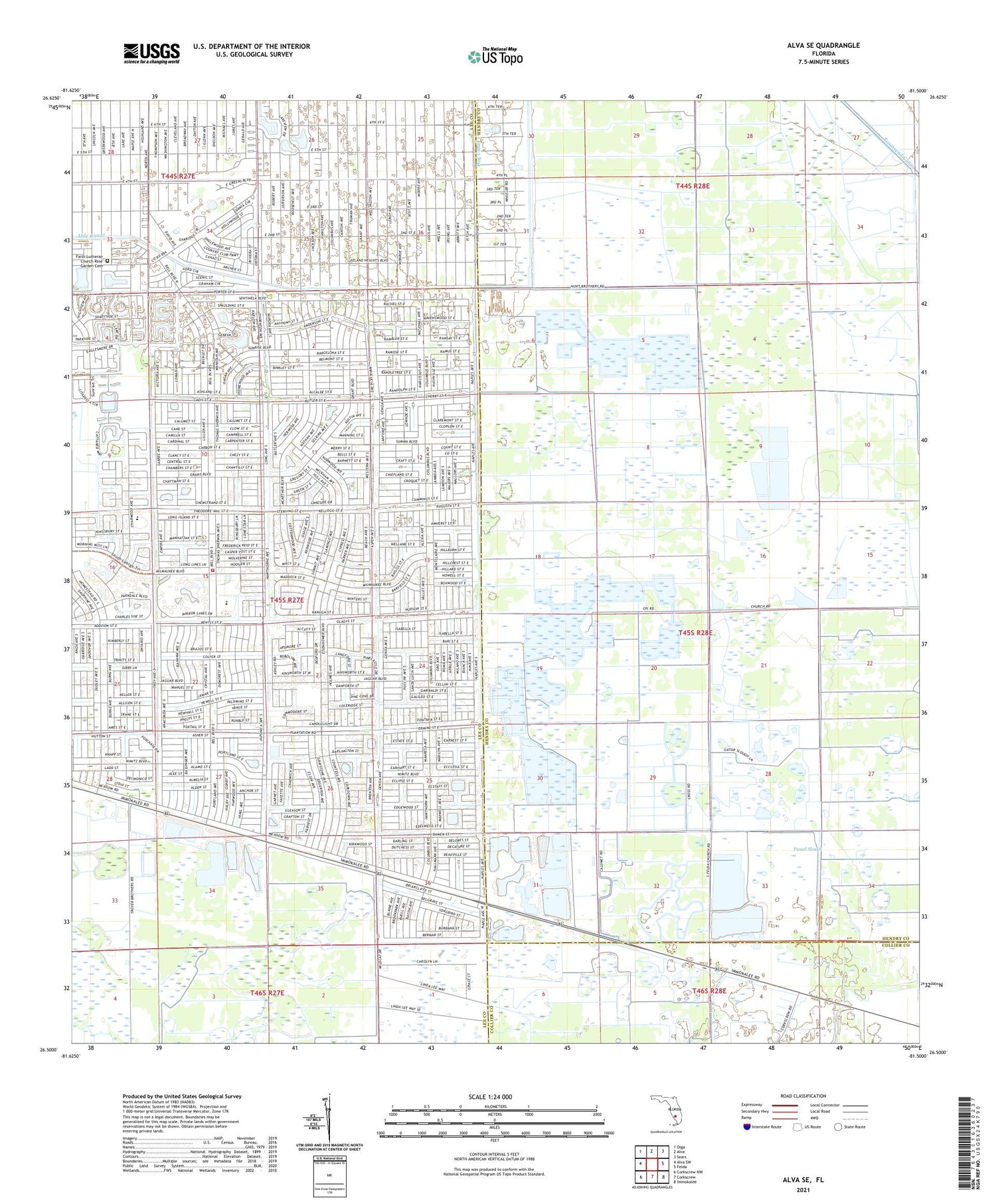
2024 topographic map quadrangle Alva SE in the state of Florida. Scale: 1:24000. Based on the newly updated USGS 7.5' US Topo map series, this map is in the following counties: Lee, Hendry, Collier. The map contains contour data, water features, and other items you are used to seeing on USGS maps, but also has updated roads and other features. This is the next generation of topographic maps. Printed on high-quality waterproof paper with UV fade-resistant inks.
Quads adjacent to this one:
West: Alva SW
Northwest: Olga
North: Alva
Northeast: Sears
East: Felda
Southeast: Immokalee
South: Corkscrew
Southwest: Corkscrew NW
This map covers the same area as the classic USGS quad with code o26081e5.
Contains the following named places: Corkscrew Lookout Tower, Faith Lutheran Church, First Baptist Church of Lehigh, Fussel Slough, Lakeview Golf Club, Lakewood Country Club, Landings Yacht Golf and Tennis Club, Lehigh Acres Christian Church, Lehigh Acres Fire Control and Rescue District Station 105 Headquarters, Richmond Avenue Baptist Church of Lehigh, Sunshine Elementary School, Temple Emanuel, WWCL-AM (Lehigh Acres), ZIP Codes: 33936, 33974


