MyTopo
Dinsmore Florida US Topo Map
Couldn't load pickup availability
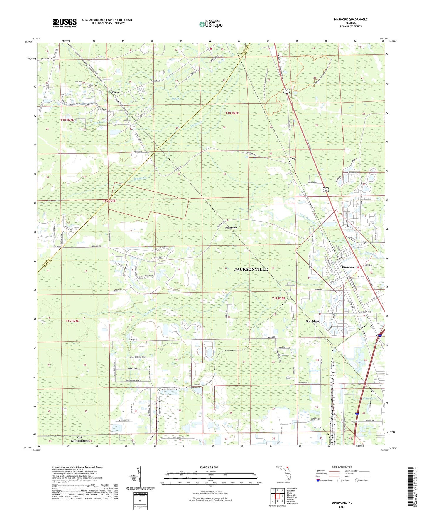
2024 topographic map quadrangle Dinsmore in the state of Florida. Scale: 1:24000. Based on the newly updated USGS 7.5' US Topo map series, this map is in the following counties: Duval, Nassau. The map contains contour data, water features, and other items you are used to seeing on USGS maps, but also has updated roads and other features. This is the next generation of topographic maps. Printed on high-quality waterproof paper with UV fade-resistant inks.
Quads adjacent to this one:
West: Bryceville
Northwest: Hilliard SW
North: Callahan
Northeast: Italia
East: Trout River
Southeast: Jacksonville
South: Marietta
Southwest: Baldwin
This map covers the same area as the classic USGS quad with code o30081d7.
Contains the following named places: Ben Branch, Calvary Chapel Church of God, Cary, Cotton Rawles Grant, D Bloodworth Grant, Dinsmoore Church of God, Dinsmore Baptist Church, Dinsmore Elementary School, Dinsmore Lookout Tower, Dinsmore United Methodist Church, Jacksonville Fire and Rescue Department Station 33, Joseph Rain and William Bailey Grant, Keen Cemetery, Keene, Kings Road, Kings Road Baptist Church, Levi Sparkman Grant, Little Trout River, Nassau County Fire and Rescue Station 10, Plummer, Saint Pauls Church, School Number 45, Silver Dolphin Mobile Home Park, Spaulding, Study Estates Mobile Home Park, Wayside Assembly of God Church, West Side Church, ZIP Code: 32219