MyTopo
Callahan Florida US Topo Map
Couldn't load pickup availability
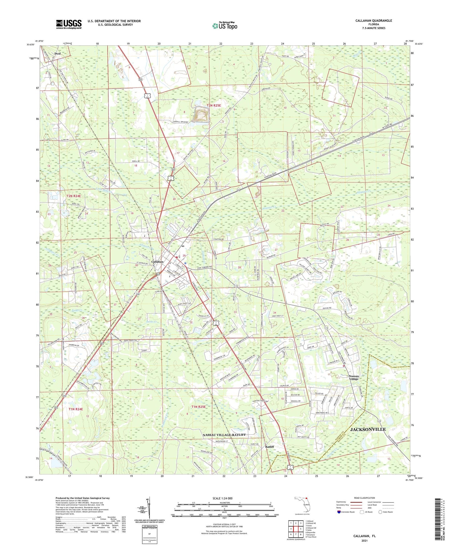
2024 topographic map quadrangle Callahan in the state of Florida. Scale: 1:24000. Based on the newly updated USGS 7.5' US Topo map series, this map is in the following counties: Nassau, Duval. The map contains contour data, water features, and other items you are used to seeing on USGS maps, but also has updated roads and other features. This is the next generation of topographic maps. Printed on high-quality waterproof paper with UV fade-resistant inks.
Quads adjacent to this one:
West: Hilliard SW
Northwest: Hilliard
North: Hilliard NE
Northeast: Gross
East: Italia
Southeast: Trout River
South: Dinsmore
Southwest: Bryceville
This map covers the same area as the classic USGS quad with code o30081e7.
Contains the following named places: Alligator Creek, Bonnet Creek Golf Club, Braddock Creek, Braddocks Trailer Park, Callahan, Callahan Elementary School, Callahan Middle School, Callahan Post Office, Callahan Volunteer Fire Rescue Station 5, Cushing Creek, Dusdee Willows Poultry Farm, Dyal, Funks Creek, Gray Gables Church, Little Mills Creek, Live Oak Church, Mount Olive Church, Nassau County, Nassau County Fire and Rescue Station 8, Nassau County Sheriff's Office Callahan Substation, Nassau Village, Nassau Village-Ratliff Census Designated Place, Ratliff, Town of Callahan, WELX-AM (Callahan), West Nassau High School, ZIP Code: 32011