MyTopo
Dog Island Florida US Topo Map
Couldn't load pickup availability
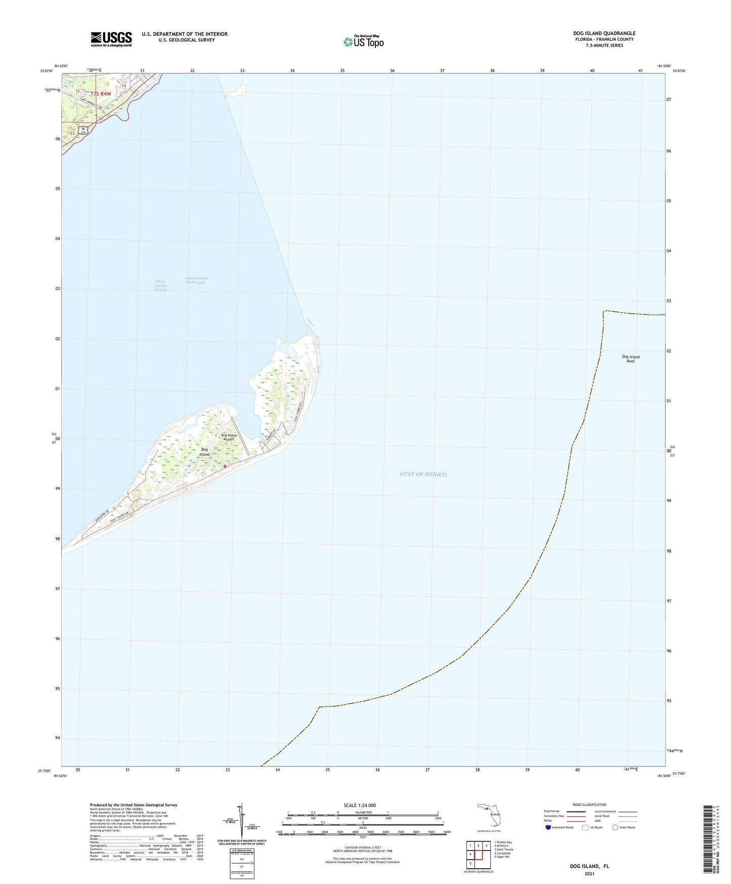
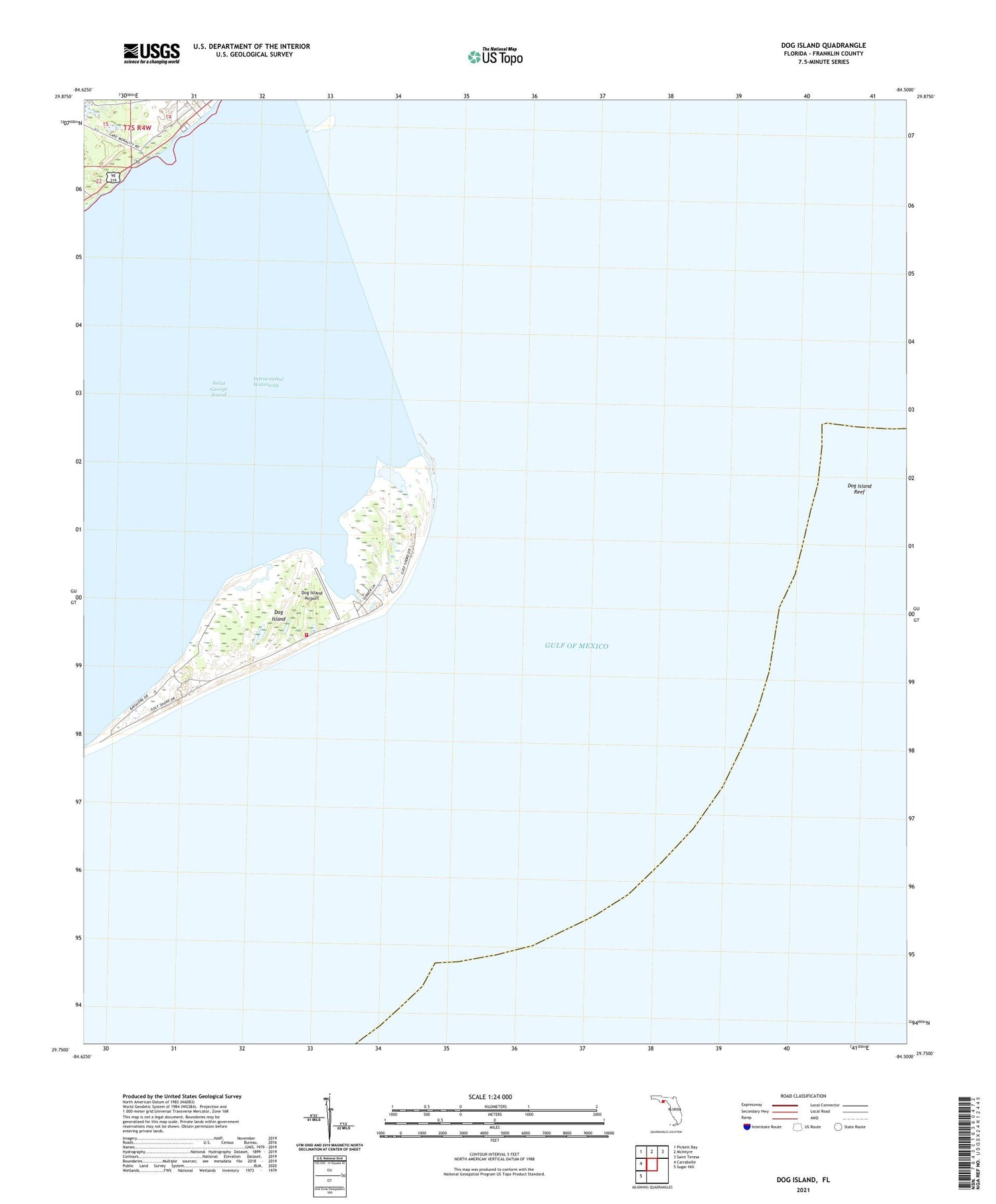
2025 topographic map quadrangle Dog Island in the state of Florida. Scale: 1:24000. Based on the newly updated USGS 7.5' US Topo map series, this map is in the following counties: Franklin. The map contains contour data, water features, and other items you are used to seeing on USGS maps, but also has updated roads and other features. This is the next generation of topographic maps. Printed on high-quality waterproof paper with UV fade-resistant inks.
Quads adjacent to this one:
West: Carrabelle
Northwest: Pickett Bay
North: McIntyre
Northeast: Saint Teresa
Southwest: Sugar Hill
This map covers the same area as the classic USGS quad with code o29084g5.
Contains the following named places: Carrabelle Division, Clower Railroad Station, Dog Island, Dog Island Airport, Dog Island Reef, Dog Island Volunteer Fire Department