MyTopo
Saint Teresa Florida US Topo Map
Couldn't load pickup availability
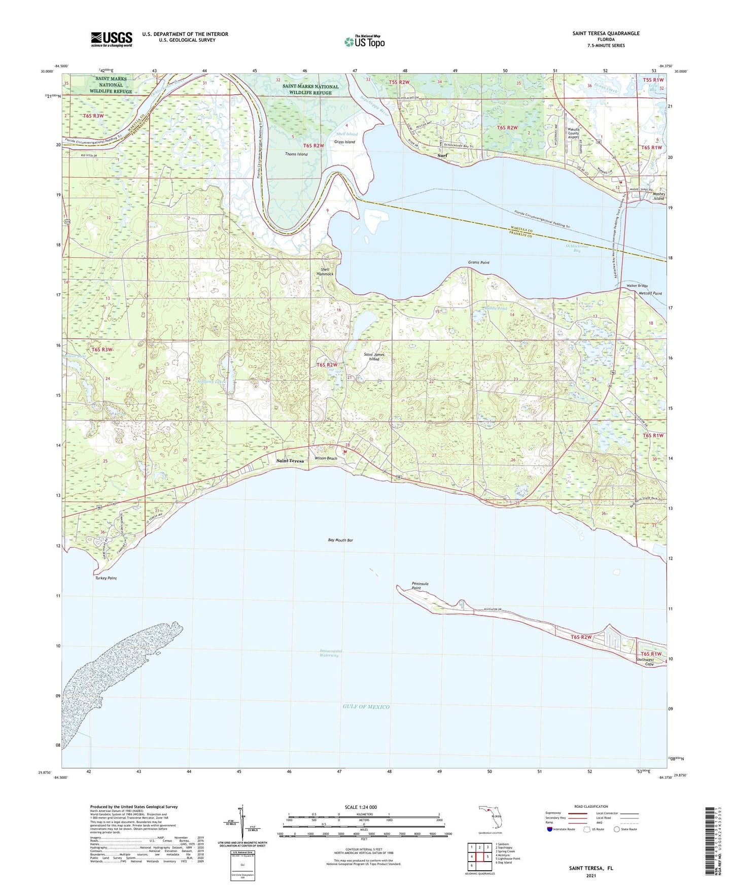
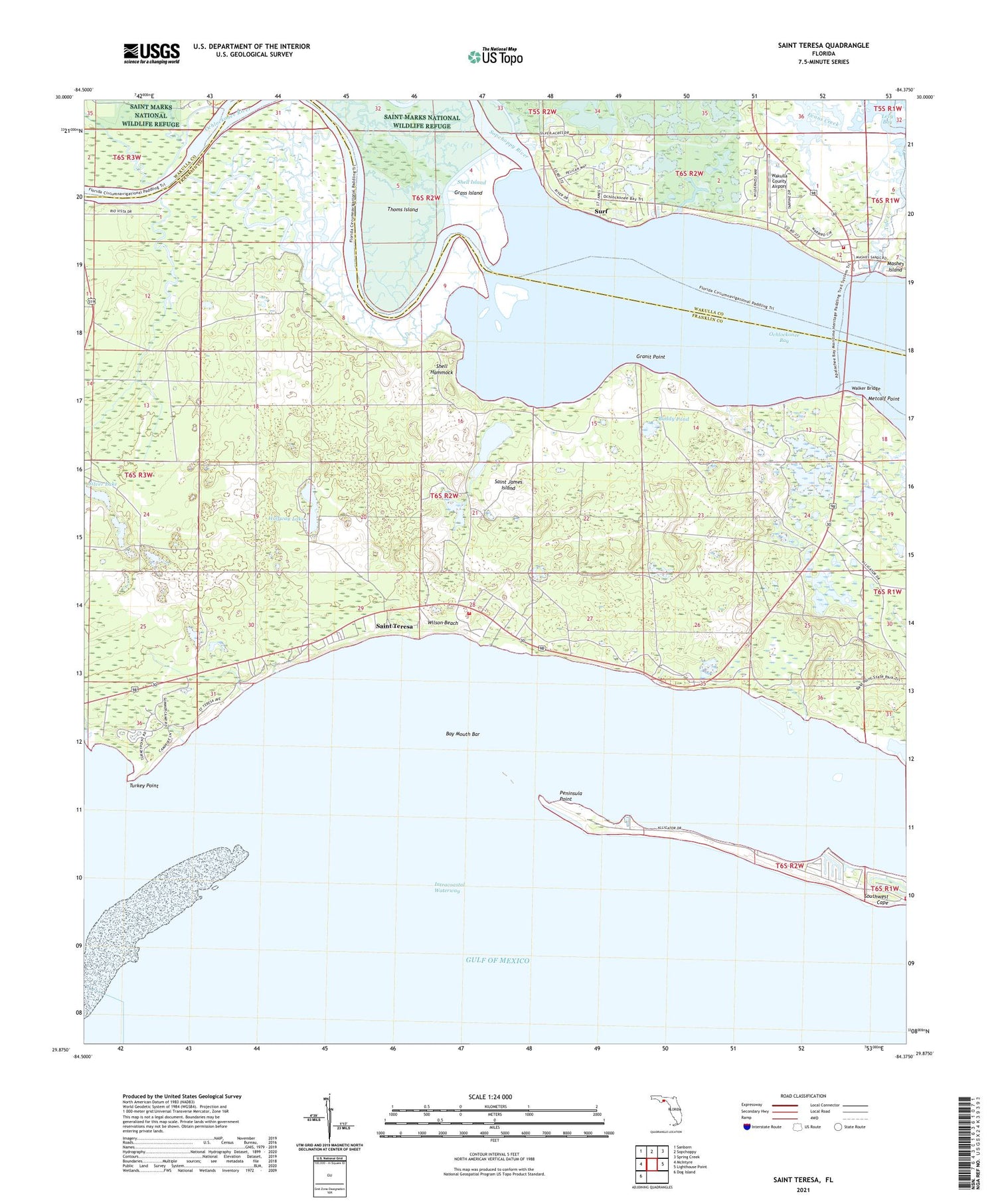
2025 topographic map quadrangle Saint Teresa in the state of Florida. Scale: 1:24000. Based on the newly updated USGS 7.5' US Topo map series, this map is in the following counties: Franklin, Wakulla. The map contains contour data, water features, and other items you are used to seeing on USGS maps, but also has updated roads and other features. This is the next generation of topographic maps. Printed on high-quality waterproof paper with UV fade-resistant inks.
Quads adjacent to this one:
West: McIntyre
Northwest: Sanborn
North: Sopchoppy
Northeast: Spring Creek
East: Lighthouse Point
Southwest: Dog Island
This map covers the same area as the classic USGS quad with code o29084h4.
Contains the following named places: Alligator Harbor, Alligator Harbor Aquatic Preserve, Alligator Point Saint Teresa Volunteer Fire Department, Alligator Point Saint Teresa Volunteer Fire Department Substation, Bay Mouth Bar, Buddy Pond, Corn Landing Lake, Granit Point, Grass Island, Halfway Lake, Little Tide Creek, Metcalf Lake, Metcalf Point, Mud Landing, Ochlocknee Bay Volunteer Fire Department Station 7, Ochlockonee Bay, Ochlockonee River, Peninsula Point, Saint Teresa, Saint Teresa Post Office, Shell Hammock, Shell Island, Silver Lake, Sopchoppy River, Southwest Cape, Surf, Tide Creek, Turkey Point, Wakulla County Airport, Walker Bridge, Wilson Beach, ZIP Code: 32346