MyTopo
Eden Florida US Topo Map
Couldn't load pickup availability
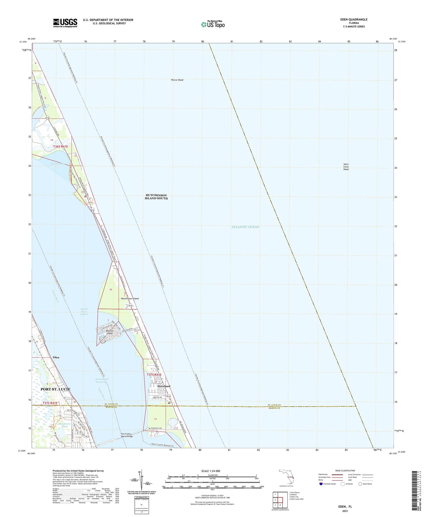
2024 topographic map quadrangle Eden in the state of Florida. Scale: 1:24000. Based on the newly updated USGS 7.5' US Topo map series, this map is in the following counties: St. Lucie, Martin. The map contains contour data, water features, and other items you are used to seeing on USGS maps, but also has updated roads and other features. This is the next generation of topographic maps. Printed on high-quality waterproof paper with UV fade-resistant inks.
Quads adjacent to this one:
West: Ankona
Northwest: Fort Pierce
South: Saint Lucie Inlet
Southwest: Palm City
This map covers the same area as the classic USGS quad with code o27080c2.
Contains the following named places: Church of God, Eden, Florida Power and Light Nuclear Power Plant Heliport, Henderson Pond, Herman Bay, Hutchinson Beach Post Office, Hutchinson Island, Hutchinson Island Division, Hutchinson Island Nuclear Power Plant, Hutchinson Island South Census Designated Place, Jensen Beach, Jensen Beach Park, Lake Eden, Nettles Island, Pierce Shoal, Saint Lucie County Fire District Station 8, Saint Lucie Power Plant, Saint Lucie Shoal, The Frank A Wacha Bridge, Waveland, ZIP Code: 34957