MyTopo
Ehren Florida US Topo Map
Couldn't load pickup availability
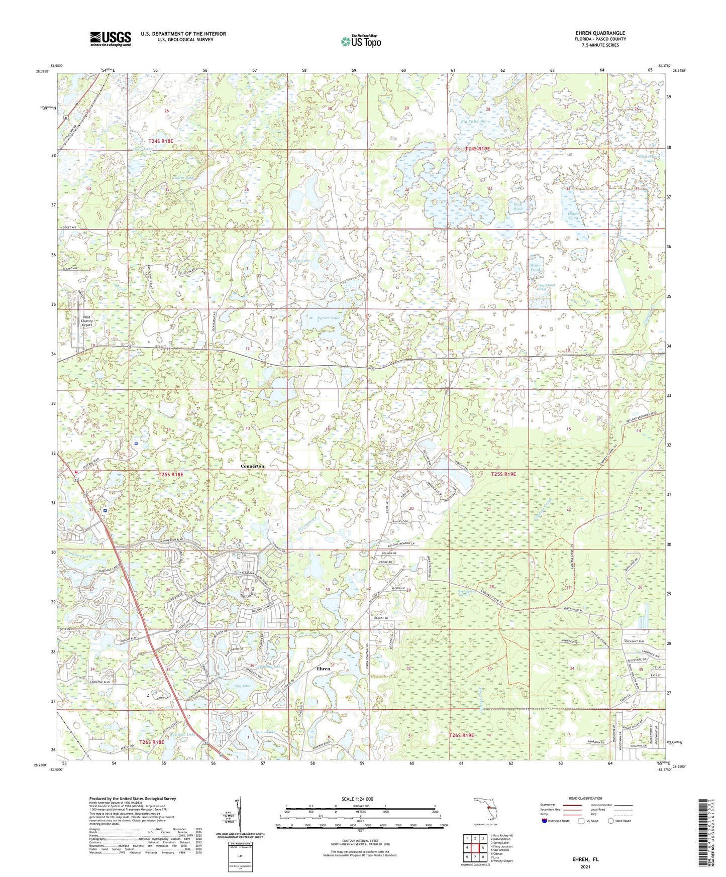
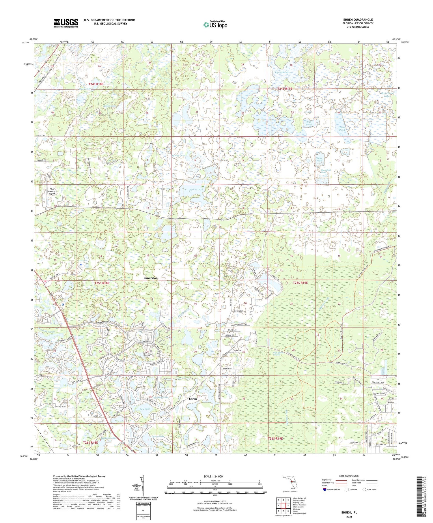
2024 topographic map quadrangle Ehren in the state of Florida. Scale: 1:24000. Based on the newly updated USGS 7.5' US Topo map series, this map is in the following counties: Pasco. The map contains contour data, water features, and other items you are used to seeing on USGS maps, but also has updated roads and other features. This is the next generation of topographic maps. Printed on high-quality waterproof paper with UV fade-resistant inks.
Quads adjacent to this one:
West: Fivay Junction
Northwest: Port Richey NE
North: Masaryktown
Northeast: Spring Lake
East: San Antonio
Southeast: Wesley Chapel
South: Lutz
Southwest: Odessa
This map covers the same area as the classic USGS quad with code o28082c4.
Contains the following named places: Bay Lake, Big Cypress Swamp, Big Fish Lake, Clear Lake, Connerton Census Designated Place, Curve Lake, Cypress Creek, Ehren, Goose Lake, Hog Island Pond, Mann Pond, New River Pond, Oak Grove Church, Oakes Pond, Parker Lake, Pasco County Fire Rescue Station 22, Pasco County Land O' Lakes Detention Center, Pasco County Sheriff's Office Court Services Bureau, Pilot Country Airport, Raft Lake, Red Bug Lake, Spivey Lake, Thomas E Weightman Middle School, Way Pond, Wistaria Lake, ZIP Codes: 34637, 34639