
MyTopo
Spring Lake Florida US Topo Map
Couldn't load pickup availability
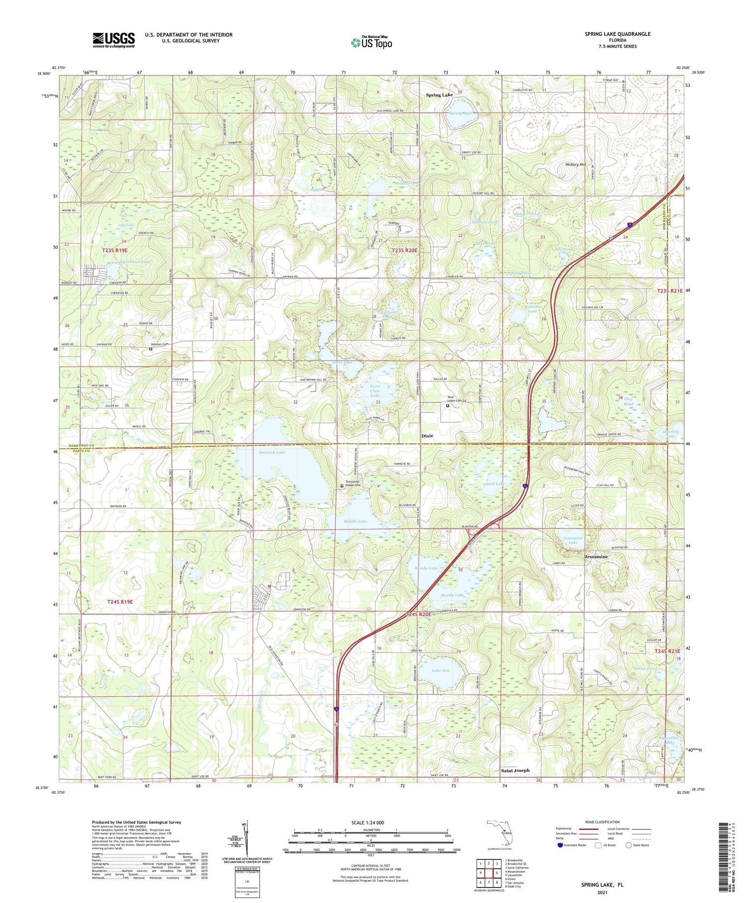
2024 topographic map quadrangle Spring Lake in the state of Florida. Scale: 1:24000. Based on the newly updated USGS 7.5' US Topo map series, this map is in the following counties: Hernando, Pasco. The map contains contour data, water features, and other items you are used to seeing on USGS maps, but also has updated roads and other features. This is the next generation of topographic maps. Printed on high-quality waterproof paper with UV fade-resistant inks.
Quads adjacent to this one:
West: Masaryktown
Northwest: Brooksville
North: Brooksville SE
Northeast: Saint Catherine
East: Lacoochee
Southeast: Dade City
South: San Antonio
Southwest: Ehren
This map covers the same area as the classic USGS quad with code o28082d3.
Contains the following named places: Bay Spring School, Charlotte Pond, Chukuchatta, Dixie, Dollar Pond, Flag Pond, Gold Lake, Hancock Lake, Harrison Lake, Hickory Hill, Jessamine, Jessamine Lake, Johnson Cemetery, Lake Iola, Long Pond, McClendon Lake, Middle Lake, Moody Lake, Mount Pleasant Church, Mountain Lake, Mud Lake, Neff Fish Camp, Neff Lake, Nicks Lake, Patsy Pond, Robison Lake, Saint Clair Lake, Saint Joseph, Sea Pond, Simmon Pond, Sparkman Lake, Spring Lake, Spring Lake Census Designated Place, Spring Lake United Methodist Church, Townsend House Cemetery, Travelers Rest Volunteer Fire Rescue Station 33, Twin Lakes Cemetery, Zuke Pond


