
MyTopo
Flagler Beach East Florida US Topo Map
Couldn't load pickup availability
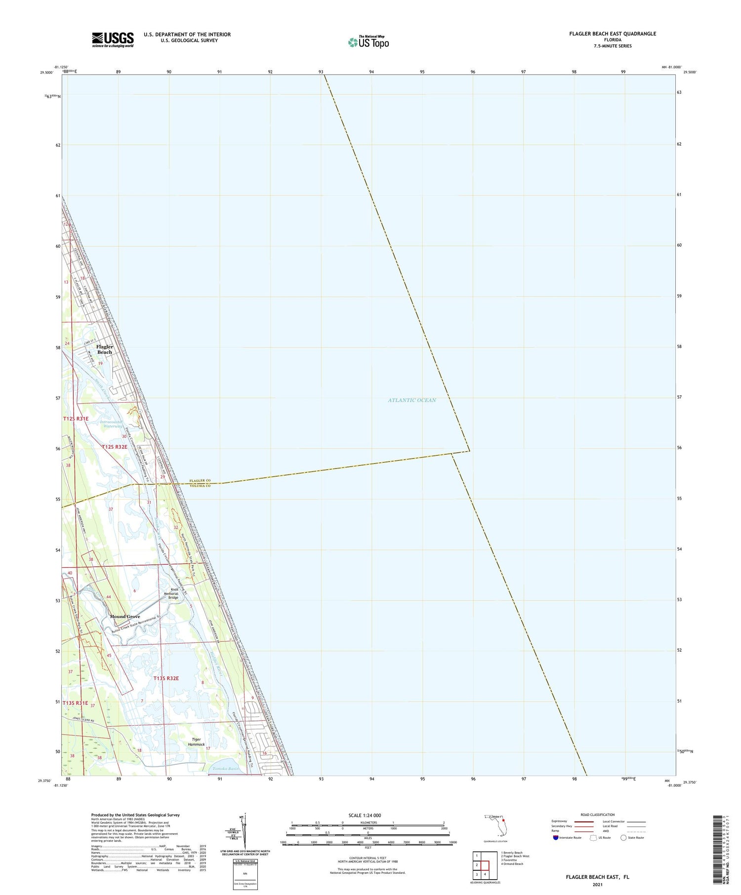
2024 topographic map quadrangle Flagler Beach East in the state of Florida. Scale: 1:24000. Based on the newly updated USGS 7.5' US Topo map series, this map is in the following counties: Volusia, Flagler. The map contains contour data, water features, and other items you are used to seeing on USGS maps, but also has updated roads and other features. This is the next generation of topographic maps. Printed on high-quality waterproof paper with UV fade-resistant inks.
Quads adjacent to this one:
West: Flagler Beach West
Northwest: Beverly Beach
South: Ormond Beach
Southwest: Favoretta
This map covers the same area as the classic USGS quad with code o29081d1.
Contains the following named places: Bulow Creek, Delray Country Club, Gamble Rogers Memorial State Recreation Area at Flagler Beach, Knox Memorial Bridge, M Kunner Grant, Mother Seton Catholic Church, Mound Grove, North Peninsula State Park, Santa Maria Del Mar Catholic Church, Smith Creek, Tiger Hammock, Tomoka Marsh Aquatic Preserve


