MyTopo
Fort Drum Florida US Topo Map
Couldn't load pickup availability
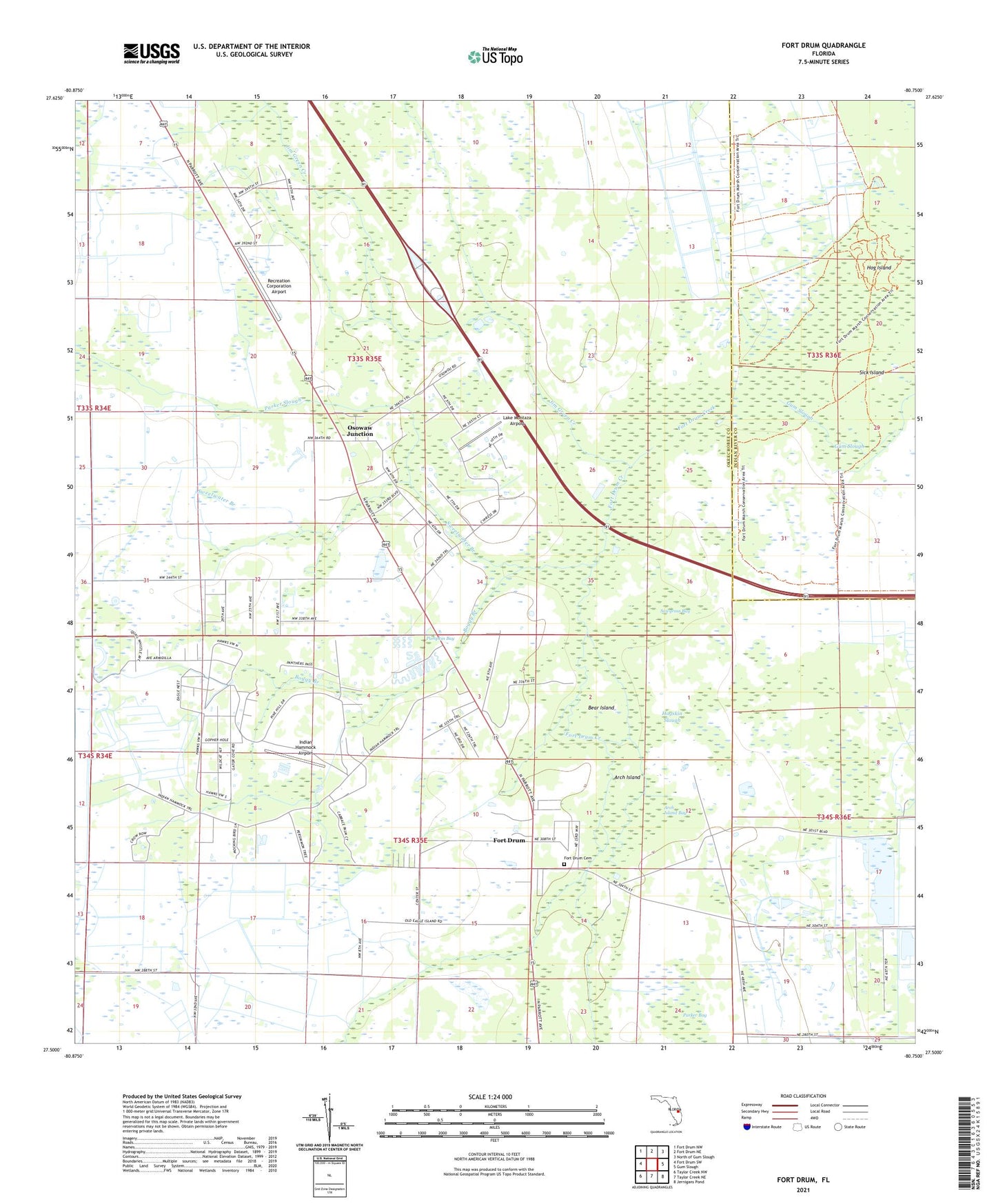
2024 topographic map quadrangle Fort Drum in the state of Florida. Scale: 1:24000. Based on the newly updated USGS 7.5' US Topo map series, this map is in the following counties: Okeechobee, Indian River. The map contains contour data, water features, and other items you are used to seeing on USGS maps, but also has updated roads and other features. This is the next generation of topographic maps. Printed on high-quality waterproof paper with UV fade-resistant inks.
Quads adjacent to this one:
West: Fort Drum SW
Northwest: Fort Drum NW
North: Fort Drum NE
Northeast: North of Gum Slough
East: Gum Slough
Southeast: Jernigans Pond
South: Taylor Creek NE
Southwest: Taylor Creek NW
This map covers the same area as the classic USGS quad with code o27080e7.
Contains the following named places: Arch Island, Arch Island Bay, Bear Island, Boggy Branch, Fort Drum, Fort Drum Creek, Gum Slough, Hog Island, Hogskin Slough, Indian Hammock Airport, Jim Green Creek, Lake Montaza Airport, Okeechobee County Fire Rescue Station 3 Fort Drum, Osowaw Junction, Parker Bay, Parker Slough, Pumpkin Bay, Recreation Corporation Airport, Sawgrass Bay, Sick Island, Sweetwater Branch