
MyTopo
Jernigans Pond Florida US Topo Map
Couldn't load pickup availability
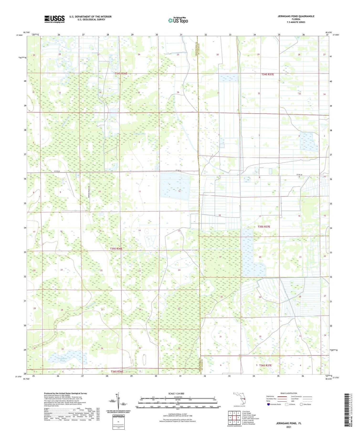
2024 topographic map quadrangle Jernigans Pond in the state of Florida. Scale: 1:24000. Based on the newly updated USGS 7.5' US Topo map series, this map is in the following counties: Okeechobee, St. Lucie. The map contains contour data, water features, and other items you are used to seeing on USGS maps, but also has updated roads and other features. This is the next generation of topographic maps. Printed on high-quality waterproof paper with UV fade-resistant inks.
Quads adjacent to this one:
West: Taylor Creek NE
Northwest: Fort Drum
North: Gum Slough
Northeast: East of Gum Slough
East: Saint Johns Marsh South
Southeast: North of Bluefield
South: Jones Hammock
Southwest: Taylor Creek SE
This map covers the same area as the classic USGS quad with code o27080d6.
Contains the following named places: Cow Creek, Cowbone Creek, Fort Floyd, Gomez Creek, Jernigans Pond


