MyTopo
Fort Lonesome Florida US Topo Map
Couldn't load pickup availability
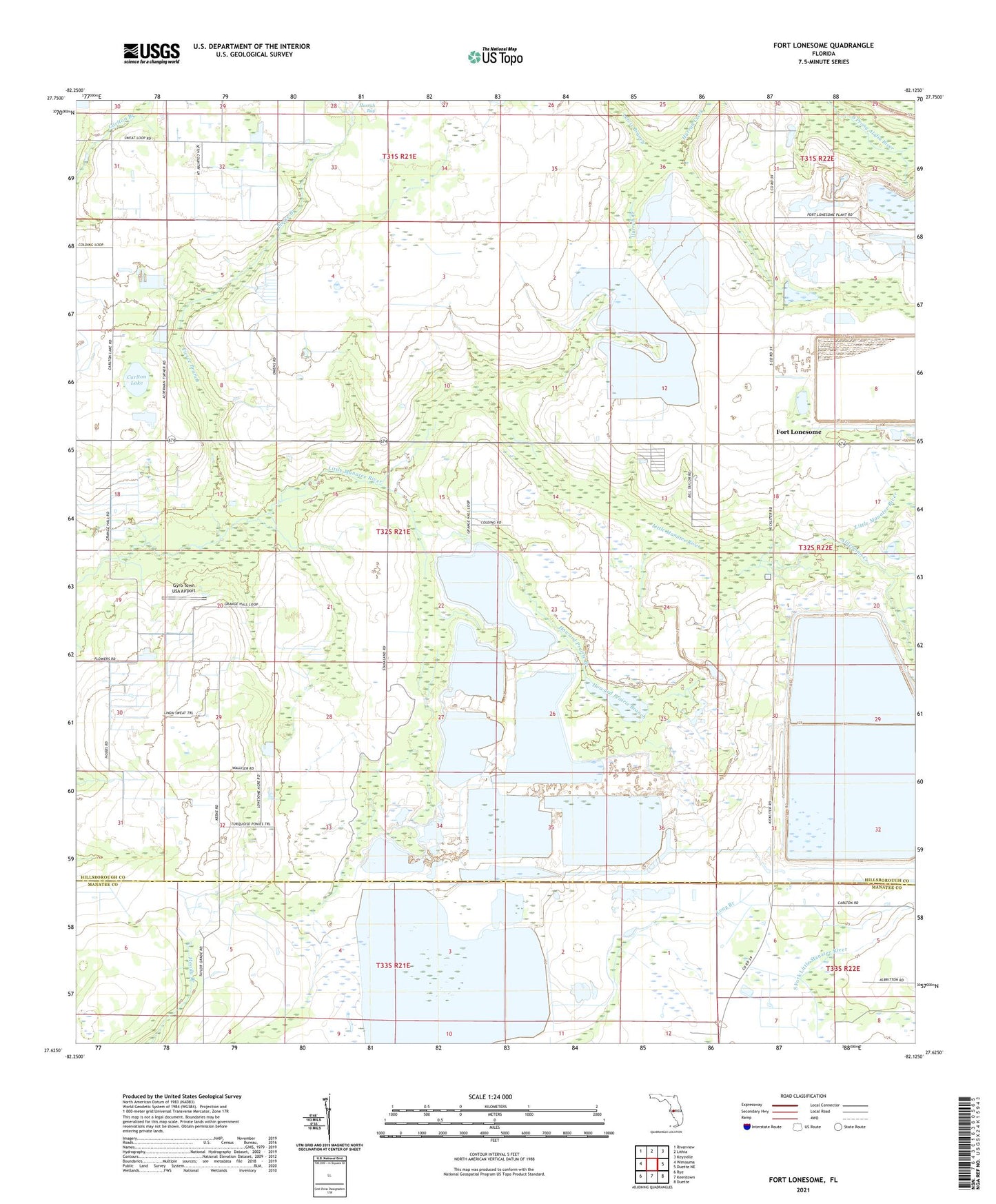
2024 topographic map quadrangle Fort Lonesome in the state of Florida. Scale: 1:24000. Based on the newly updated USGS 7.5' US Topo map series, this map is in the following counties: Hillsborough, Manatee. The map contains contour data, water features, and other items you are used to seeing on USGS maps, but also has updated roads and other features. This is the next generation of topographic maps. Printed on high-quality waterproof paper with UV fade-resistant inks.
Quads adjacent to this one:
West: Wimauma
Northwest: Riverview
North: Lithia
Northeast: Keysville
East: Duette NE
Southeast: Duette
South: Keentown
Southwest: Rye
This map covers the same area as the classic USGS quad with code o27082f2.
Contains the following named places: Alderman Creek, Alderman-Carlton Ranchettes, Carlton Lake, Carter Country, Clark Farms, Fellowship Church, Fort Lonesome, Gyro Town USA Airport, Hiscock Acres, Howard Prairie Branch, Hurrah Church, Hurrah Fire Tower, Lewis Branch, Lonesome Hollow, Pierce Branch, Seth Country Tracts, Summerfield Wimauma Estates, Tatom Estates, Watts Junction