MyTopo
Keentown Florida US Topo Map
Couldn't load pickup availability
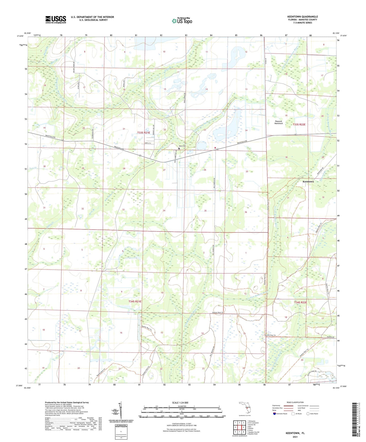
2024 topographic map quadrangle Keentown in the state of Florida. Scale: 1:24000. Based on the newly updated USGS 7.5' US Topo map series, this map is in the following counties: Manatee. The map contains contour data, water features, and other items you are used to seeing on USGS maps, but also has updated roads and other features. This is the next generation of topographic maps. Printed on high-quality waterproof paper with UV fade-resistant inks.
Quads adjacent to this one:
West: Rye
Northwest: Wimauma
North: Fort Lonesome
Northeast: Duette NE
East: Duette
Southeast: Myakka Head
South: Myakka City NW
Southwest: Verna
This map covers the same area as the classic USGS quad with code o27082e2.
Contains the following named places: Baker Branch, Bunker Hill, Bunker Hill Church, Duette Park, Duette Volunteer Fire - Rescue Department, Grapeyard Creek, Keen Branch, Keen Cemetery, Keentown, Long Branch, Moody Branch, Peacock Branch, Peacock Hammock, Southfork Airport