MyTopo
Fort Pierce NW Florida US Topo Map
Couldn't load pickup availability
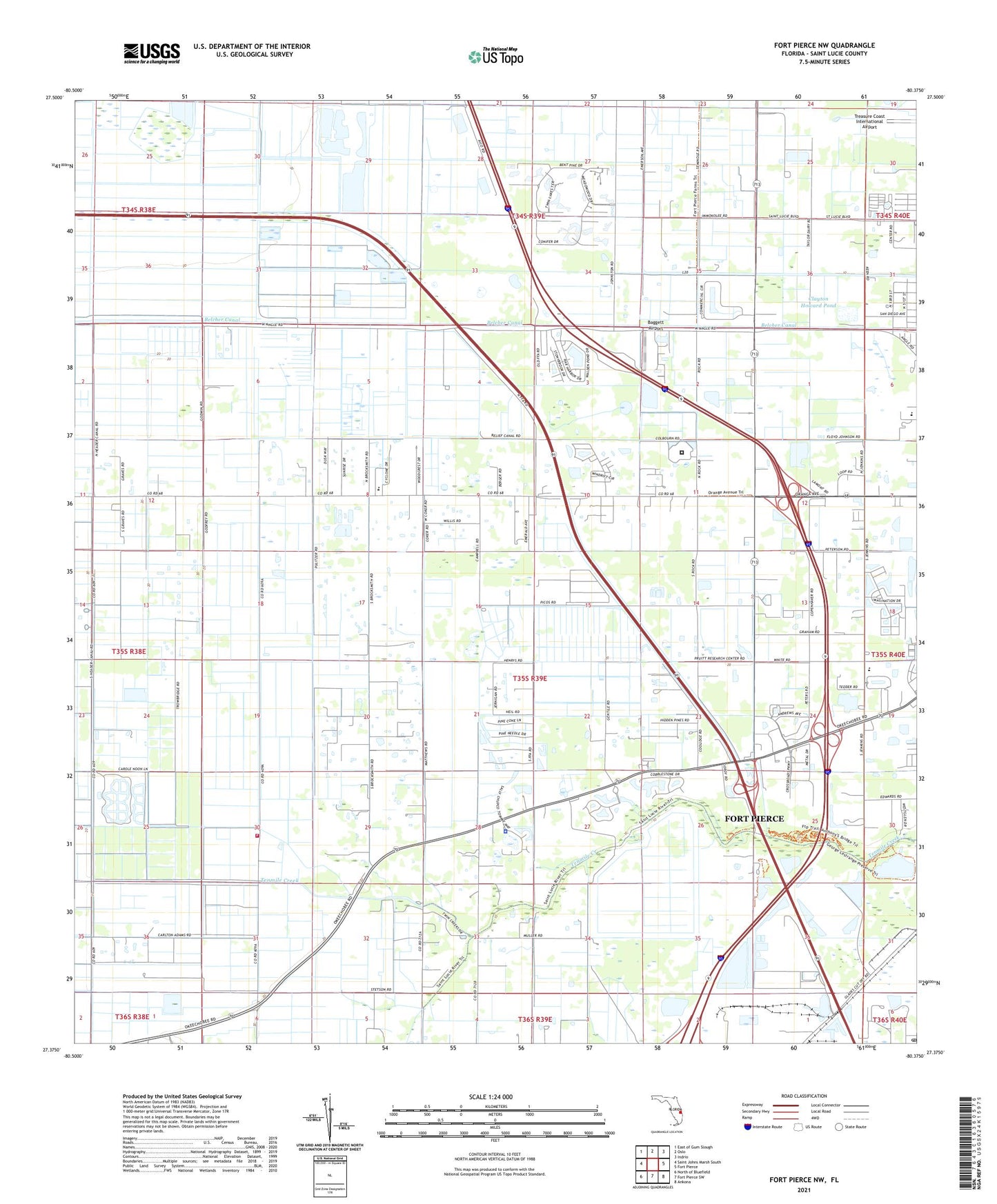
2024 topographic map quadrangle Fort Pierce NW in the state of Florida. Scale: 1:24000. Based on the newly updated USGS 7.5' US Topo map series, this map is in the following counties: St. Lucie. The map contains contour data, water features, and other items you are used to seeing on USGS maps, but also has updated roads and other features. This is the next generation of topographic maps. Printed on high-quality waterproof paper with UV fade-resistant inks.
Quads adjacent to this one:
West: Saint Johns Marsh South
Northwest: East of Gum Slough
North: Oslo
Northeast: Indrio
East: Fort Pierce
Southeast: Ankona
South: Fort Pierce SW
Southwest: North of Bluefield
This map covers the same area as the classic USGS quad with code o27080d4.
Contains the following named places: Baggett Airport, Belcher Canal, Clayton Howard Pond, Florida Club at Martin County, Fort Pierce Post Office, Fort Pierce Reservation, Fort Pierce Westwood High School, Golden Ponds Mobile Home Park, Orange Avenue Baptist Church, Saint Lucie County, Saint Lucie County Fire District Station 11, Saint Lucie County Jail, Seminole Police Department - Fort Pierce, Sunrise Shopping Center, Williams Hawgwild Airport, World on Fire Revivals, ZIP Code: 34981