
MyTopo
Fort Pierce SW Florida US Topo Map
Couldn't load pickup availability
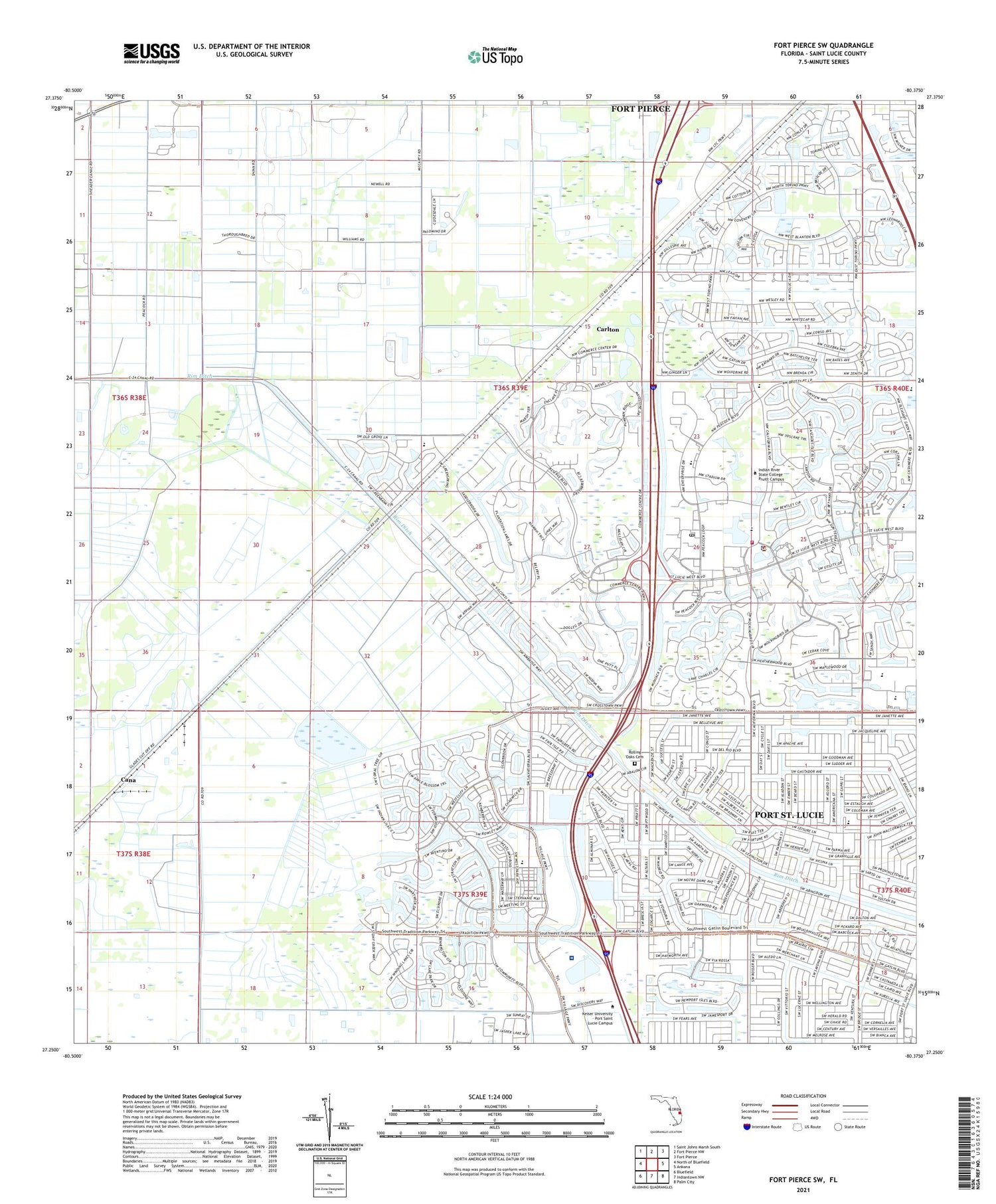
2024 topographic map quadrangle Fort Pierce SW in the state of Florida. Scale: 1:24000. Based on the newly updated USGS 7.5' US Topo map series, this map is in the following counties: St. Lucie. The map contains contour data, water features, and other items you are used to seeing on USGS maps, but also has updated roads and other features. This is the next generation of topographic maps. Printed on high-quality waterproof paper with UV fade-resistant inks.
Quads adjacent to this one:
West: North of Bluefield
Northwest: Saint Johns Marsh South
North: Fort Pierce NW
Northeast: Fort Pierce
East: Ankona
Southeast: Palm City
South: Indiantown NW
Southwest: Bluefield
This map covers the same area as the classic USGS quad with code o27080c4.
Contains the following named places: All Villages Presbyterian Church, Cana, Carlton, City of Port Saint Lucie, Del Rio Fellowship Church, Digital Domain Park, Diversion Canal, Episcopal Church of the Nativity, Faith Congregational Church, Header Canal, Indian River Community College, Indian River Community College Saint Lucie West Library, Port Saint Lucie Police Department Western Regional Office, Port Saint Lucie Post Office, Rim Ditch, Saint Bernadette Catholic Church, Saint Lucie County Fire District Station 14, Saint Lucie County Sheriff's Office Crime Prevention Unit, Spring Run Golf Club, Sunlight Community Church, Temple Beth El Israel, Treasure Coast Baptist Church, ZIP Codes: 34986, 34987


