MyTopo
Gardner Florida US Topo Map
Couldn't load pickup availability
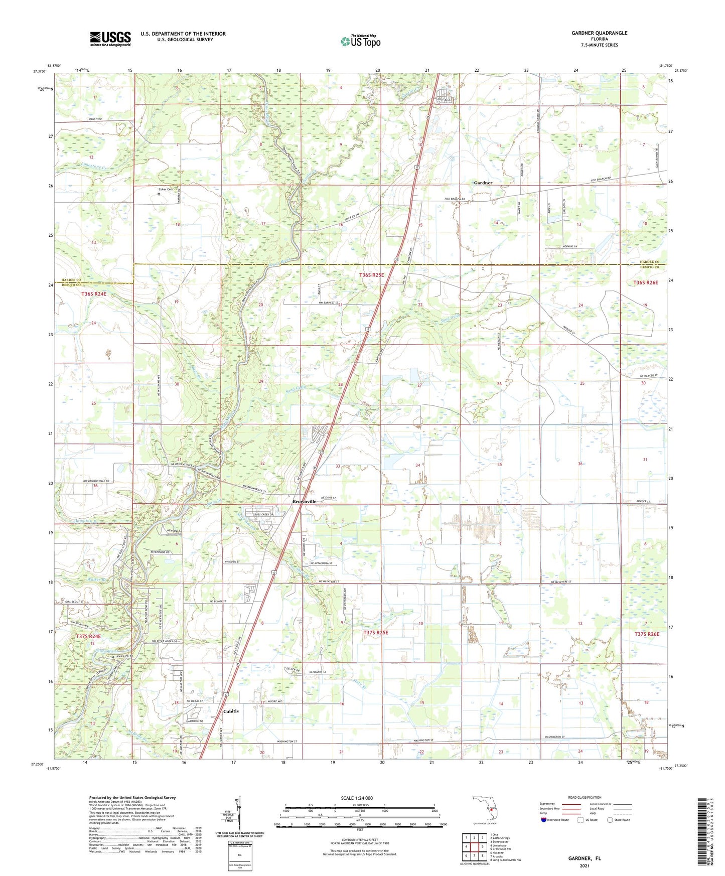
2024 topographic map quadrangle Gardner in the state of Florida. Scale: 1:24000. Based on the newly updated USGS 7.5' US Topo map series, this map is in the following counties: DeSoto, Hardee. The map contains contour data, water features, and other items you are used to seeing on USGS maps, but also has updated roads and other features. This is the next generation of topographic maps. Printed on high-quality waterproof paper with UV fade-resistant inks.
Quads adjacent to this one:
West: Limestone
Northwest: Ona
North: Zolfo Springs
Northeast: Sweetwater
East: Crewsville SW
Southeast: Long Island Marsh NW
South: Arcadia
Southwest: Nocatee
This map covers the same area as the classic USGS quad with code o27081c7.
Contains the following named places: Arcadia Drive-In, Bear Branch, Brownville, Brownville Baptist Church, Charlie Creek, Coker Cemetery, Cubitis, Gardner, Gardner Airport, Gardner Census Designated Place, Hampton Branch, Jerrys Park Mobile Home Park, Mare Branch, Sand Gully, Walker Branch, WXKT-FM (Arcadia)