MyTopo
Long Island Marsh NW Florida US Topo Map
Couldn't load pickup availability
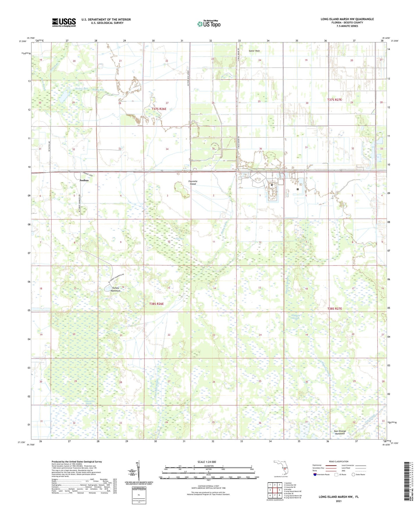
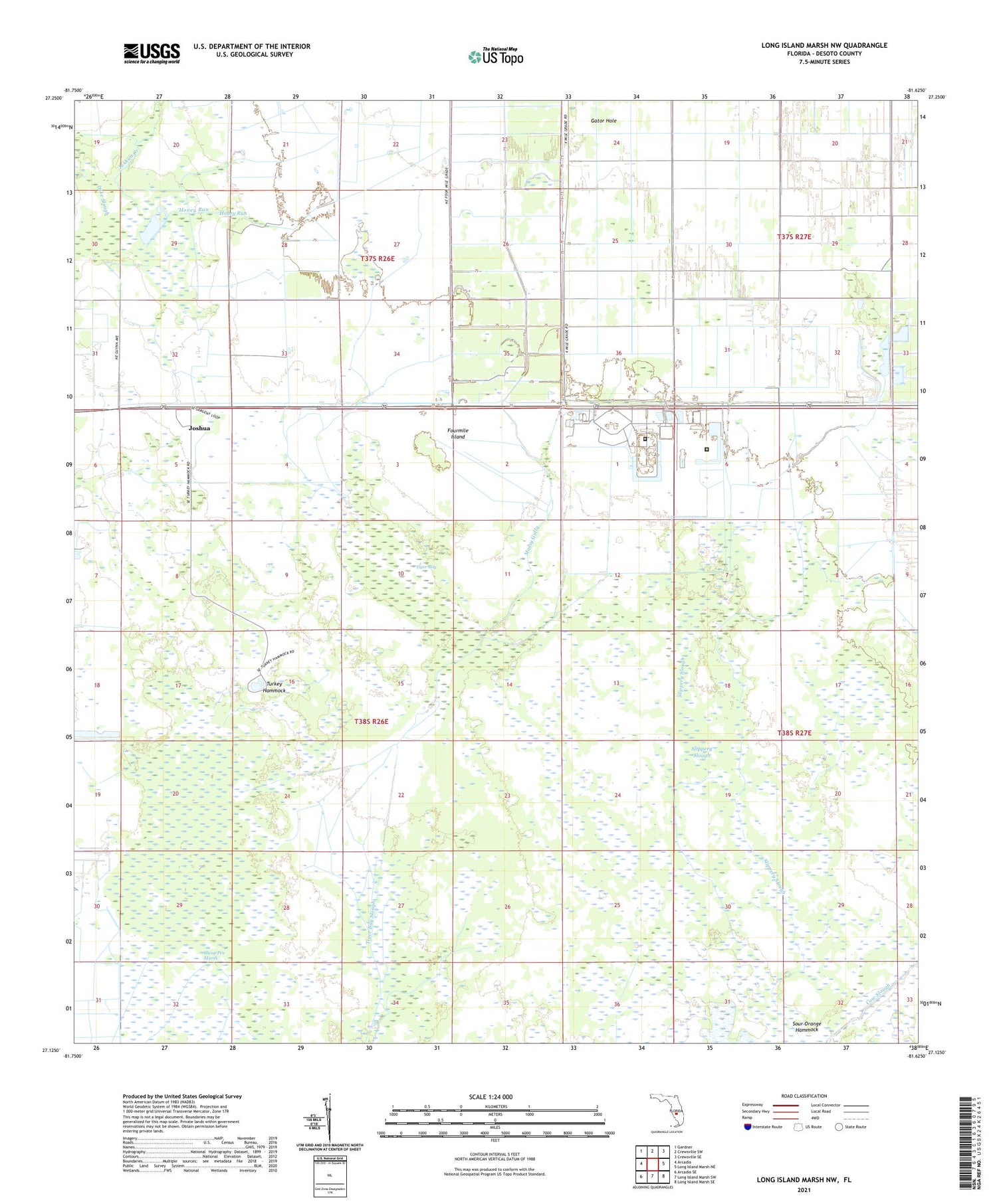
2024 topographic map quadrangle Long Island Marsh NW in the state of Florida. Scale: 1:24000. Based on the newly updated USGS 7.5' US Topo map series, this map is in the following counties: DeSoto. The map contains contour data, water features, and other items you are used to seeing on USGS maps, but also has updated roads and other features. This is the next generation of topographic maps. Printed on high-quality waterproof paper with UV fade-resistant inks.
Quads adjacent to this one:
West: Arcadia
Northwest: Gardner
North: Crewsville SW
Northeast: Crewsville SE
East: Long Island Marsh NE
Southeast: Long Island Marsh SE
South: Long Island Marsh SW
Southwest: Arcadia SE
This map covers the same area as the classic USGS quad with code o27081b6.
Contains the following named places: Arcadia East Division, Bright Hour Ranch Airport, Desoto Annex Correctional Institution, DeSoto Correctional Institute State Mental Hospital, Florida Civil Commitment Center, Florida Civil Commitment Center Arcadia, Fourmile Island, Gator Hole, Honey Run, Joshua, Lake Slough, Mossy Gully, Parker Ranch, Sheep Pen Marsh, Slippery Slough, Sour Orange Hammock, Tiger Bay, Turkey Hammock