MyTopo
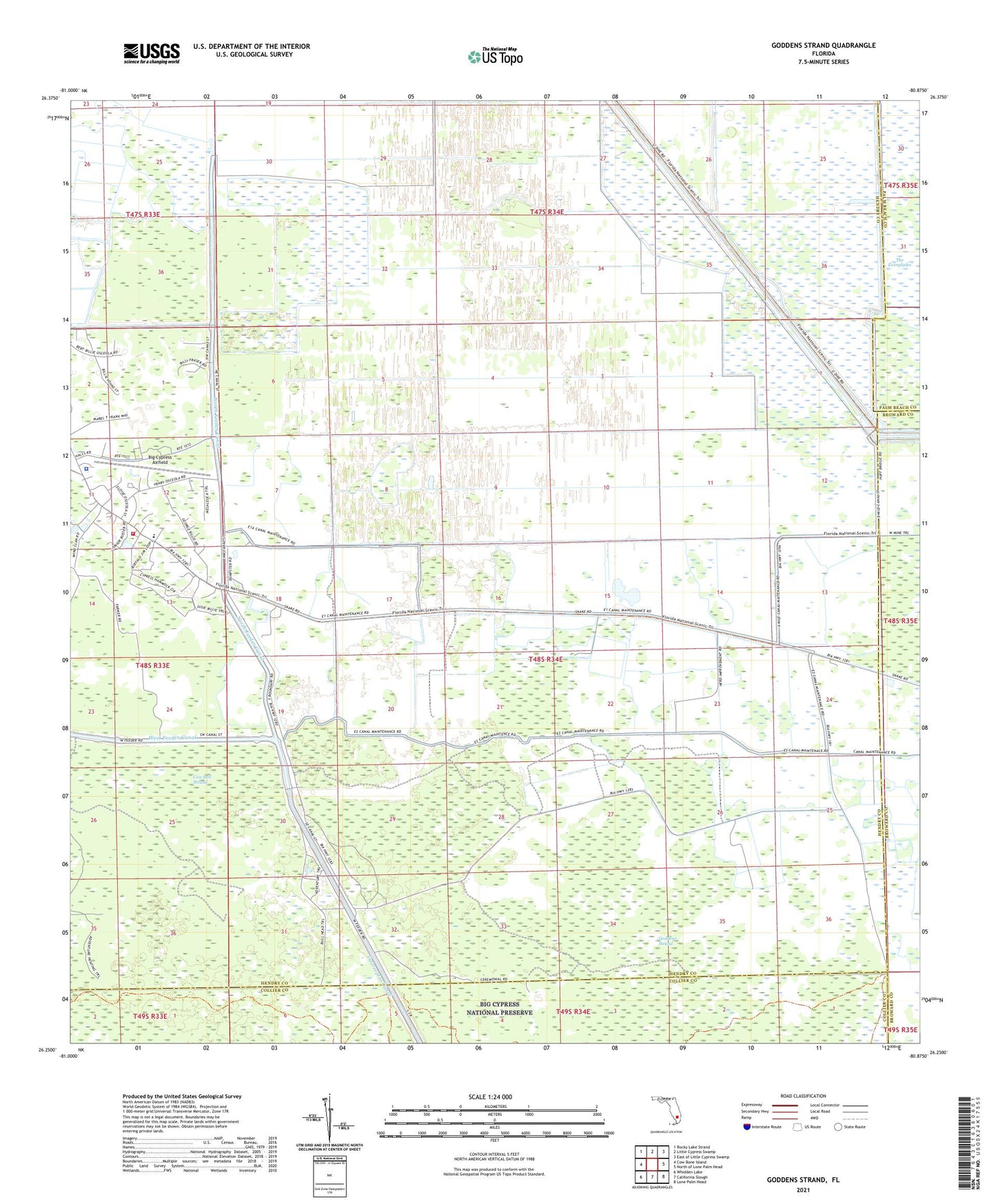
Goddens Strand Florida US Topo Map
Couldn't load pickup availability
2024 topographic map quadrangle Goddens Strand in the state of Florida. Scale: 1:24000. Based on the newly updated USGS 7.5' US Topo map series, this map is in the following counties: Hendry, Collier, Broward, Palm Beach. The map contains contour data, water features, and other items you are used to seeing on USGS maps, but also has updated roads and other features. This is the next generation of topographic maps. Printed on high-quality waterproof paper with UV fade-resistant inks.
Quads adjacent to this one:
West: Cow Bone Island
Northwest: Rocky Lake Strand
North: Little Cypress Swamp
Northeast: East of Little Cypress Swamp
East: North of Lone Palm Head
Southeast: Lone Palm Head
South: California Slough
Southwest: Whidden Lake
This map covers the same area as the classic USGS quad with code o26080c8.
Contains the following named places: Alsachkee Day School, Big Cypress Airfield, Big Cypress Church, Big Cypress Fire and Emergency Medical Services, Big Cypress Reservation, Browns Indian Trading Post, New Testament Church, North Feeder Canal, Seminole Police Department - Big Cypress