MyTopo
Cow Bone Island Florida US Topo Map
Couldn't load pickup availability
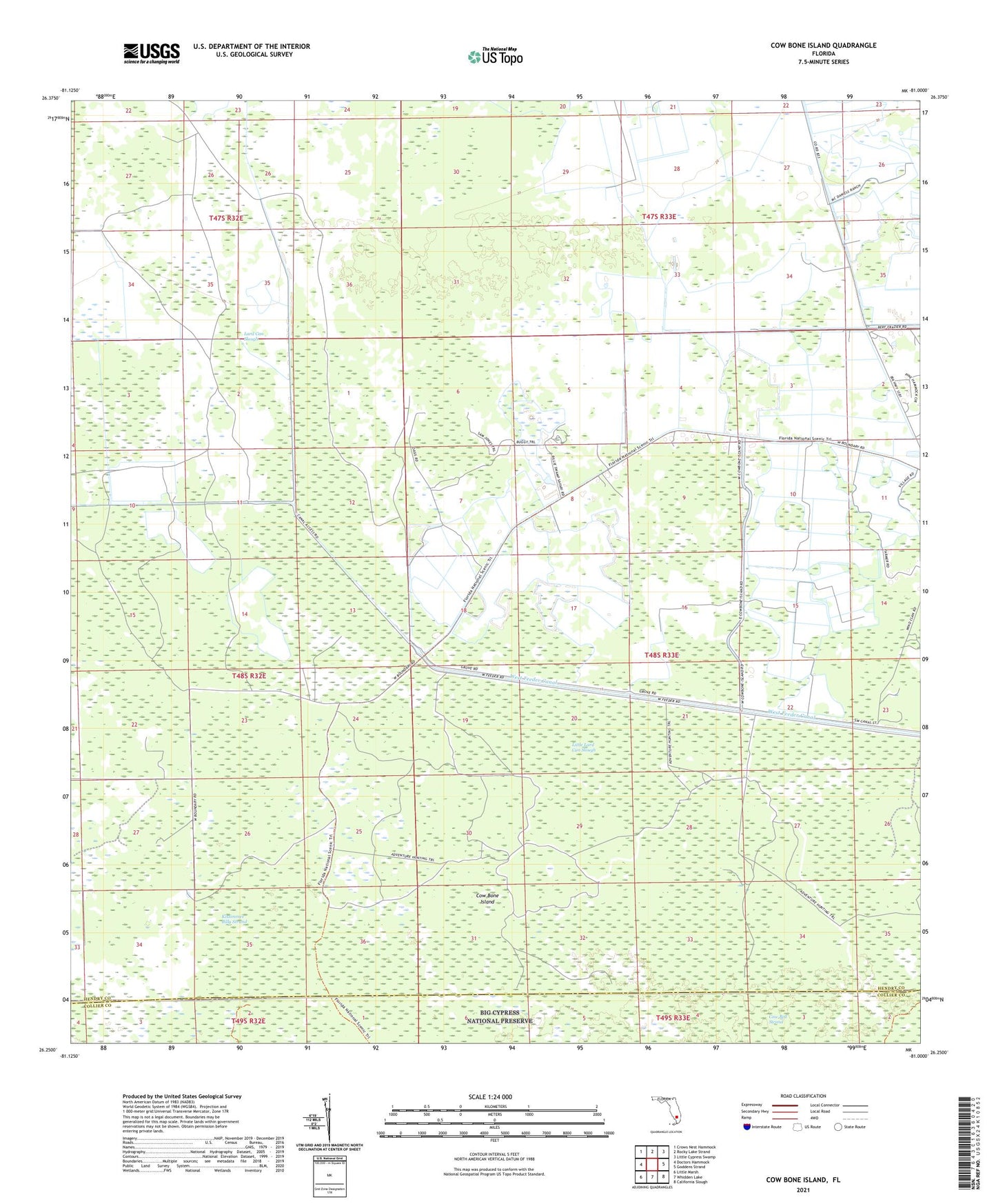
2024 topographic map quadrangle Cow Bone Island in the state of Florida. Scale: 1:24000. Based on the newly updated USGS 7.5' US Topo map series, this map is in the following counties: Hendry, Collier. The map contains contour data, water features, and other items you are used to seeing on USGS maps, but also has updated roads and other features. This is the next generation of topographic maps. Printed on high-quality waterproof paper with UV fade-resistant inks.
Quads adjacent to this one:
West: Doctors Hammock
Northwest: Crows Nest Hammock
North: Rocky Lake Strand
Northeast: Little Cypress Swamp
East: Goddens Strand
Southeast: California Slough
South: Whidden Lake
Southwest: Little Marsh
This map covers the same area as the classic USGS quad with code o26081c1.
Contains the following named places: Cow Bone Island, Lard Can Slough, Little Lard Can Slough, West Feeder Canal