MyTopo
Grassy Key Florida US Topo Map
Couldn't load pickup availability
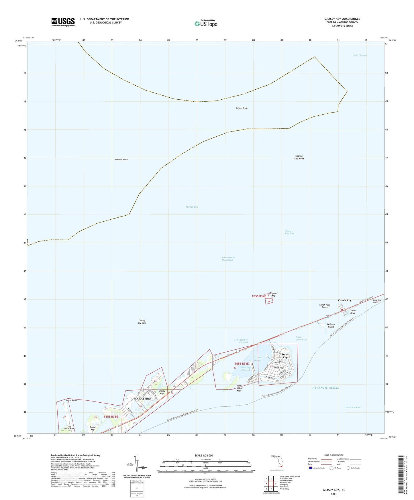
2024 topographic map quadrangle Grassy Key in the state of Florida. Scale: 1:24000. Based on the newly updated USGS 7.5' US Topo map series, this map is in the following counties: Monroe. The map contains contour data, water features, and other items you are used to seeing on USGS maps, but also has updated roads and other features. This is the next generation of topographic maps. Printed on high-quality waterproof paper with UV fade-resistant inks.
Quads adjacent to this one:
West: Bamboo Key
Northwest: East Bahia Honda Key NE
North: Schooner Bank
Northeast: Buchanan Keys
East: Long Key
South: Crawl Key
Southwest: Marathon
This map covers the same area as the classic USGS quad with code o24080g8.
Contains the following named places: Bamboo Banks, Burnt Point, Channel Key, Channel Key Banks, Channel Key Pass, Conch Key, Conch Keys, Conch Keys Banks, Duck Key, Duck Key Census Designated Place, Duck Key Channel, Flying Bonefish Seaplane Base, Grassy Key, Grassy Key Bank, Jolly Roger Travel Park, Key Colony Beach Shopping Center, Monroe County Fire Rescue - Station 17, Toms Harbor, Toms Harbor Channel, Toms Harbor Cut, Toms Harbor Keys, Tripod Banks, Walkers Island, WFET-TV (Marathon), WKKB-FM (Key Colony Beach), Yacht Channel