MyTopo
Green Point Florida US Topo Map
Couldn't load pickup availability
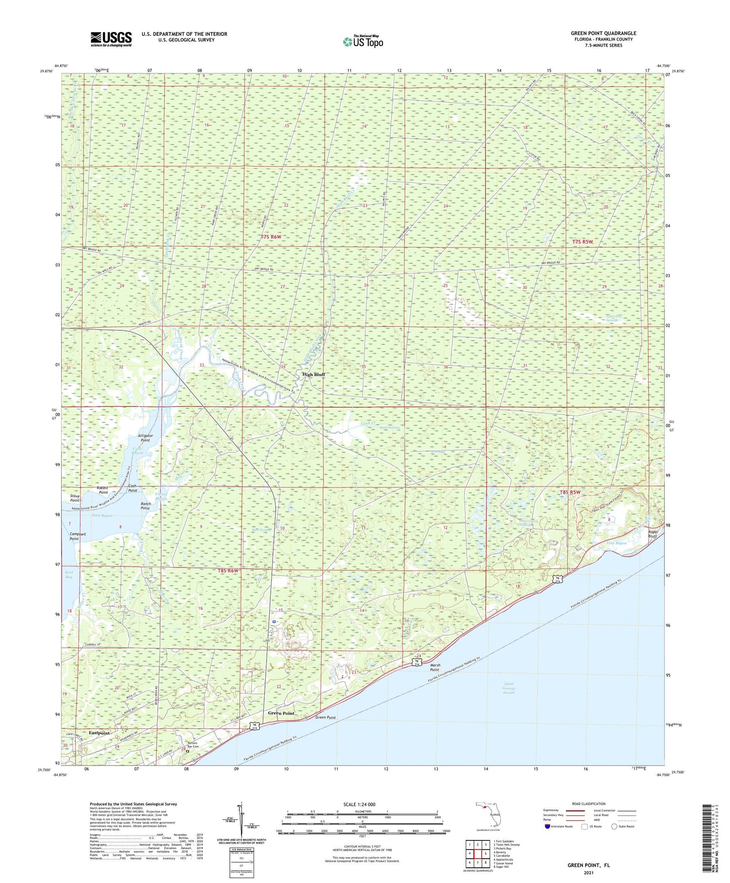
2024 topographic map quadrangle Green Point in the state of Florida. Scale: 1:24000. Based on the newly updated USGS 7.5' US Topo map series, this map is in the following counties: Franklin. The map contains contour data, water features, and other items you are used to seeing on USGS maps, but also has updated roads and other features. This is the next generation of topographic maps. Printed on high-quality waterproof paper with UV fade-resistant inks.
Quads adjacent to this one:
West: Beverly
Northwest: Fort Gadsden
North: Tates Hell Swamp
Northeast: Pickett Bay
East: Carrabelle
Southeast: Sugar Hill
South: Goose Island
Southwest: Apalachicola
This map covers the same area as the classic USGS quad with code o29084g7.
Contains the following named places: Alligator Point, Bear Bay, Bear Creek, Bird Swamp, Campbell Point, Carrin Bayou, Cash Bayou, Cash Creek, Cash Point, Cash Swamp, Cow Creek, East Bayou, Eastpoint Census Designated Place, Eastpoint Division, Franklin County, Franklin County Sheriff's Office, Green Point, High Bluff, High Bluff Creek, Marian Creek, Marsh Point, Miller Creek, Otter Creek Swamp, Porters Bar Cemetery, Rabbit Point, Rake Creek, Ranch Point, Sandbank Creek, Stave Point, Tates Hell Swamp, Yent Bayou