
MyTopo
Havana South Florida US Topo Map
Couldn't load pickup availability
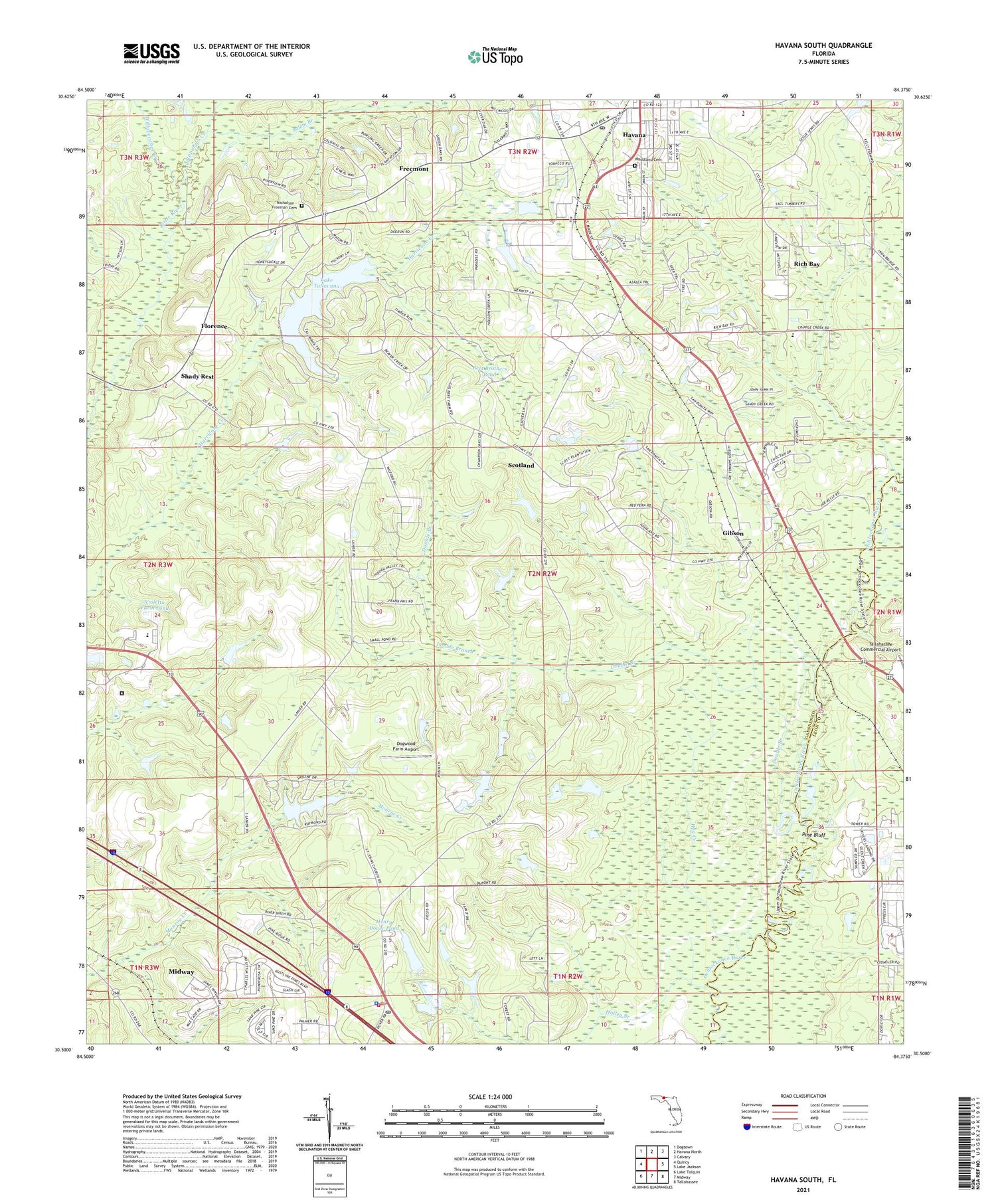
2024 topographic map quadrangle Havana South in the state of Florida. Scale: 1:24000. Based on the newly updated USGS 7.5' US Topo map series, this map is in the following counties: Gadsden, Leon. The map contains contour data, water features, and other items you are used to seeing on USGS maps, but also has updated roads and other features. This is the next generation of topographic maps. Printed on high-quality waterproof paper with UV fade-resistant inks.
Quads adjacent to this one:
West: Quincy
Northwest: Dogtown
North: Havana North
Northeast: Calvary
East: Lake Jackson
Southeast: Tallahassee
South: Midway
Southwest: Lake Talquin
This map covers the same area as the classic USGS quad with code o30084e4.
Contains the following named places: Altschul Railroad Station, Attapulgus Creek, Bert Brothers Pond, China Hill Church, Dogwood Farm Airport, Double Branch, Florence, Freemont, Gibson, Havana, Havana Day Care Center, Havana Division, Havana Elementary School, Havana Fire Tower, Havana Middle School, Havana Post Office, Henry Dover Pond, Hog Creek, Holley Branch, Hopewell Church, Lake Tallavana, Lake Yvette, Mary G Munroe Pond, Midway Police Department, Midway Post Office, Midway Volunteer Fire Department, Neals Temple, Nicholson - Freeman Cemetery, Ohathlockhouchy, Panacea United Methodist Church, Pine Bluff, Pine Park School, Piney Grove Church, Rich Bay, Rich Bay Church, Saint James Church, Saint John Missionary Baptist Church, Saint Johns Church, Saint Pauls Church, Salem Branch, Scotland, Shady Rest, Tallahassee Commercial Airport, Topkegaiga, Town and Country Shopping Center, Violetta Farm Pond, WFHT-FM (Quincy), Willacoochee Creek, WMLO-FM (Havana), Woodland Cemetery, ZIP Code: 32333


