MyTopo
Calvary Georgia US Topo Map
Couldn't load pickup availability
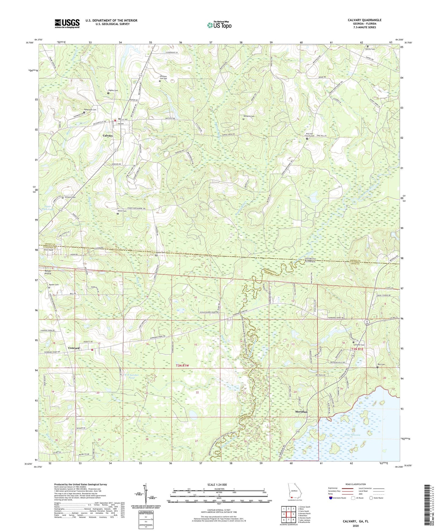
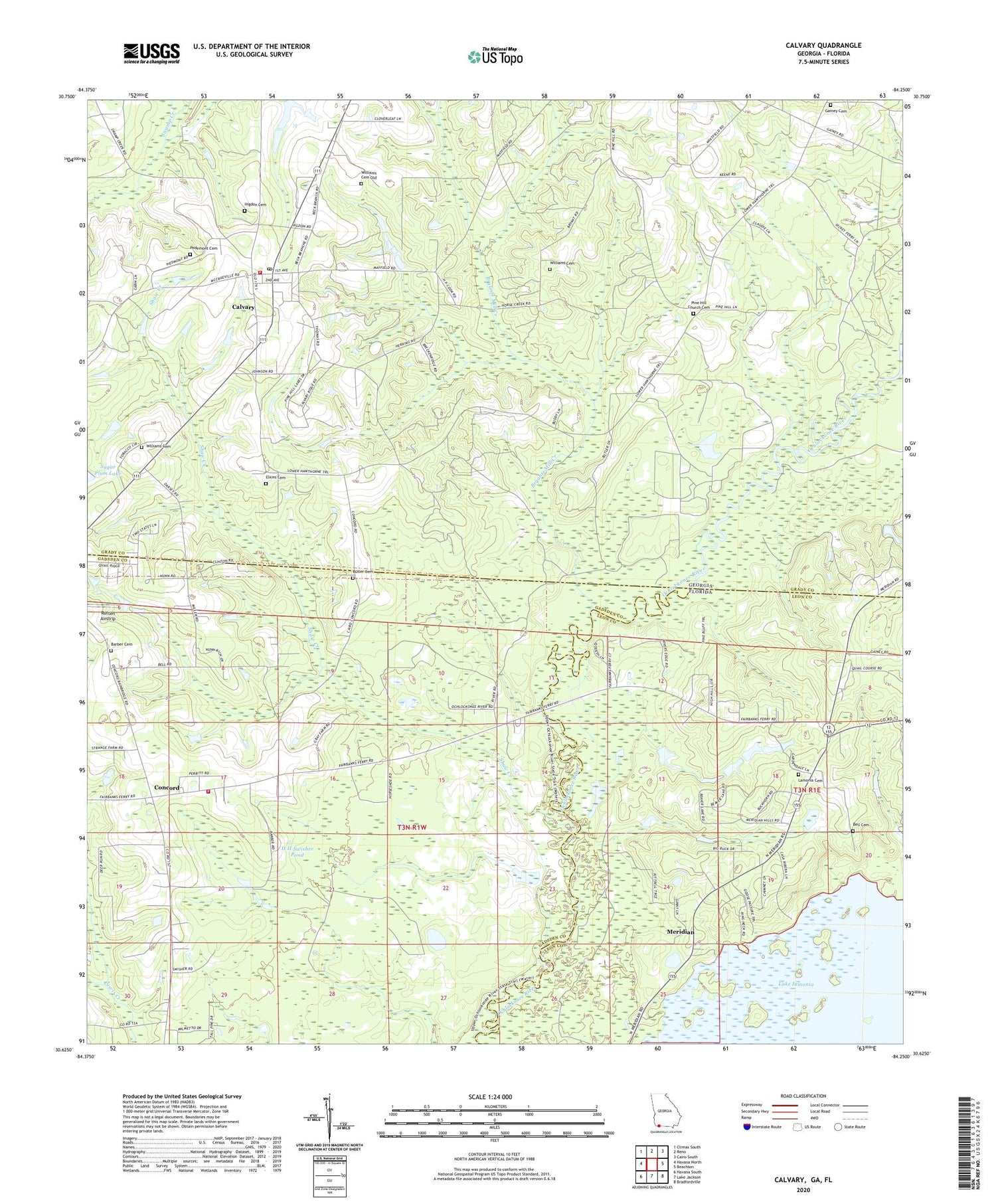
2024 topographic map quadrangle Calvary in the states of Florida, Georgia. Scale: 1:24000. Based on the newly updated USGS 7.5' US Topo map series, this map is in the following counties: Grady, Gadsden, Leon. The map contains contour data, water features, and other items you are used to seeing on USGS maps, but also has updated roads and other features. This is the next generation of topographic maps. Printed on high-quality waterproof paper with UV fade-resistant inks.
Quads adjacent to this one:
West: Havana North
Northwest: Climax South
North: Reno
Northeast: Cairo South
East: Beachton
Southeast: Bradfordville
South: Lake Jackson
Southwest: Havana South
This map covers the same area as the classic USGS quad with code o30084f3.
Contains the following named places: Barber Cemetery, Beck Branch School, Bell Cemetery, Bell School, Bryants Mill Creek, Butler Cemetery, Calvary, Calvary Baptist Church, Calvary Census Designated Place, Calvary Post Office, Calvary United Methodist Church, Calvary-Reno Division, China Hill Church, Concord, Concord Volunteer Fire Department, Elkins Cemetery, Gainey Cemetery, Grady County Volunteer Fire Department Calvary Station, H H Swisher Pond, Hiamonee, Higdon Cemetery, Lamonia Cemetery, Meridian, Ocklockonee, Pedemont Cemetery, Piedmont Primitive Baptist Church, Pine Hill, Pine Hill Assembly of God Church, Pine Hill Church, Pine Hill Church Cemetery, Rutten Airstrip, Saint Calvary Church, Saint Johns Church, Saint Marys Church, Shaw Creek, Sugar Plum Lake Dam, Williams Cemetery, Williams Cemetery Old