MyTopo
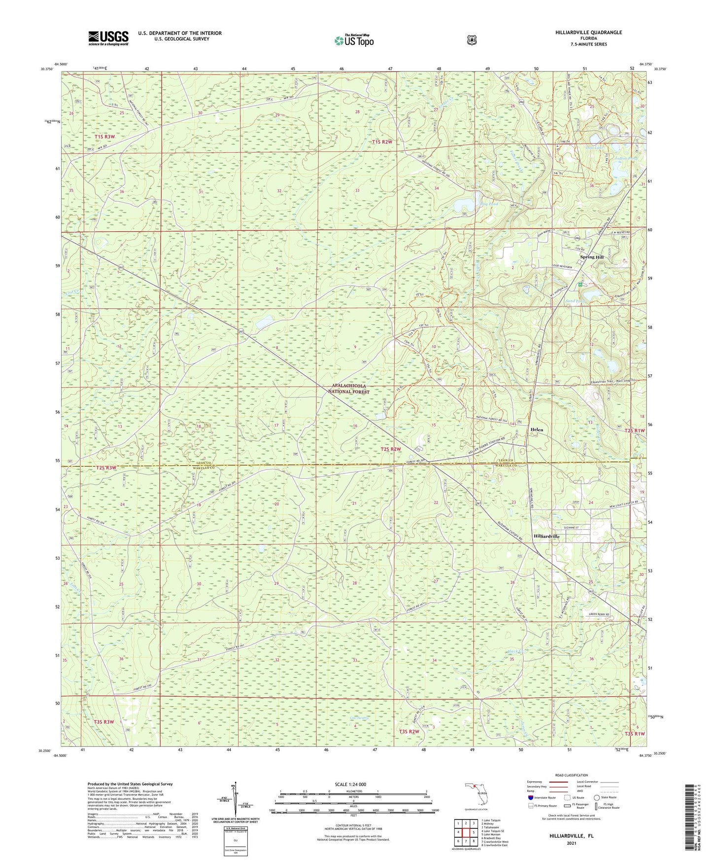
Hilliardville Florida US Topo Map
Couldn't load pickup availability
Also explore the Hilliardville Forest Service Topo of this same quad for updated USFS data
2024 topographic map quadrangle Hilliardville in the state of Florida. Scale: 1:24000. Based on the newly updated USGS 7.5' US Topo map series, this map is in the following counties: Leon, Wakulla. The map contains contour data, water features, and other items you are used to seeing on USGS maps, but also has updated roads and other features. This is the next generation of topographic maps. Printed on high-quality waterproof paper with UV fade-resistant inks.
Quads adjacent to this one:
West: Lake Talquin SE
Northwest: Lake Talquin
North: Midway
Northeast: Tallahassee
East: Lake Munson
Southeast: Crawfordville East
South: Crawfordville West
Southwest: Bradwell Bay
This map covers the same area as the classic USGS quad with code o30084c4.
Contains the following named places: Black Creek, Dog Pond, Helen, Hilliardville, Lofton Pond, Lost Lake, Lost Lake Recreation Site, New Light Church, Sand Pond, Southwest Leon Division, Spring Hill, Trout Pond Recreation Area, Wakulla Work Center