
MyTopo
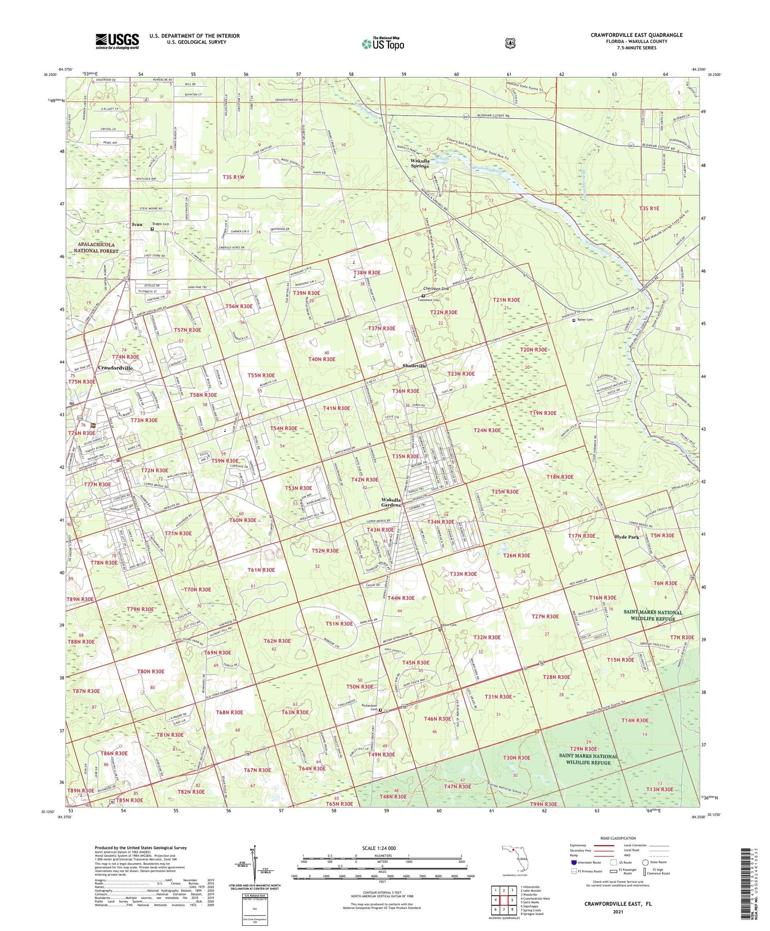
Crawfordville East Florida US Topo Map
Couldn't load pickup availability
Also explore the Crawfordville East Forest Service Topo of this same quad for updated USFS data
2024 topographic map quadrangle Crawfordville East in the state of Florida. Scale: 1:24000. Based on the newly updated USGS 7.5' US Topo map series, this map is in the following counties: Wakulla. The map contains contour data, water features, and other items you are used to seeing on USGS maps, but also has updated roads and other features. This is the next generation of topographic maps. Printed on high-quality waterproof paper with UV fade-resistant inks.
Quads adjacent to this one:
West: Crawfordville West
Northwest: Hilliardville
North: Lake Munson
Northeast: Woodville
East: Saint Marks
Southeast: Sprague Island
South: Spring Creek
Southwest: Sopchoppy
This map covers the same area as the classic USGS quad with code o30084b3.
Contains the following named places: Beaulah Church, Causseaux Cemetery, Cherokee Sink, Crawfordville Census Designated Place, Crawfordville Post Office, Duggar Cemetery, Edward Ball Wakulla Springs State Park, First Baptist Church, Hyde Park, Ivan, Ivan Church, Jump Creek, McBride Slough, Medart Assembly of God Church, Mount Olive Primitive Baptist Church, Pilgrims Rest Church, Raher Cemetery, Richardson Cemetery, Riversink Baptist Church, Saint Pauls Church, Saint Pauls United Methodist Church, Salem Church, Seventh Day Adventist Church, Shadeville, Shadeville Elementary School, The Church of Jesus Christ of Latter Day Saints-Crawfordville, Thessalonia Missionary Church, Wakulla Club Airport, Wakulla County Fire Rescue Station, Wakulla Gardens, Wakulla Middle School, Wakulla Springs, Walker Cemetery, Wasupa, ZIP Code: 32327


