MyTopo
Hosford Florida US Topo Map
Couldn't load pickup availability
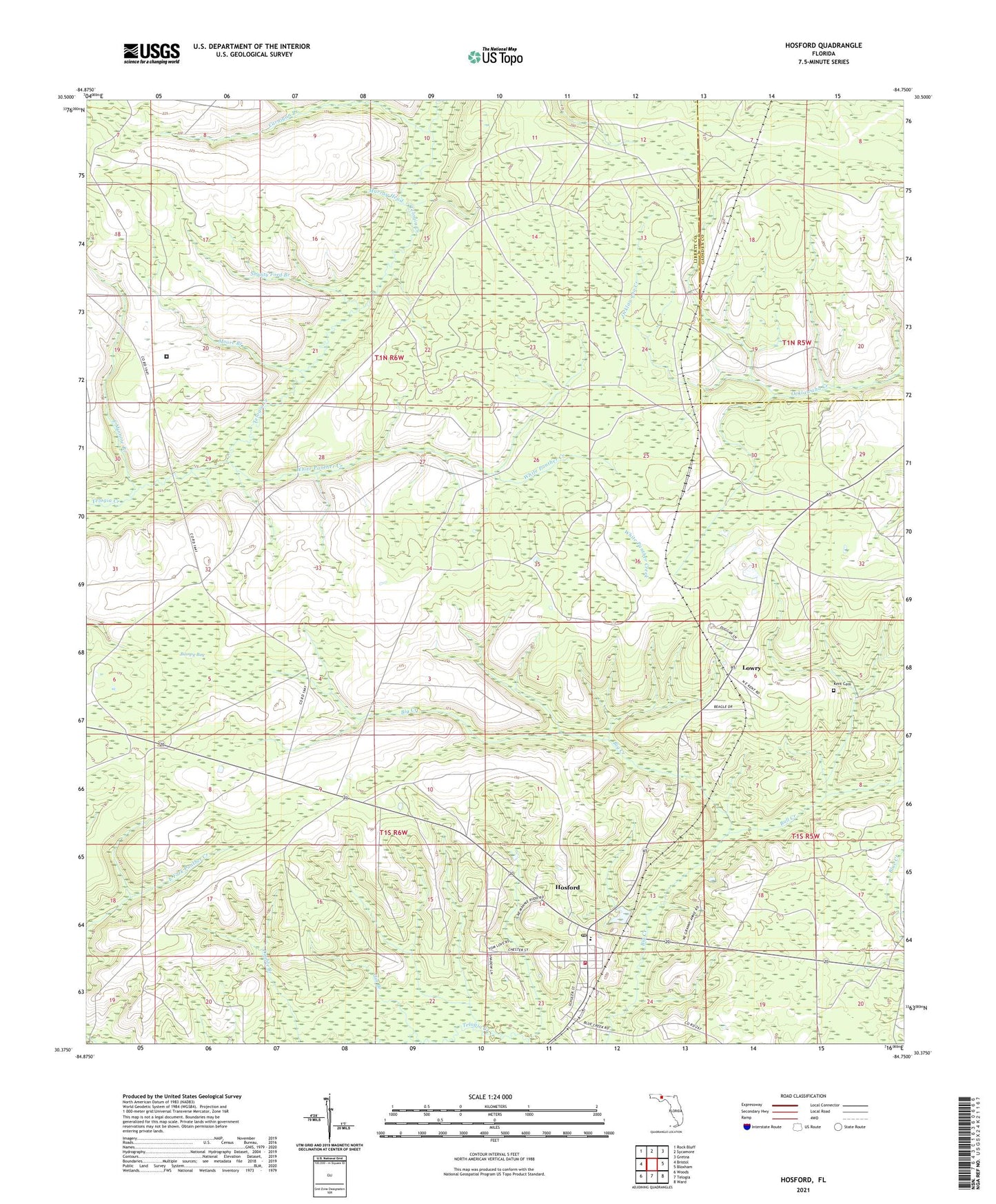
2024 topographic map quadrangle Hosford in the state of Florida. Scale: 1:24000. Based on the newly updated USGS 7.5' US Topo map series, this map is in the following counties: Liberty, Gadsden. The map contains contour data, water features, and other items you are used to seeing on USGS maps, but also has updated roads and other features. This is the next generation of topographic maps. Printed on high-quality waterproof paper with UV fade-resistant inks.
Quads adjacent to this one:
West: Bristol
Northwest: Rock Bluff
North: Sycamore
Northeast: Gretna
East: Bloxham
Southeast: Ward
South: Telogia
Southwest: Woods
This map covers the same area as the classic USGS quad with code o30084d7.
Contains the following named places: Bull Creek, Bumpy Bay, Carnigan Branch, East Minnow Branch, Gin Branch, Hosford, Hosford - Telogia Volunteer Fire Department, Hosford Census Designated Place, Hosford Post Office, Kent Cemetery, Liberty Correctional Institution, Liberty County Correctional Institute, Lowry, Moore Branch, Murray Head, Robert Brent Wildlife Management Area, Shanty Ford Branch, White Panther Creek