MyTopo
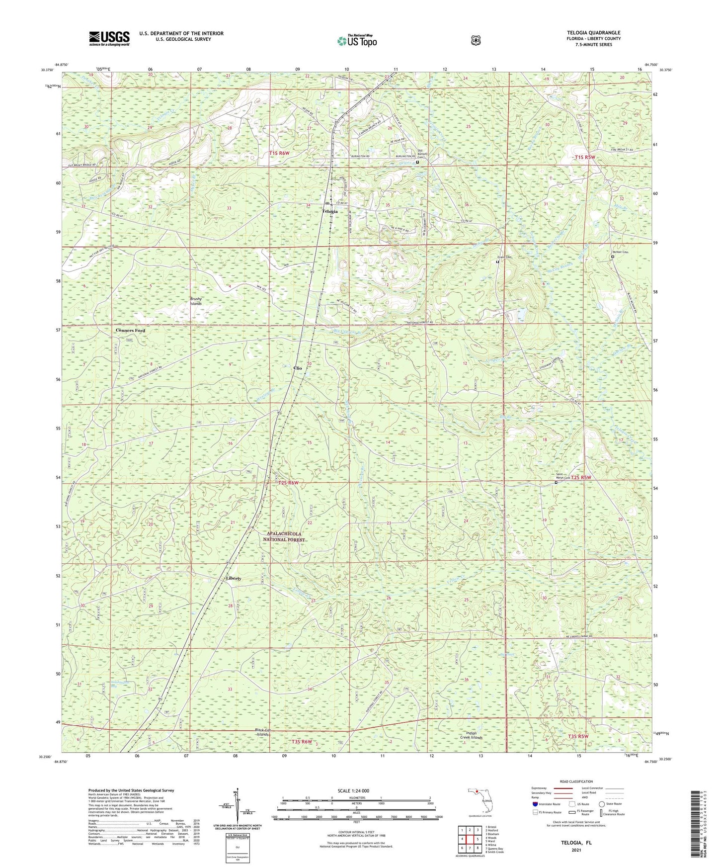
Telogia Florida US Topo Map
Couldn't load pickup availability
Also explore the Telogia Forest Service Topo of this same quad for updated USFS data
2024 topographic map quadrangle Telogia in the state of Florida. Scale: 1:24000. Based on the newly updated USGS 7.5' US Topo map series, this map is in the following counties: Liberty. The map contains contour data, water features, and other items you are used to seeing on USGS maps, but also has updated roads and other features. This is the next generation of topographic maps. Printed on high-quality waterproof paper with UV fade-resistant inks.
Quads adjacent to this one:
West: Woods
Northwest: Bristol
North: Hosford
Northeast: Bloxham
East: Ward
Southeast: Smith Creek
South: Queens Bay
Southwest: Wilma
This map covers the same area as the classic USGS quad with code o30084c7.
Contains the following named places: Barbecue Branch, Big Branch, Big Creek, Big Cypress Branch, Big Thick, Black Curve, Brushy Islands, Butcherknife Branch, Clio, Conners Ford, Cooper Branch, Double Branch, Driver Branch, Dykes Branch, Evans Cemetery, Harlow Branch, Liberty, McCoy Branch, McNair Branch, McNair Cemetery, Mercer Fire Tower, Mile Branch, Mill Pond Branch, Old Burnoff Cemetery, Panther Creek, Reedy Branch, Saint Marys Cemetery, Stokes Branch, Telogia, Telogia Post Office, Western Branch