MyTopo
Lake Delancy Florida US Topo Map
Couldn't load pickup availability
Also explore the Lake Delancy Forest Service Topo of this same quad for updated USFS data
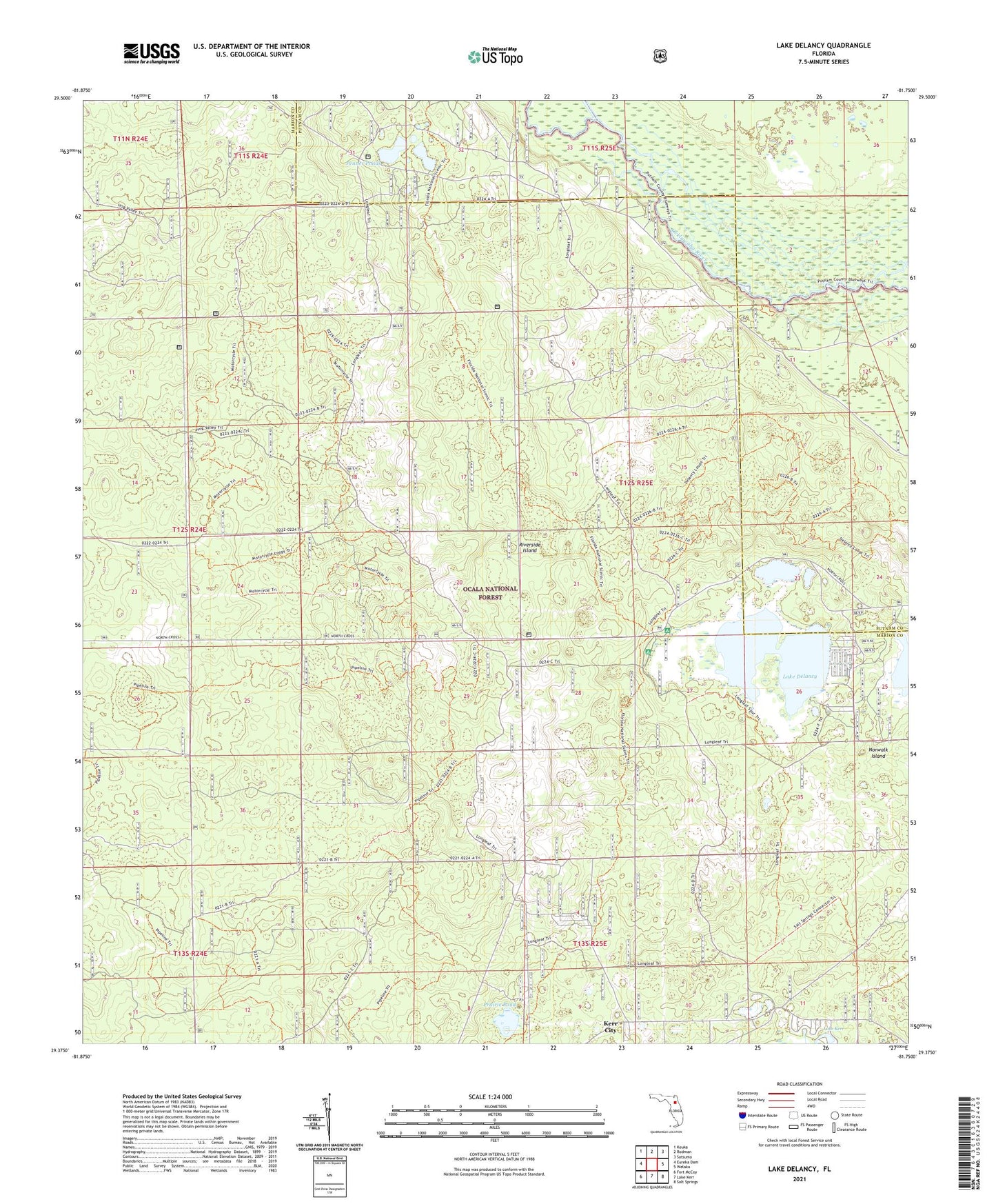
2024 topographic map quadrangle Lake Delancy in the state of Florida. Scale: 1:24000. Based on the newly updated USGS 7.5' US Topo map series, this map is in the following counties: Marion, Putnam. The map contains contour data, water features, and other items you are used to seeing on USGS maps, but also has updated roads and other features. This is the next generation of topographic maps. Printed on high-quality waterproof paper with UV fade-resistant inks.
Quads adjacent to this one:
West: Eureka Dam
Northwest: Keuka
North: Rodman
Northeast: Satsuma
East: Welaka
Southeast: Salt Springs
South: Lake Kerr
Southwest: Fort McCoy
This map covers the same area as the classic USGS quad with code o29081d7.
Contains the following named places: Grassy Pond Recreation Area, Lake Delancy, Lake Delancy Recreation Area, Norwalk Island, Ocala Sand Pine Seed Orchard, Penner Ponds, Prairie Pond, Riverside Island, ZIP Code: 32134