MyTopo
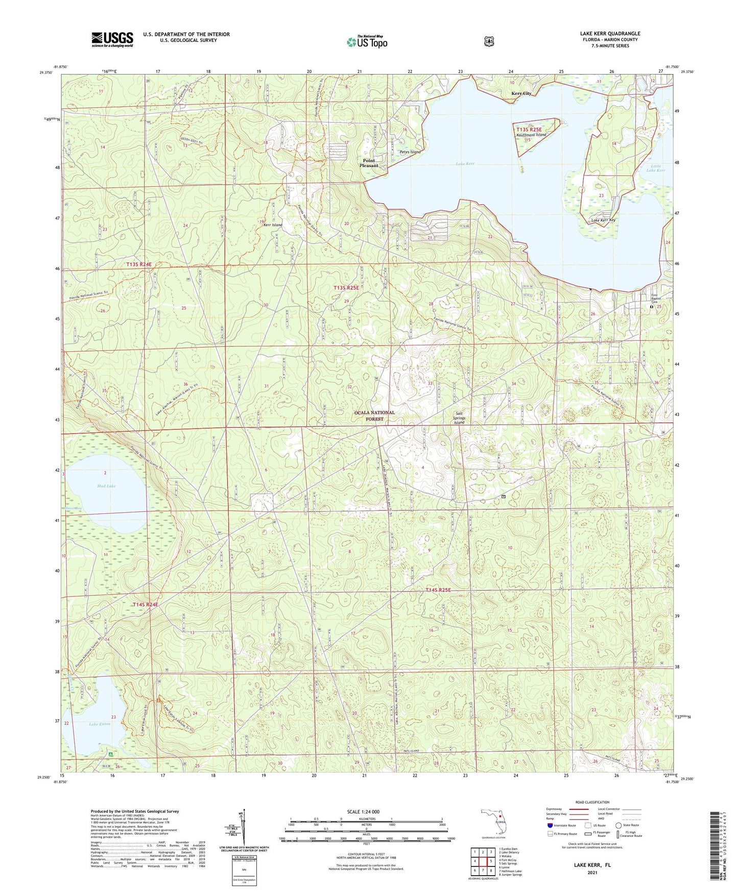
Lake Kerr Florida US Topo Map
Couldn't load pickup availability
Also explore the Lake Kerr Forest Service Topo of this same quad for updated USFS data
2024 topographic map quadrangle Lake Kerr in the state of Florida. Scale: 1:24000. Based on the newly updated USGS 7.5' US Topo map series, this map is in the following counties: Marion. The map contains contour data, water features, and other items you are used to seeing on USGS maps, but also has updated roads and other features. This is the next generation of topographic maps. Printed on high-quality waterproof paper with UV fade-resistant inks.
Quads adjacent to this one:
West: Fort McCoy
Northwest: Eureka Dam
North: Lake Delancy
Northeast: Welaka
East: Salt Springs
Southeast: Juniper Springs
South: Halfmoon Lake
Southwest: Lynne
This map covers the same area as the classic USGS quad with code o29081c7.
Contains the following named places: Eureka Lookout Tower, First Baptist Cemetery, First Baptist Church of Salt Springs, Florida Gas Transmission Company Radio Tower, Hulls Creek, Kauffmans Island, Kerr City, Kerr Island, Lake Eaton, Lake Eaton Campground, Lake Kerr, Lake Kerr Census Designated Place, Lake Kerr Key, Little Lake Kerr, Mason Bay, Moorehead Park, Mud Lake, New Beginnings Church of God, North Hunt Information Center, Petes Island, Point Pleasant, Salt Springs Island, Youth Camp Recreation Site