MyTopo
Lake Weohyakapka Florida US Topo Map
Couldn't load pickup availability
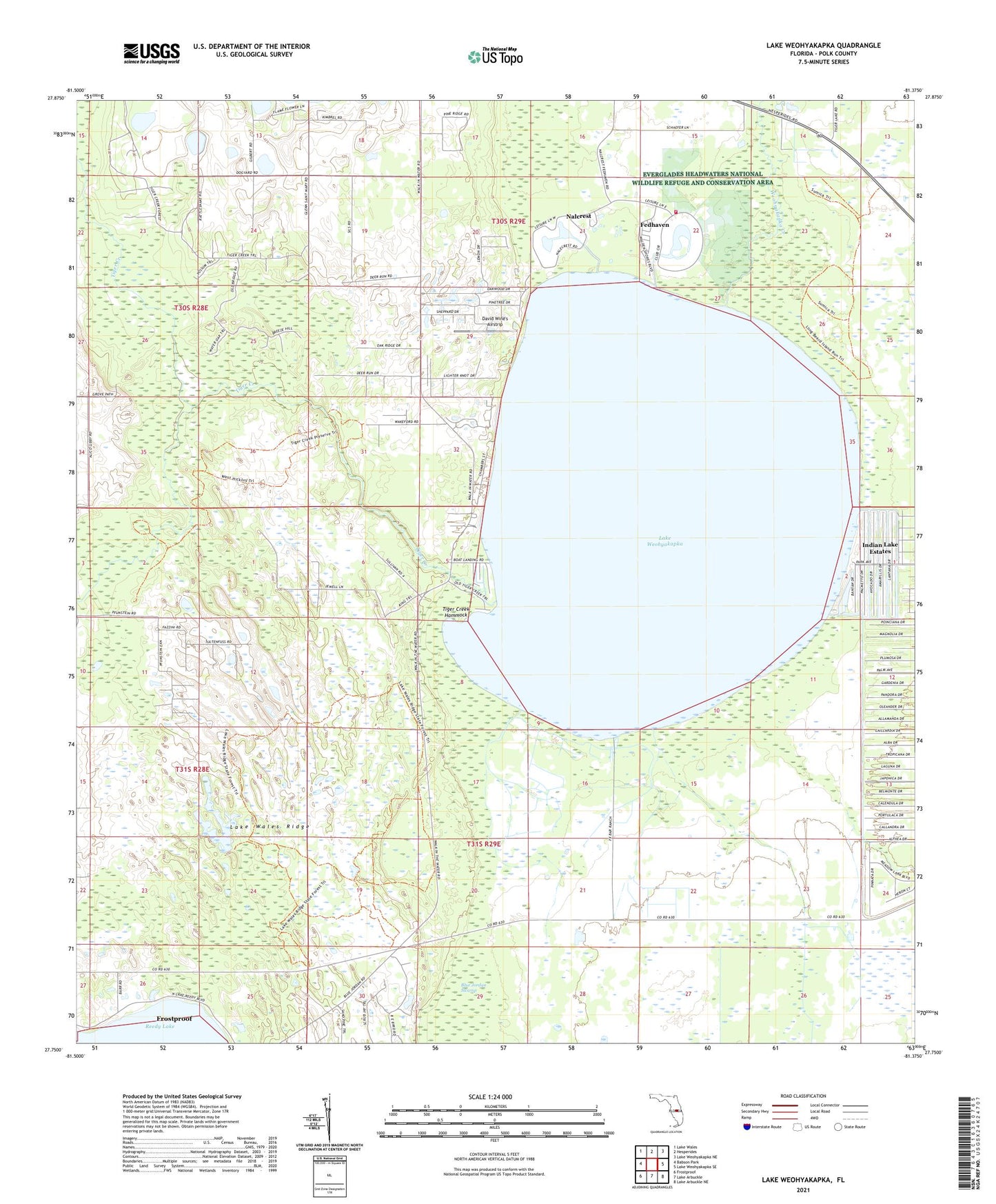
2024 topographic map quadrangle Lake Weohyakapka in the state of Florida. Scale: 1:24000. Based on the newly updated USGS 7.5' US Topo map series, this map is in the following counties: Polk. The map contains contour data, water features, and other items you are used to seeing on USGS maps, but also has updated roads and other features. This is the next generation of topographic maps. Printed on high-quality waterproof paper with UV fade-resistant inks.
Quads adjacent to this one:
West: Babson Park
Northwest: Lake Wales
North: Hesperides
Northeast: Lake Weohyakapka NE
East: Lake Weohyakapka SE
Southeast: Lake Arbuckle NE
South: Lake Arbuckle
Southwest: Frostproof
This map covers the same area as the classic USGS quad with code o27081g4.
Contains the following named places: Fedhaven, Flyjivefly Airport, Indian Lake Estates, Lake Andrea, Lake Wales Division, Lake Weohyakapka, Nalcrest, Polk County Emergency Medical Services Station 6 Nalcrest, Polk County Fire Department Station 9 Fedhaven, Tiger Creek, Tiger Creek Hammock, Walden Shores Mobile Home Park, ZIP Codes: 33854, 33856