MyTopo
Hesperides Florida US Topo Map
Couldn't load pickup availability
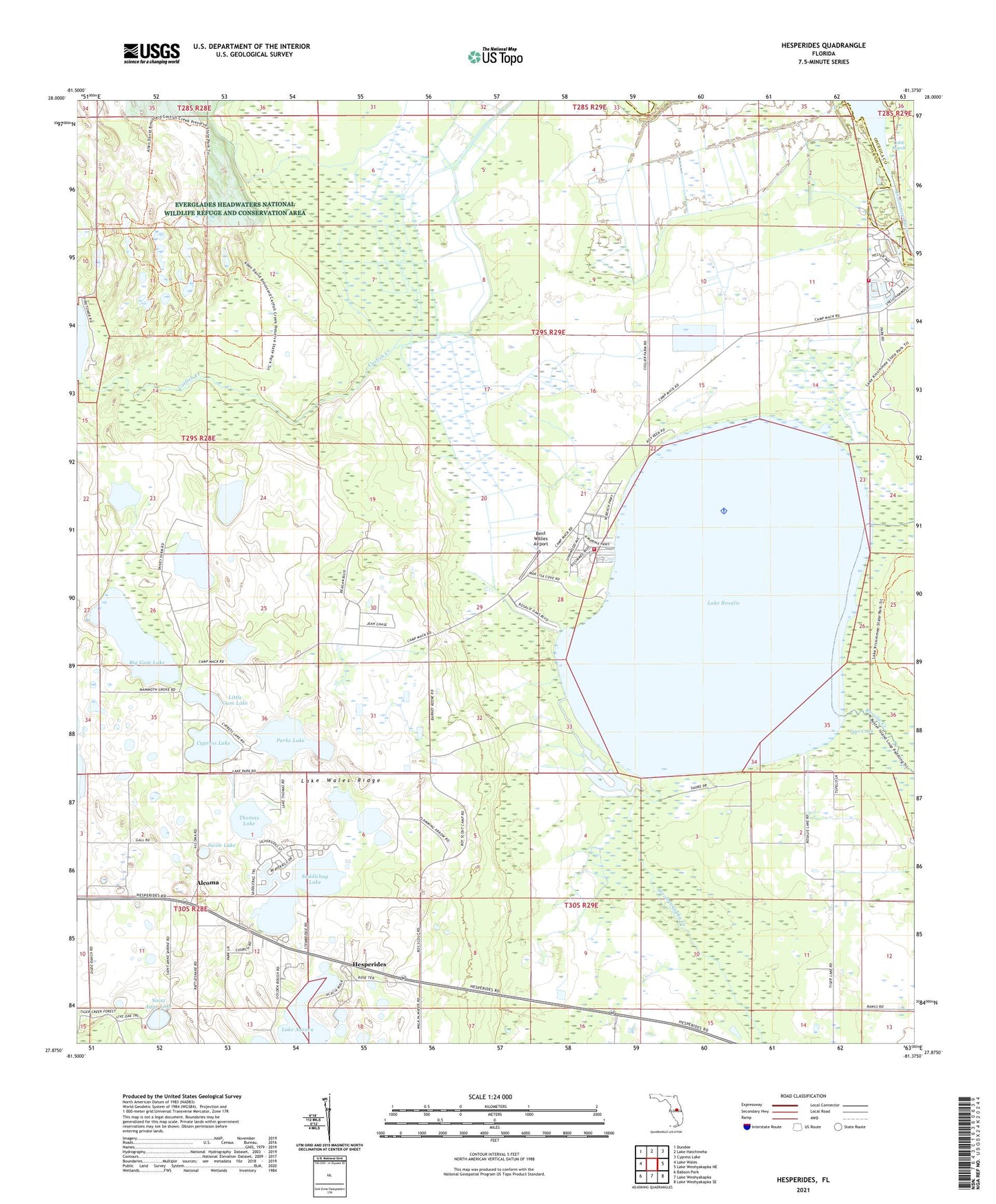
2024 topographic map quadrangle Hesperides in the state of Florida. Scale: 1:24000. Based on the newly updated USGS 7.5' US Topo map series, this map is in the following counties: Polk, Osceola. The map contains contour data, water features, and other items you are used to seeing on USGS maps, but also has updated roads and other features. This is the next generation of topographic maps. Printed on high-quality waterproof paper with UV fade-resistant inks.
Quads adjacent to this one:
West: Lake Wales
Northwest: Dundee
North: Lake Hatchineha
Northeast: Cypress Lake
East: Lake Weohyakapka NE
Southeast: Lake Weohyakapka SE
South: Lake Weohyakapka
Southwest: Babson Park
This map covers the same area as the classic USGS quad with code o27081h4.
Contains the following named places: Alcoma, Bay Area Baptist Church, Bent Willies Airport, Beulah Church, Big Gum Lake, Camp Mack, Cypress Lake, Fort Gardner, Harrys Harbor Mobile Home Park, Hesperides, Kissimmee River Mobile Home Park, Kissimmee River Volunteer Fire Station 16, Kissimmee River Volunteer Fire Station 17, Lake Aurora, Lake Kissimmee State Park, Lake Rosalie, Little Gum Lake, Parks Lake, Saddlebag Lake, Sage Seadrome, Saint Anne Lake, Saint Anne Shrine, Swim Lake, The Harbor Mobile Home Park, Thomas Lake, Tiger Creek, Weohyakapka Creek