MyTopo
Loxahatchee Florida US Topo Map
Couldn't load pickup availability
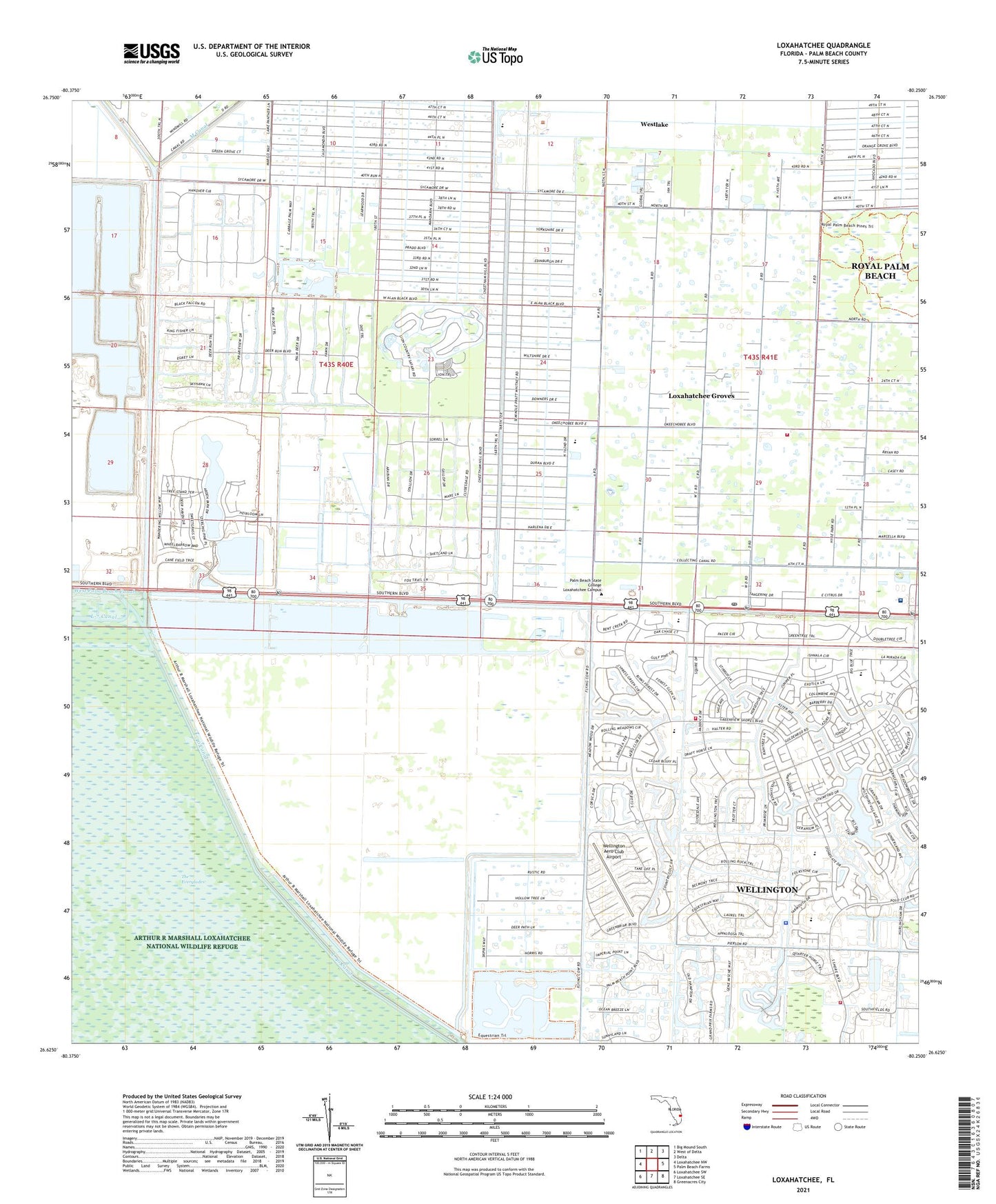
2024 topographic map quadrangle Loxahatchee in the state of Florida. Scale: 1:24000. Based on the newly updated USGS 7.5' US Topo map series, this map is in the following counties: Palm Beach. The map contains contour data, water features, and other items you are used to seeing on USGS maps, but also has updated roads and other features. This is the next generation of topographic maps. Printed on high-quality waterproof paper with UV fade-resistant inks.
Quads adjacent to this one:
West: Loxahatchee NW
Northwest: Big Mound South
North: West of Delta
Northeast: Delta
East: Palm Beach Farms
Southeast: Greenacres City
South: Loxahatchee SE
Southwest: Loxahatchee SW
This map covers the same area as the classic USGS quad with code o26080f3.
Contains the following named places: Binks Forest Elementary School, Fire Station Number 21, Fire Station Number 27, Loxahatchee Groves, Loxahatchee Groves Elementary School, Loxahatchee Post Office, New Horizons Elementary School, Palm Beach County Fire Rescue Station 20, Palm Beach County Fire Rescue Station 21, Palm Beach County Fire Rescue Station 27, Palm Beach County Sheriff's Office District 8, Palms West Hospital, Palms West Hospital Helistop, Recreation Area Six, Sunsport Gardens Mobile Home Park, Town of Loxahatchee Groves, Village of Wellington, Wellington Aero Club Airport, Wellington Country Club, Wellington Elementary School, Wellington High School, Wellington Landings Middle School, West Bay Club, West End Golf Club, West Meadows Golf Club, Western Pines Community Middle School, WoeQ-AM (Royal Palm Beach), ZIP Code: 33470