MyTopo
West of Delta Florida US Topo Map
Couldn't load pickup availability
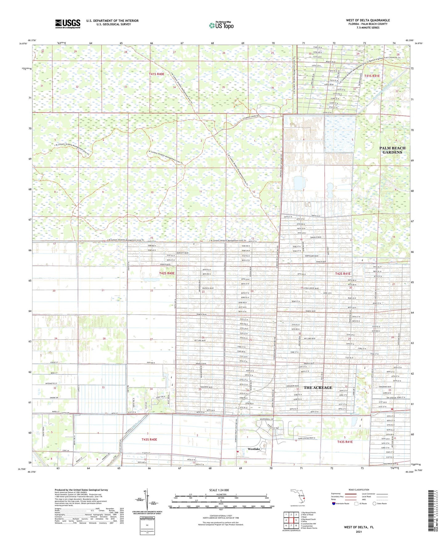
2024 topographic map quadrangle West of Delta in the state of Florida. Scale: 1:24000. Based on the newly updated USGS 7.5' US Topo map series, this map is in the following counties: Palm Beach. The map contains contour data, water features, and other items you are used to seeing on USGS maps, but also has updated roads and other features. This is the next generation of topographic maps. Printed on high-quality waterproof paper with UV fade-resistant inks.
Quads adjacent to this one:
West: Big Mound South
Northwest: Big Mound North
North: West of Rood
Northeast: Rood
East: Delta
Southeast: Palm Beach Farms
South: Loxahatchee
Southwest: Loxahatchee NW
This map covers the same area as the classic USGS quad with code o26080g3.
Contains the following named places: City of Westlake, Fire Station Number 22, Fire Station Number 26, Frontier Elementary School, Golden Grove Elementary School, M Canal, Palm Beach County Fire Rescue Station 22, Palm Beach County Fire Rescue Station 26, Pierce Hammock Elementary School, South Florida Youth Conservation Camp, The Acreage, The Acreage Census Designated Place, Western Community Division, Westlake, WLVJ-AM (Royal Palm Beach), WoeQ-AM (Royal Palm Beach)