MyTopo
McAlpin Florida US Topo Map
Couldn't load pickup availability
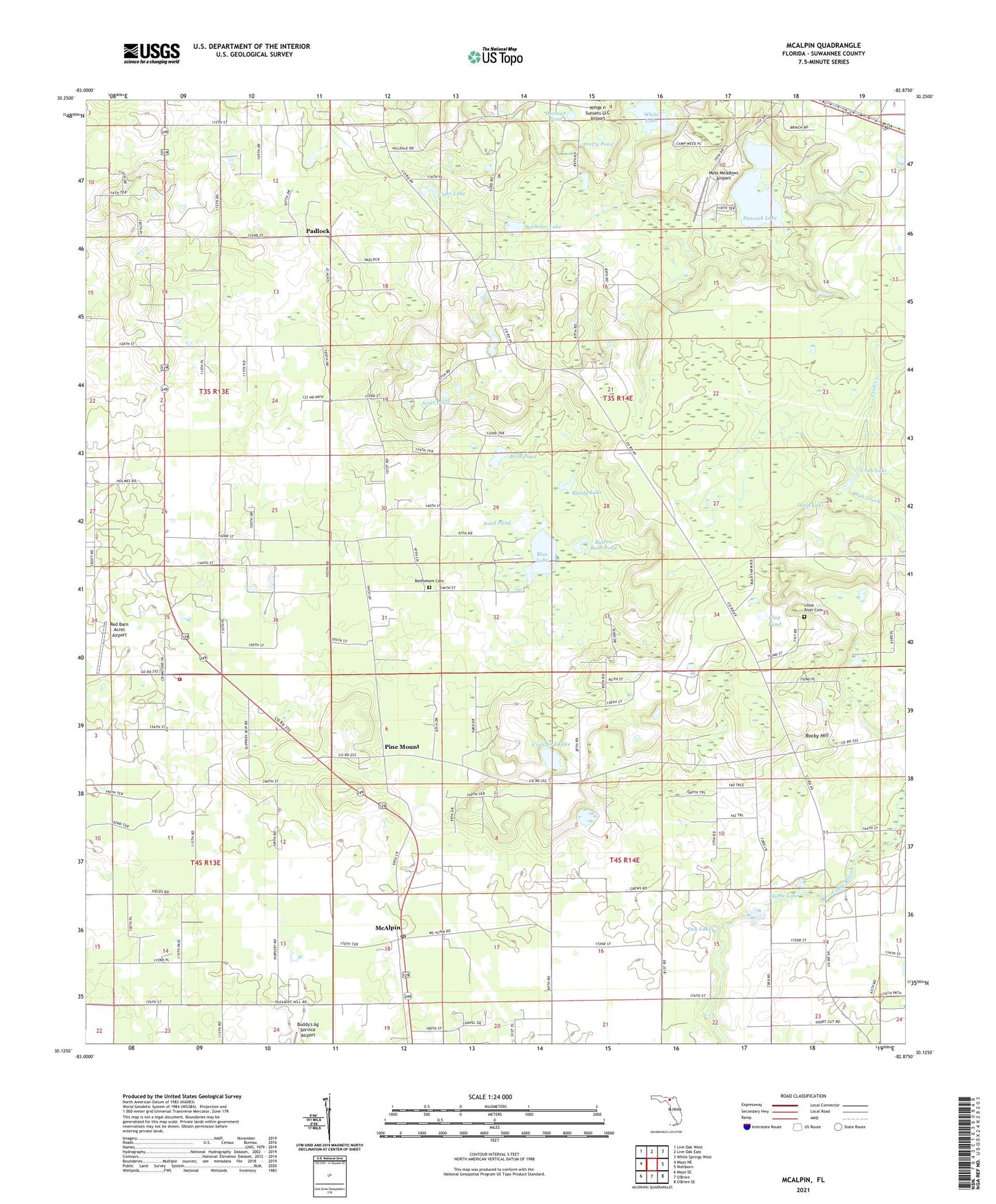
2024 topographic map quadrangle McAlpin in the state of Florida. Scale: 1:24000. Based on the newly updated USGS 7.5' US Topo map series, this map is in the following counties: Suwannee. The map contains contour data, water features, and other items you are used to seeing on USGS maps, but also has updated roads and other features. This is the next generation of topographic maps. Printed on high-quality waterproof paper with UV fade-resistant inks.
Quads adjacent to this one:
West: Mayo NE
Northwest: Live Oak West
North: Live Oak East
Northeast: White Springs West
East: Wellborn
Southwest: Mayo SE
This map covers the same area as the classic USGS quad with code o30082b8.
Contains the following named places: Bachelor Lake, Bandy Lake, Bethelehem Church, Bethlehem Cemetery, Beulah Hill Church, Blue Lake, Blume Lake, Brim Pond, Button Bush Pond, Crab Lake, Crawford Lake, Crawford Lake Church, Deep Lake, Dorman Pond, Dry Lake, Flag Pond, Little River Cemetery, McAlpin, McAlpin Church, McAlpin Post Office, McAlpin Volunteer Fire Department, McAlpin-Wellborn Division, Moss Meadows Airport, Mount Moriah Church, Mount Sinai Church, Mount Zion Church, Padlock, Peacock Lake, Pine Mount, Pine Mount Church, Pretty Pond, Red Barn Acres Airport, Rocky Hill, Sand Pond, Scott Pond, Suwannee County, Suwannee County Fire Rescue Station 2, Tiger Lake, Tiger Lake Church, White Lake, WNFB-FM (Lake City), ZIP Code: 32062