MyTopo
Mickler Landing Florida US Topo Map
Couldn't load pickup availability
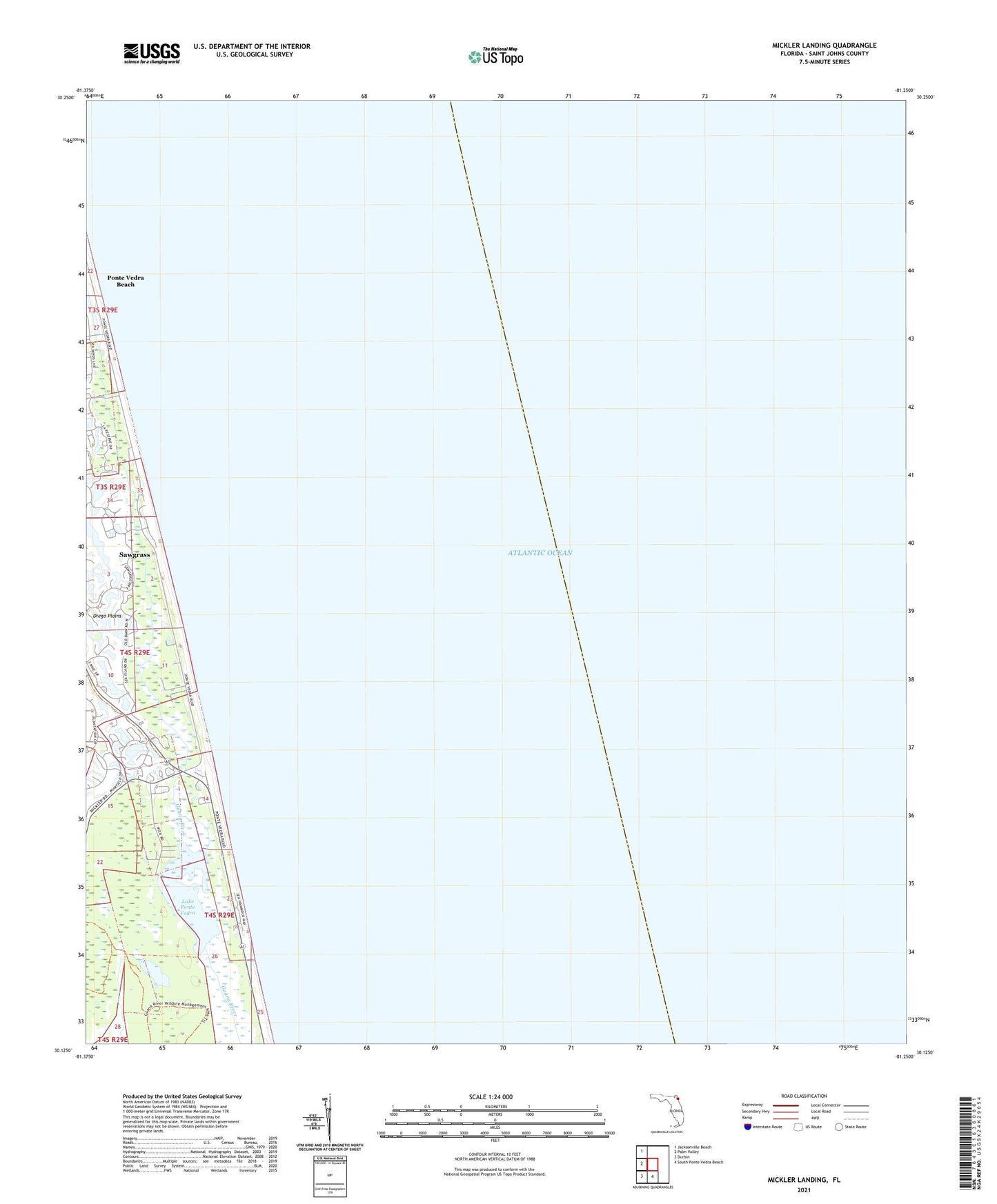
2024 topographic map quadrangle Mickler Landing in the state of Florida. Scale: 1:24000. Based on the newly updated USGS 7.5' US Topo map series, this map is in the following counties: St. Johns. The map contains contour data, water features, and other items you are used to seeing on USGS maps, but also has updated roads and other features. This is the next generation of topographic maps. Printed on high-quality waterproof paper with UV fade-resistant inks.
Quads adjacent to this one:
West: Palm Valley
Northwest: Jacksonville Beach
South: South Ponte Vedra Beach
Southwest: Durbin
This map covers the same area as the classic USGS quad with code o30081b3.
Contains the following named places: Diego Plains, Lake Ponte Vedra, Mickler Landing, Pointe Verdra Village Square, Sawgrass, Sawgrass Census Designated Place, Silver Lakes Recreational Resort and Golf Club, ZIP Code: 32082