MyTopo
South Ponte Vedra Beach Florida US Topo Map
Couldn't load pickup availability
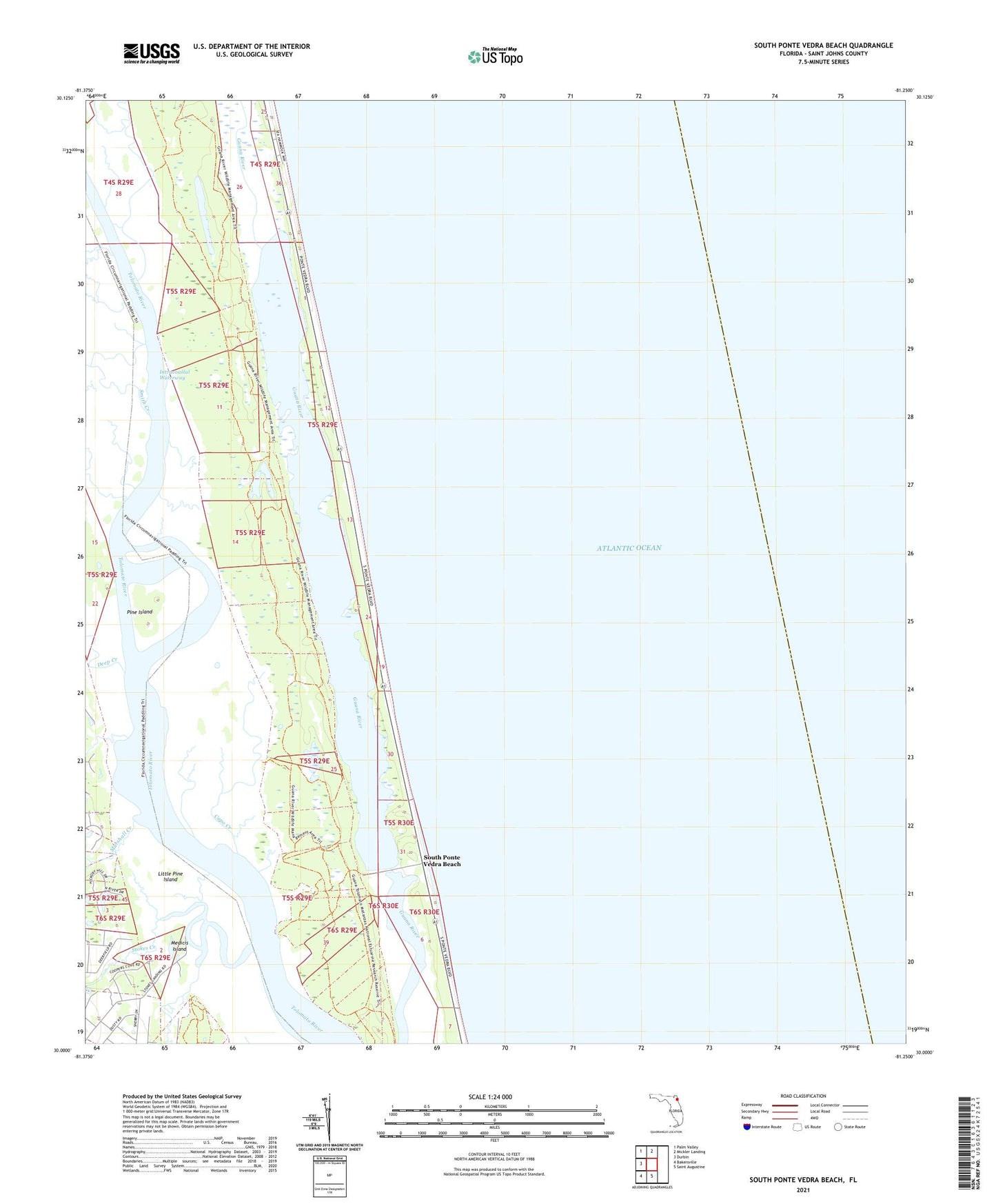
2024 topographic map quadrangle South Ponte Vedra Beach in the state of Florida. Scale: 1:24000. Based on the newly updated USGS 7.5' US Topo map series, this map is in the following counties: St. Johns. The map contains contour data, water features, and other items you are used to seeing on USGS maps, but also has updated roads and other features. This is the next generation of topographic maps. Printed on high-quality waterproof paper with UV fade-resistant inks.
Quads adjacent to this one:
West: Durbin
Northwest: Palm Valley
North: Mickler Landing
South: Saint Augustine
Southwest: Bakersville
This map covers the same area as the classic USGS quad with code o30081a3.
Contains the following named places: Booth Landing, Capo Creek, Cook Landing, Deep Creek, Guana Dam, Guana River State Park, Guano Lake, Little Pine Island, Marshall Creek, Medicis Island, Pine Island, Shell Bluff Landing, Smith Creek, South Ponte Vedra Beach, Spanish Landing, Stokes Creek