MyTopo
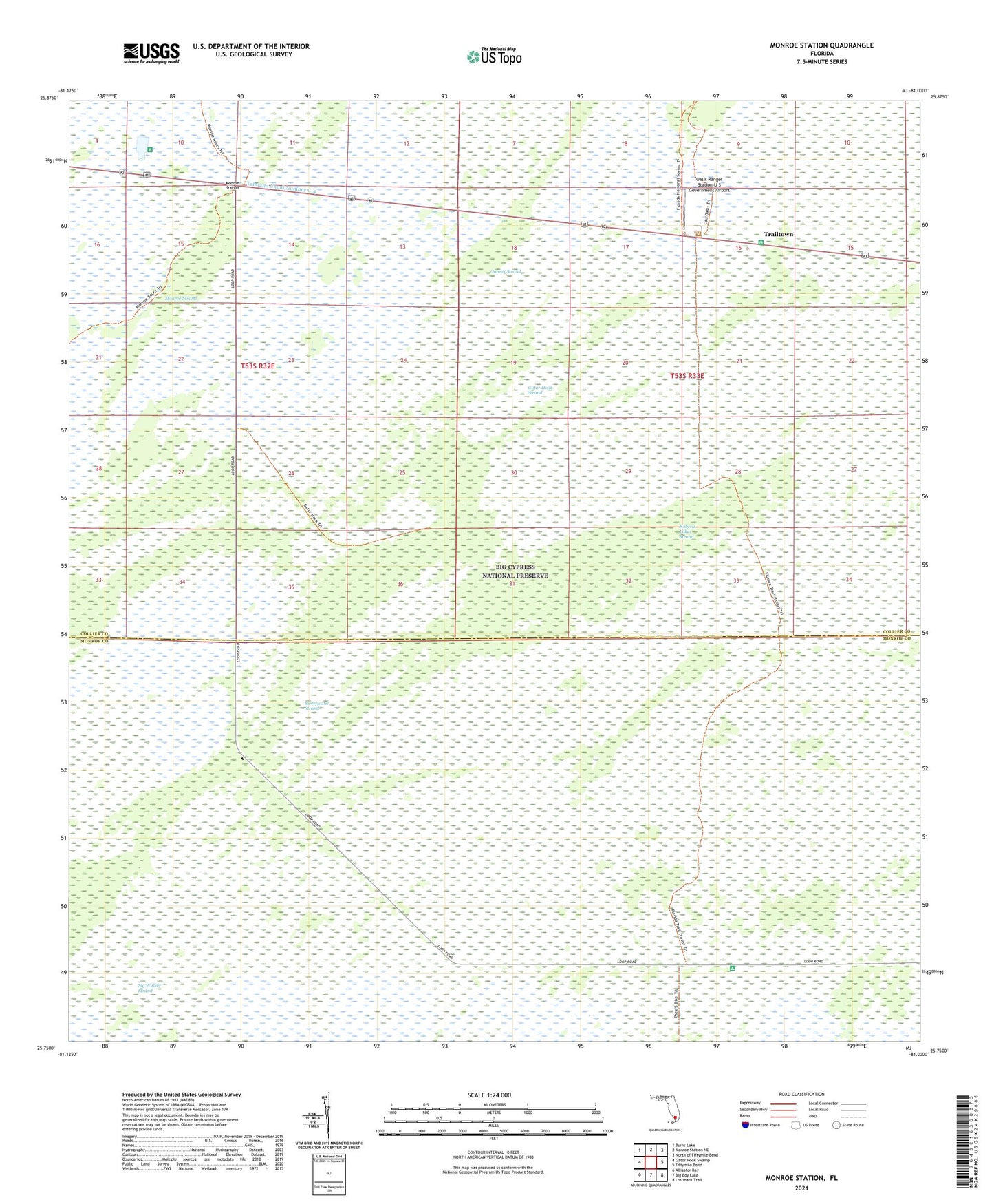
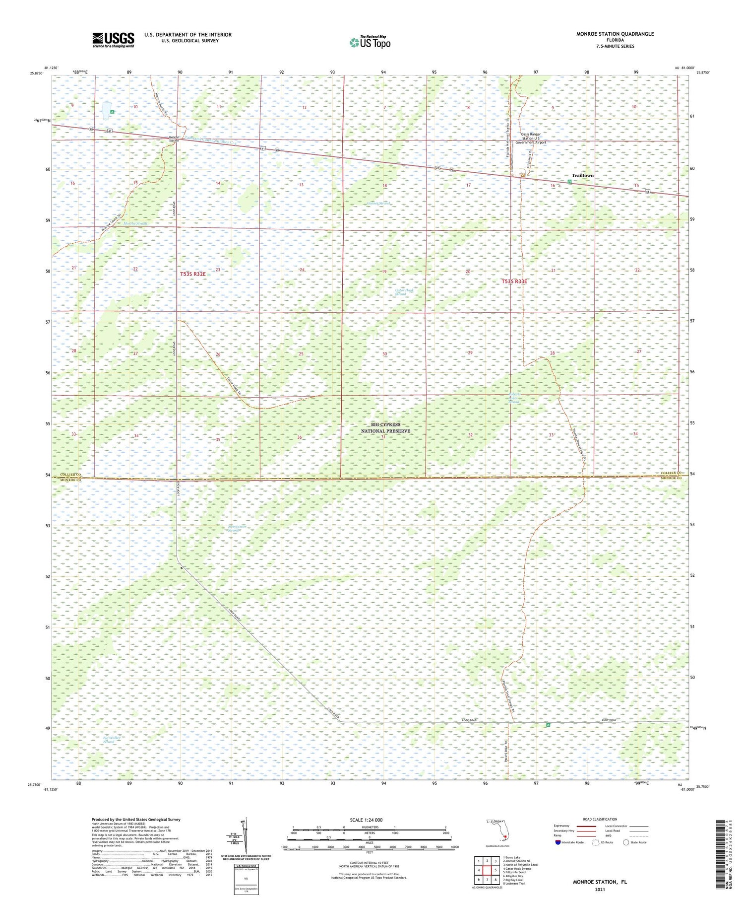
Monroe Station Florida US Topo Map
Couldn't load pickup availability
2024 topographic map quadrangle Monroe Station in the state of Florida. Scale: 1:24000. Based on the newly updated USGS 7.5' US Topo map series, this map is in the following counties: Collier, Monroe. The map contains contour data, water features, and other items you are used to seeing on USGS maps, but also has updated roads and other features. This is the next generation of topographic maps. Printed on high-quality waterproof paper with UV fade-resistant inks.
Quads adjacent to this one:
West: Gator Hook Swamp
Northwest: Burns Lake
North: Monroe Station NE
Northeast: North of Fiftymile Bend
East: Fiftymile Bend
Southeast: Lostmans Trail
South: Big Boy Lake
Southwest: Alligator Bay
This map covers the same area as the classic USGS quad with code o25081g1.
Contains the following named places: Gannet Strand, Gator Hook Strand, Monroe Station, Oasis Ranger Station-U S Government Airport, Roberts Lakes Strand, Sweetwater Strand, Trailtown