MyTopo
North of Fiftymile Bend Florida US Topo Map
Couldn't load pickup availability
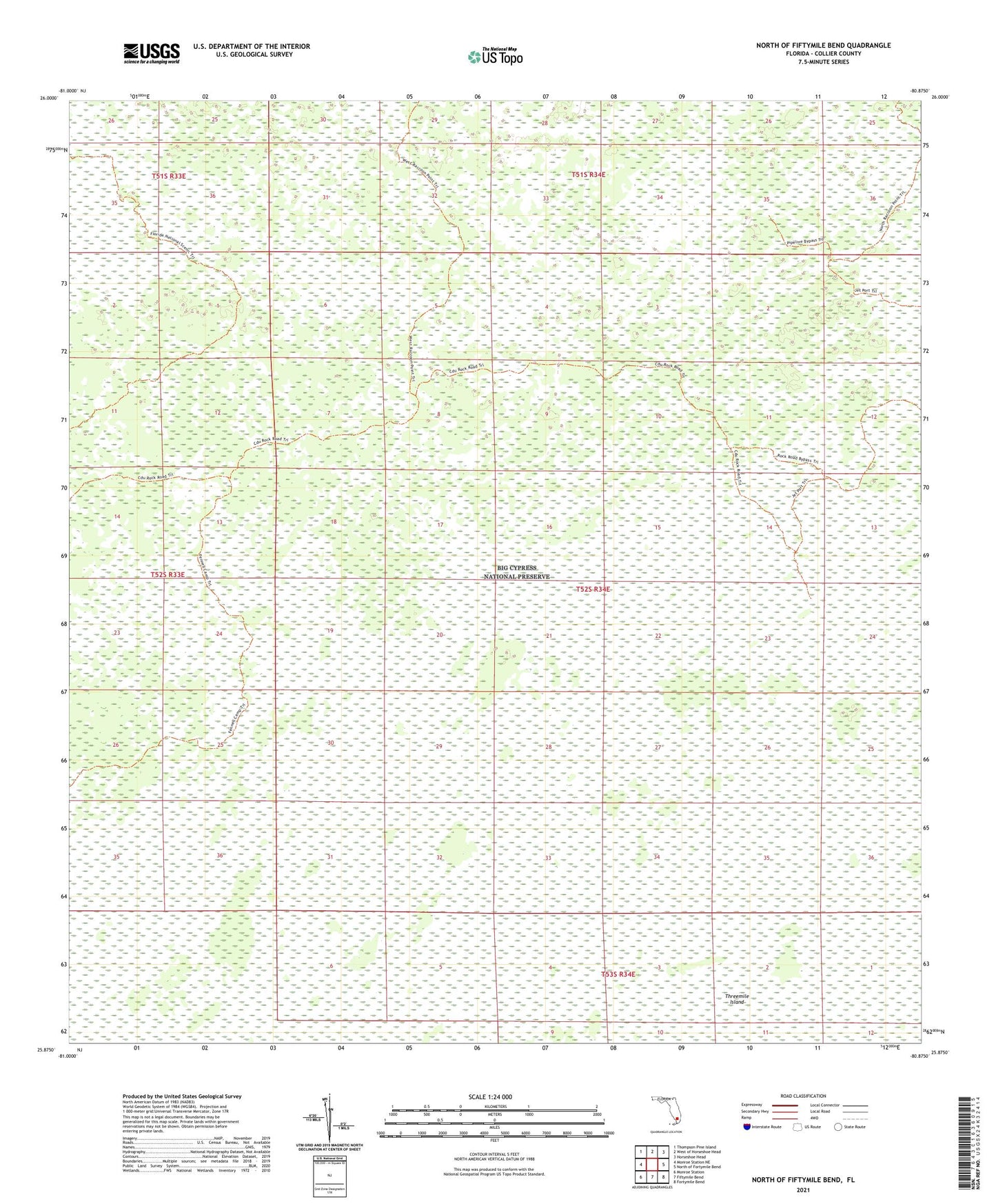
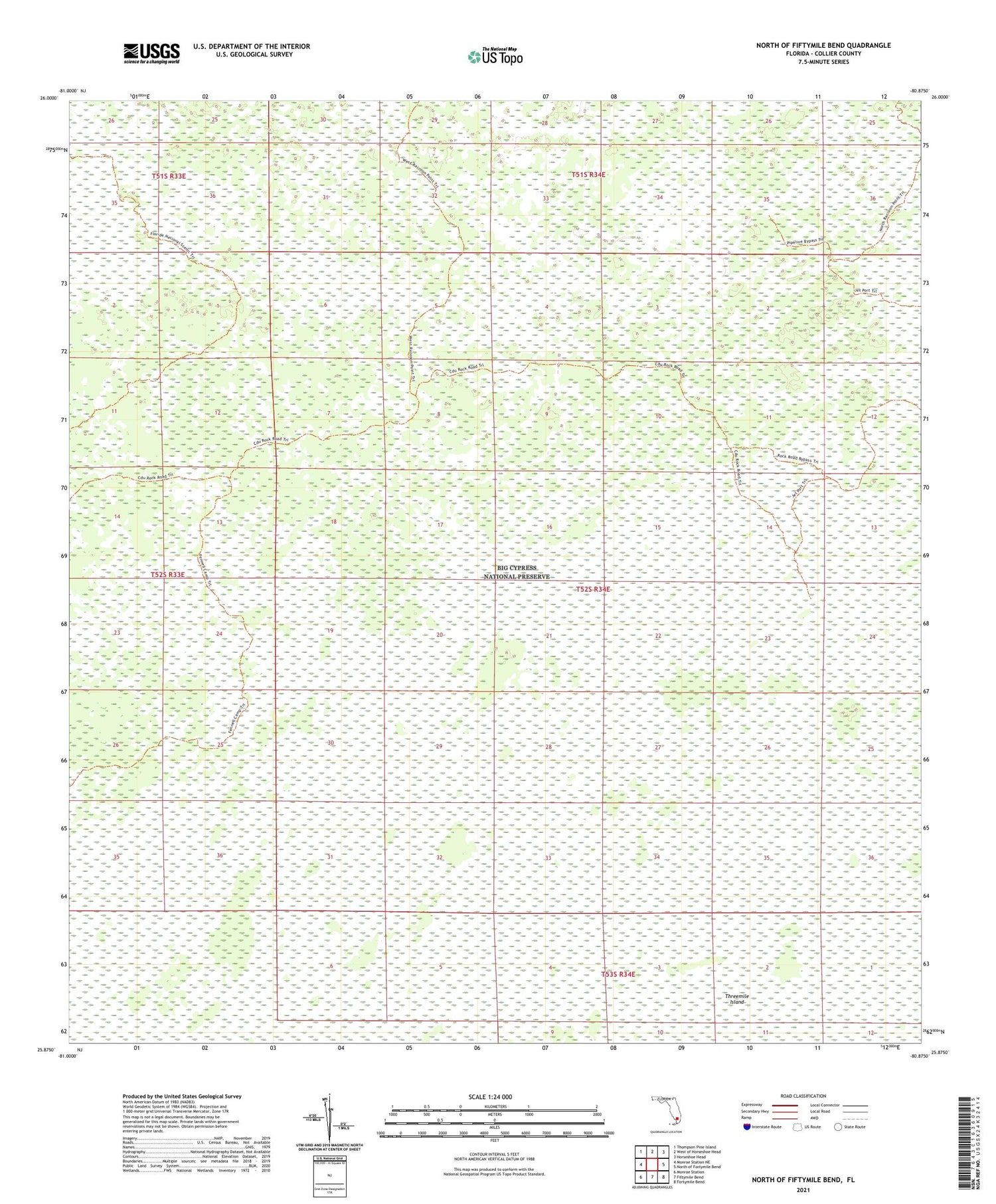
2024 topographic map quadrangle North of Fiftymile Bend in the state of Florida. Scale: 1:24000. Based on the newly updated USGS 7.5' US Topo map series, this map is in the following counties: Collier. The map contains contour data, water features, and other items you are used to seeing on USGS maps, but also has updated roads and other features. This is the next generation of topographic maps. Printed on high-quality waterproof paper with UV fade-resistant inks.
Quads adjacent to this one:
West: Monroe Station NE
Northwest: Thompson Pine Island
North: West of Horseshoe Head
Northeast: Horseshoe Head
East: North of Fortymile Bend
Southeast: Fortymile Bend
South: Fiftymile Bend
Southwest: Monroe Station
This map covers the same area as the classic USGS quad with code o25080h8.
Contains the following named places: Corn Dance Trail, Country Club Plaza, Golden Grades Day School, Lake Katherine Shopping Center, North Dade Detention Center, Overtown Day Care and Neighborhood Center, Threemile Island