MyTopo
Narcoossee NE Florida US Topo Map
Couldn't load pickup availability
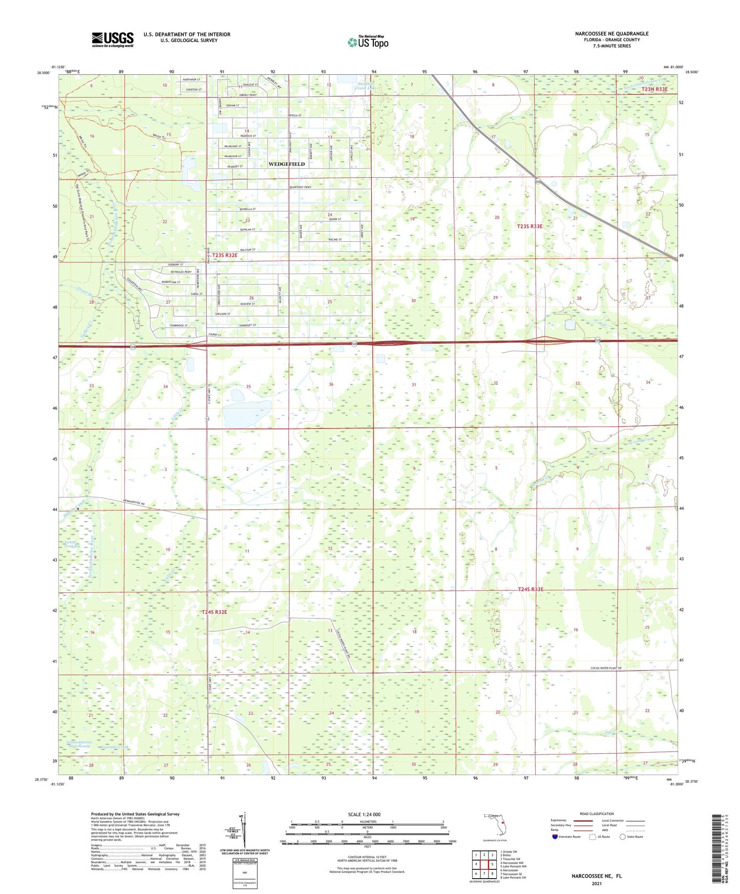
2024 topographic map quadrangle Narcoossee NE in the state of Florida. Scale: 1:24000. Based on the newly updated USGS 7.5' US Topo map series, this map is in the following counties: Orange. The map contains contour data, water features, and other items you are used to seeing on USGS maps, but also has updated roads and other features. This is the next generation of topographic maps. Printed on high-quality waterproof paper with UV fade-resistant inks.
Quads adjacent to this one:
West: Narcoossee NW
Northwest: Oviedo SW
North: Bithlo
Northeast: Titusville SW
East: Lake Poinsett NW
Southeast: Lake Poinsett SW
South: Narcoossee SE
Southwest: Narcoossee
This map covers the same area as the classic USGS quad with code o28081d1.
Contains the following named places: East Orange Division, Green Branch, Haines City Mall, Heart of Florida Centre, Little Creek, Magnolia Fire Tower, Magnolia Ranch, Sandhill Crane Lake, Turkey Creek, Wedgefield, Wedgefield Census Designated Place, Wewahotee, ZIP Code: 32833