MyTopo
Narcoossee NW Florida US Topo Map
Couldn't load pickup availability
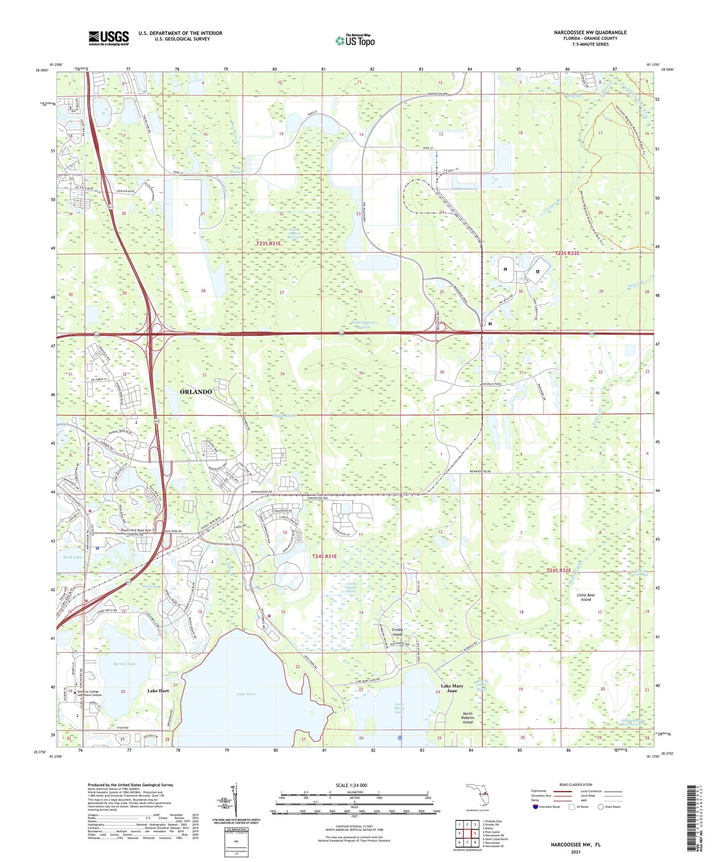
2024 topographic map quadrangle Narcoossee NW in the state of Florida. Scale: 1:24000. Based on the newly updated USGS 7.5' US Topo map series, this map is in the following counties: Orange. The map contains contour data, water features, and other items you are used to seeing on USGS maps, but also has updated roads and other features. This is the next generation of topographic maps. Printed on high-quality waterproof paper with UV fade-resistant inks.
Quads adjacent to this one:
West: Pine Castle
Northwest: Orlando East
North: Oviedo SW
Northeast: Bithlo
East: Narcoossee NE
Southeast: Narcoossee SE
South: Narcoossee
Southwest: Saint Cloud North
This map covers the same area as the classic USGS quad with code o28081d2.
Contains the following named places: Barton Lake, Barton Lake Mobile Home Park, Bay Branch, Boggy Branch, Buck Lake, Cowpen Branch, Crosby Island, Crosby Island Marsh, Disston Canal, Florida Department of Corrections Central Florida Reception Center, Florida Department of Corrections Central Florida Reception Center East Unit, Florida Department of Corrections Central Florida Reception Center South Unit, Haines City Plaza, Hart Branch, Lake Hart, Lake Hart Census Designated Place, Lake Mary Jane Census Designated Place, Little Bear Island, Moss Park, Myrtle Bay, Orange County Fire Rescue Station 76, Orange County Fire Rescue Station 77, Orlando Fire Department Station 15, Orlando Police Department - Lake Nona Community Office, Quail West Golf and Country Club, Roberts Island Slough, Stanton Energy Center, Tala Apopka, Turkey Creek Bay, Whippoorwill Mobile Home Park, Wide Cypress Branch, Wide Cypress Swamp, Yalaka, ZIP Codes: 32829, 32831, 32832