
MyTopo
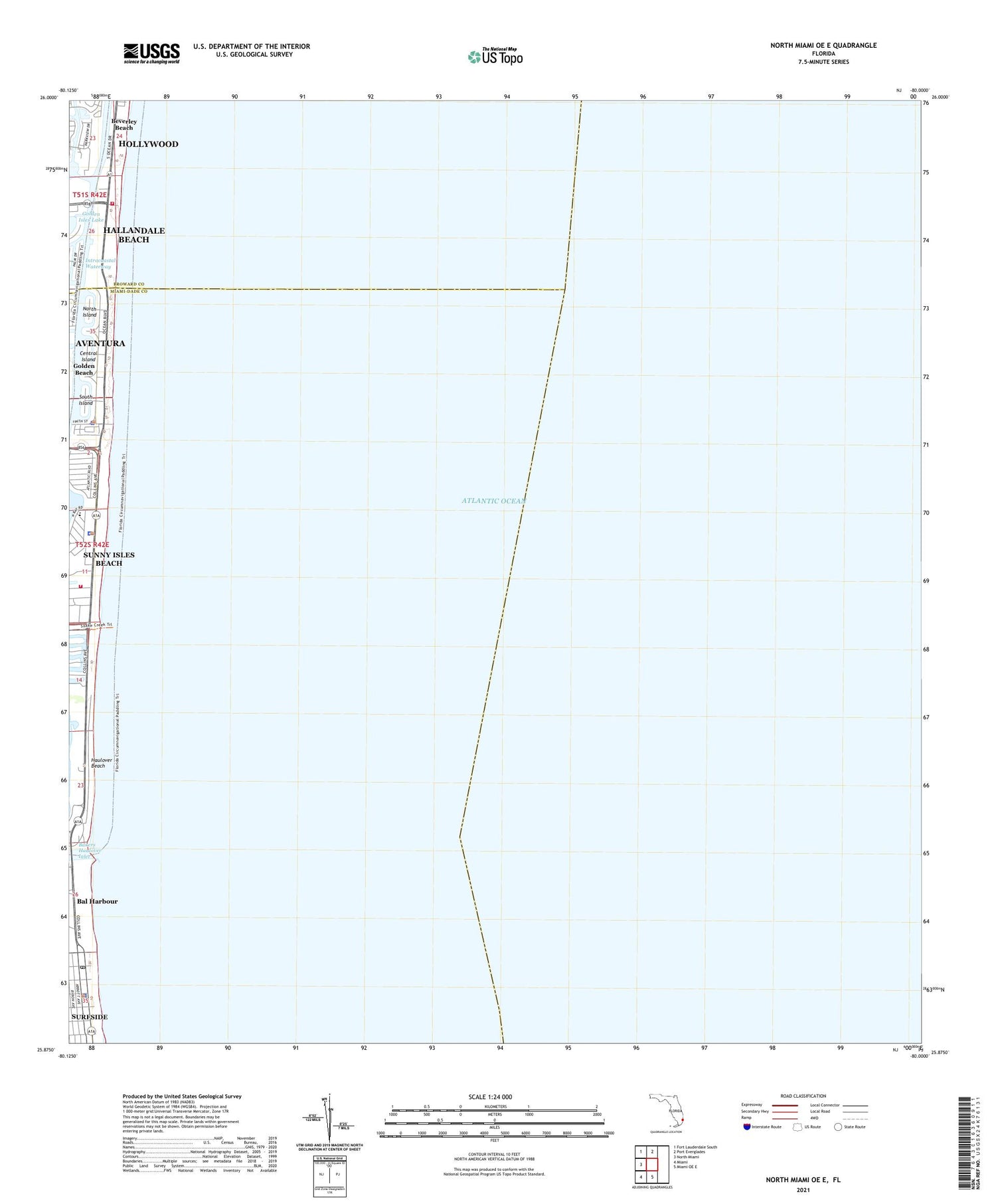
North Miami OE E Florida US Topo Map
Couldn't load pickup availability
2024 topographic map quadrangle North Miami OE E in the state of Florida. Scale: 1:24000. Based on the newly updated USGS 7.5' US Topo map series, this map is in the following counties: Miami-Dade, Broward. The map contains contour data, water features, and other items you are used to seeing on USGS maps, but also has updated roads and other features. This is the next generation of topographic maps. Printed on high-quality waterproof paper with UV fade-resistant inks.
Quads adjacent to this one:
West: North Miami
Northwest: Fort Lauderdale South
North: Port Everglades
South: Miami OE E
Southwest: Miami
Contains the following named places: Bakers Haulover Inlet, Bal Harbor Beach, Bal Harbour Shops, Bal Harbour Village Police Department Patrol Division, Beverley Beach, Care House of Hallandale Beach, Central Island, City of Sunny Isles Beach, Golden Beach, Golden Beach City Hall, Golden Beach Police Department, Hallandale Beach Fire Rescue Station 60, Hallandale Fire Station, Haulover Beach, Haulover Beach Park, Loggia Beach Park, Miami - Dade County Fire Rescue Station 10, North Island, North Park, R K Sunny Isles Plaza, Saint Mary Magdalen Church, Seawalk Pointe Shopping Center, South Island, South Park, Sunny Isle Fishing Pier, Sunny Isles Beach, Sunny Isles Beach Park, Sunny Isles Beach Police Department, Sunny Isles Post Office, Surf-Bal-Bay Library, Surfside Police Department, Surfside Post Office, Surfside Town Hall, Temple Bnai Zion, Town of Golden Beach, Town of Surfside, Village of Bal Harbour, Waterways Shoppes


