MyTopo
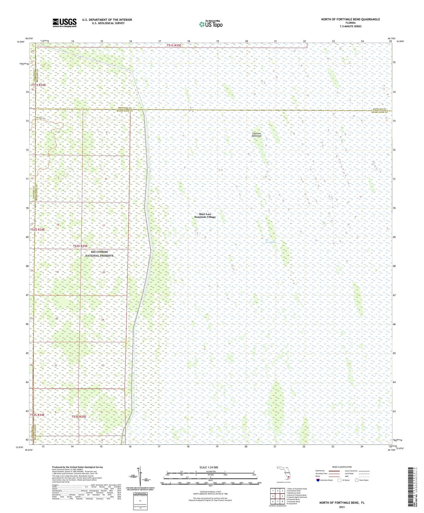
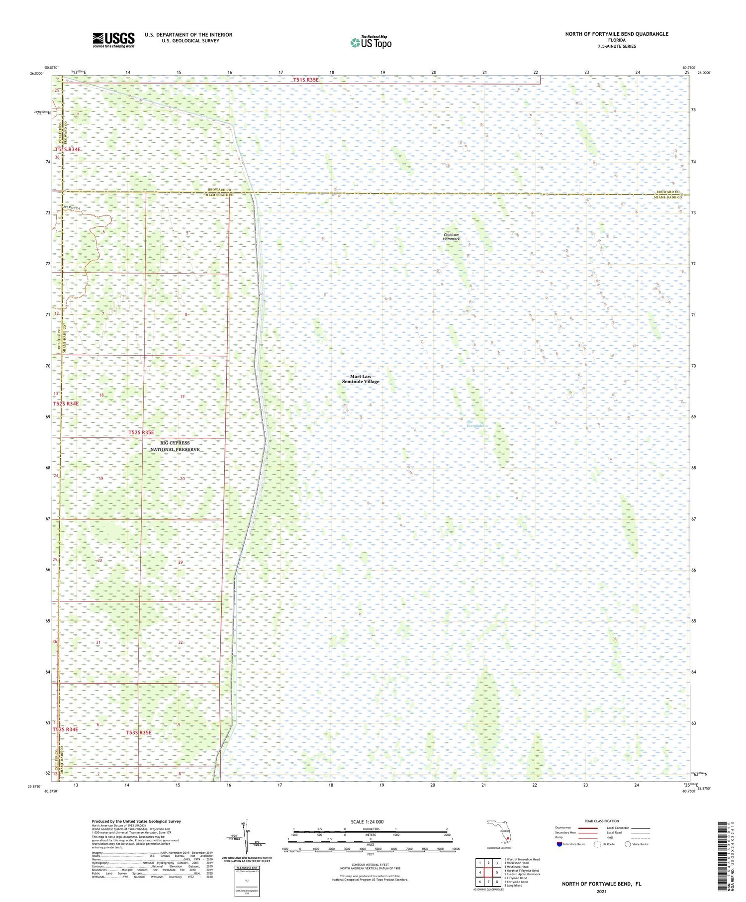
North of Fortymile Bend Florida US Topo Map
Couldn't load pickup availability
2024 topographic map quadrangle North of Fortymile Bend in the state of Florida. Scale: 1:24000. Based on the newly updated USGS 7.5' US Topo map series, this map is in the following counties: Miami-Dade, Broward, Collier. The map contains contour data, water features, and other items you are used to seeing on USGS maps, but also has updated roads and other features. This is the next generation of topographic maps. Printed on high-quality waterproof paper with UV fade-resistant inks.
Quads adjacent to this one:
West: North of Fiftymile Bend
Northwest: West of Horseshoe Head
North: Horseshoe Head
Northeast: Melaleuca Head
East: Custard Apple Hammock
Southeast: Long Island
South: Fortymile Bend
Southwest: Fiftymile Bend
This map covers the same area as the classic USGS quad with code o25080h7.
Contains the following named places: Choctaw Hammock, Levee 28 Tieback, Mart Law Seminole Village, Panther Camp, Sam Franks Old Farm, Sam Willie Seminole Village