MyTopo
Okefenokee Slough Florida US Topo Map
Couldn't load pickup availability
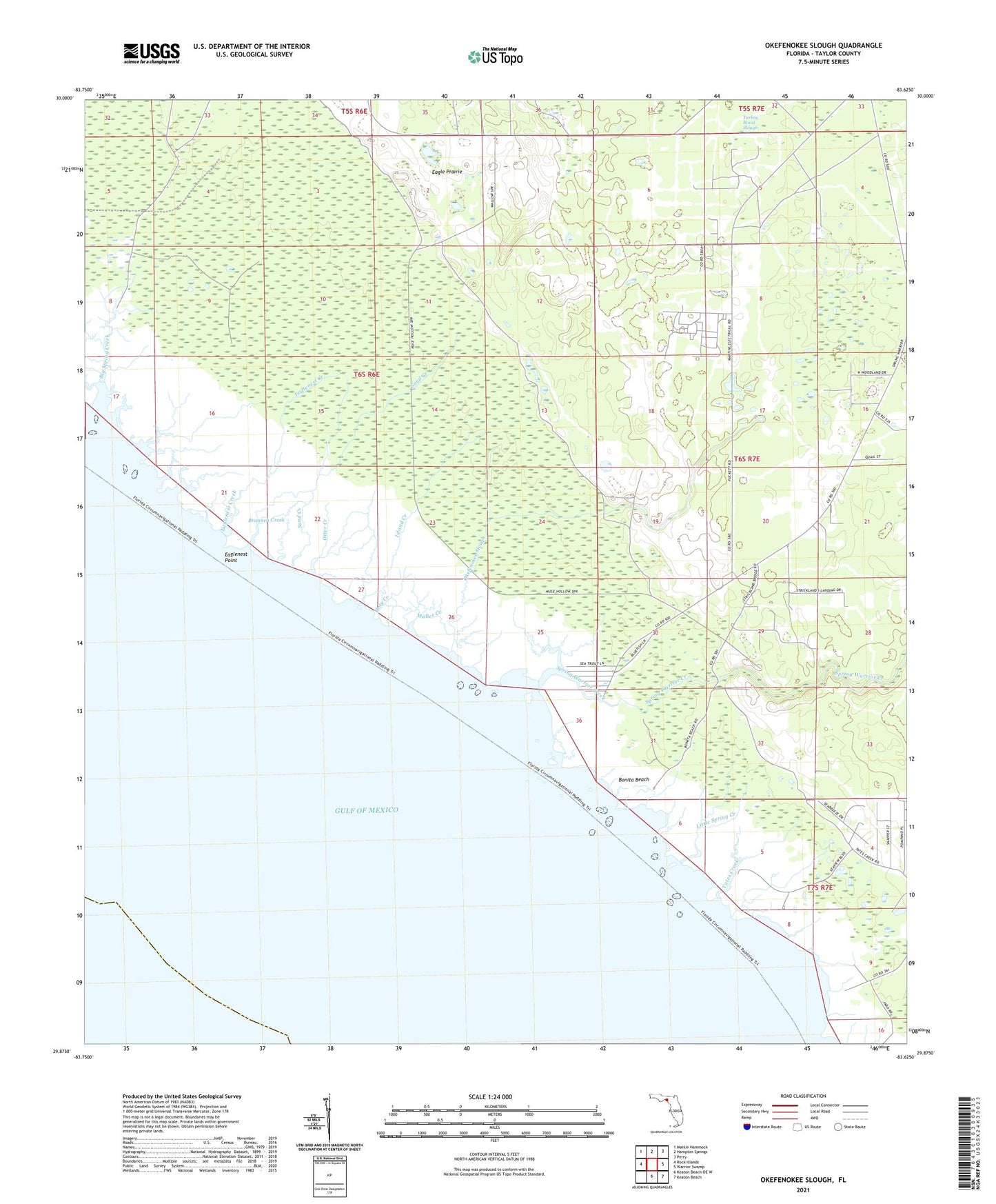
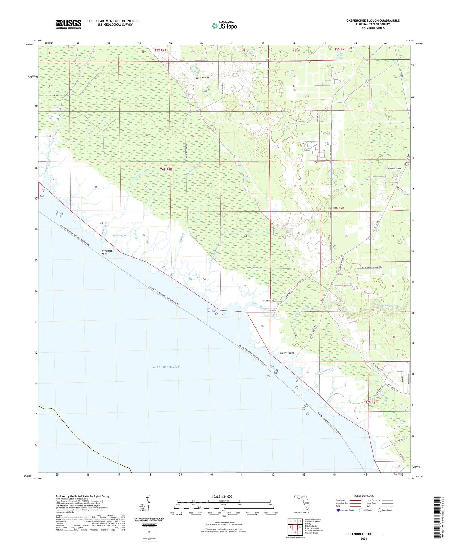
2025 topographic map quadrangle Okefenokee Slough in the state of Florida. Scale: 1:24000. Based on the newly updated USGS 7.5' US Topo map series, this map is in the following counties: Taylor. The map contains contour data, water features, and other items you are used to seeing on USGS maps, but also has updated roads and other features. This is the next generation of topographic maps. Printed on high-quality waterproof paper with UV fade-resistant inks.
Quads adjacent to this one:
West: Rock Islands
Northwest: Manlin Hammock
North: Hampton Springs
Northeast: Perry
East: Warrior Swamp
Southeast: Keaton Beach
South: Keaton Beach OE W
This map covers the same area as the classic USGS quad with code o29083h6.
Contains the following named places: Adams Beach, Big Spring Creek, Bonita Beach, Brannen Creek, Eagle Prairie, Eaglenest Creek, Eaglenest Point, Ezell Camp, Holy Creek, Island Creek, Jabo Camp, Little Spring Creek, Mullet Creek, Okefenokee Slough, Otter Creek, Sand Creek, Spring Warrior Camp, Spring Warrior Creek, Spring Warriors, Taylor County, Turkey Roost Slough, Yates Camp, Yates Creek