
MyTopo
Warrior Swamp Florida US Topo Map
Couldn't load pickup availability
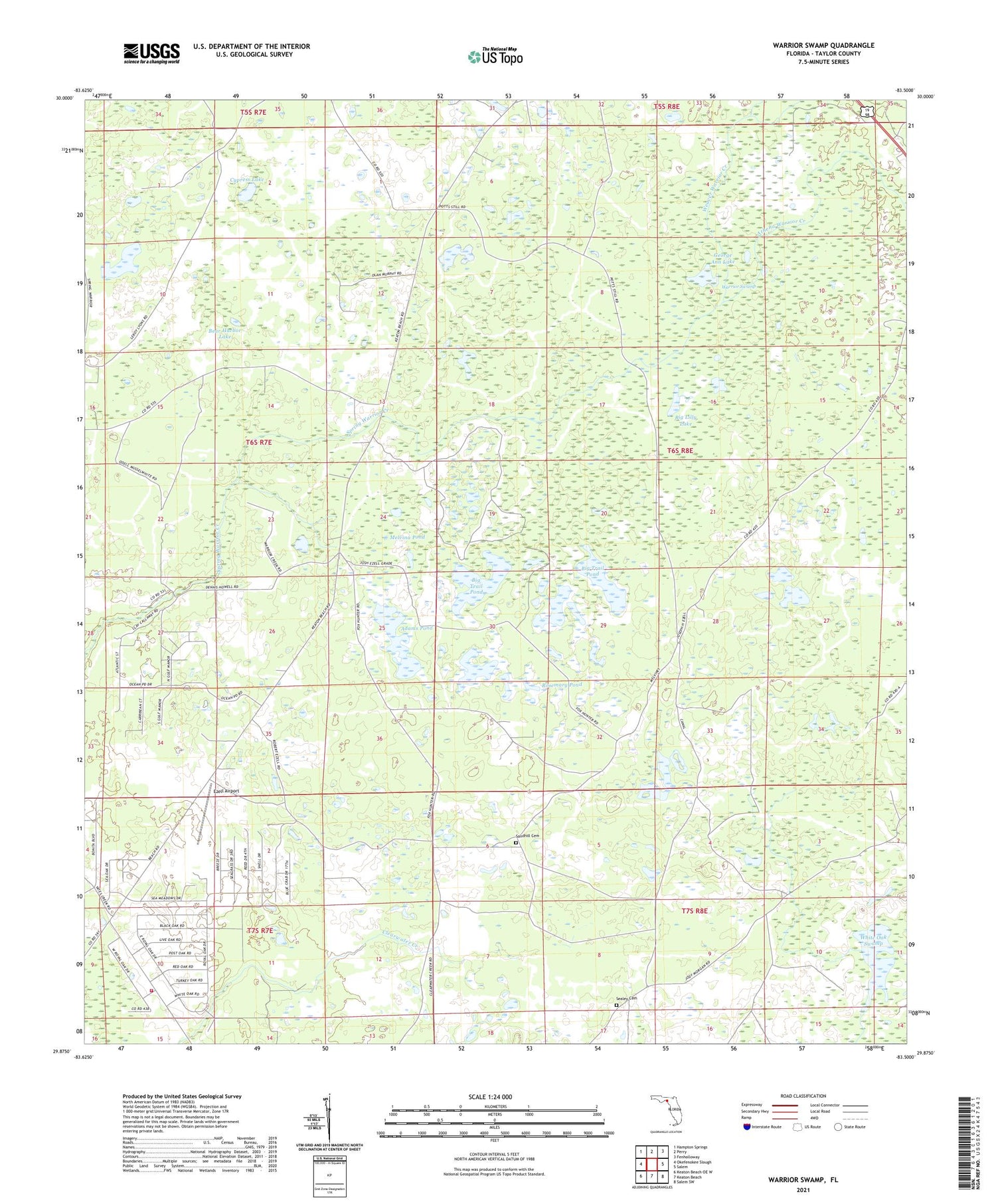
2024 topographic map quadrangle Warrior Swamp in the state of Florida. Scale: 1:24000. Based on the newly updated USGS 7.5' US Topo map series, this map is in the following counties: Taylor. The map contains contour data, water features, and other items you are used to seeing on USGS maps, but also has updated roads and other features. This is the next generation of topographic maps. Printed on high-quality waterproof paper with UV fade-resistant inks.
Quads adjacent to this one:
West: Okefenokee Slough
Northwest: Hampton Springs
North: Perry
Northeast: Fenholloway
East: Salem
Southeast: Salem SW
South: Keaton Beach
Southwest: Keaton Beach OE W
This map covers the same area as the classic USGS quad with code o29083h5.
Contains the following named places: Adams Pond, Athena Warrior Creek, Bear Harbor Lake, Big Lilly Lake, Big Trail Pond, Bird Pond, Clearwater Creek, Cypress Lake, Ezell Airport, George Ann Lake, Huxford Camp, Huxford Lookout Tower, Little Saint John Church, Melvina Pond, Middle Warrior Creek, Rosemary Pond, Sandhill Cemetery, Sealey Cemetery, Taylor County Fire and Rescue Station 6, Warrior Swamp, Weaver Warrior Creek, White Oak Swamp, ZIP Code: 32348


