MyTopo
Pace Florida US Topo Map
Couldn't load pickup availability
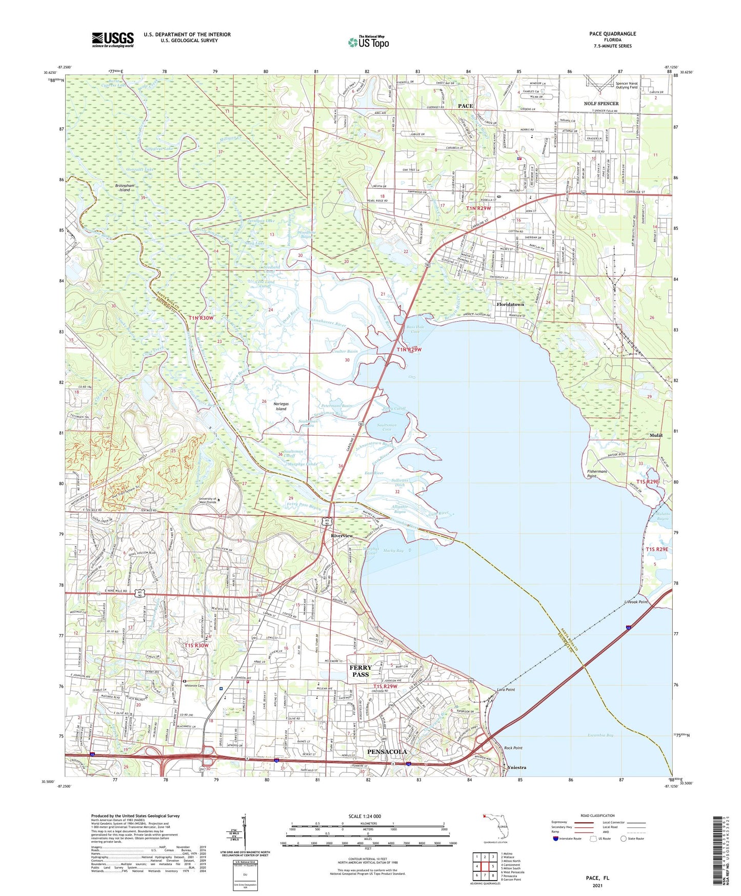
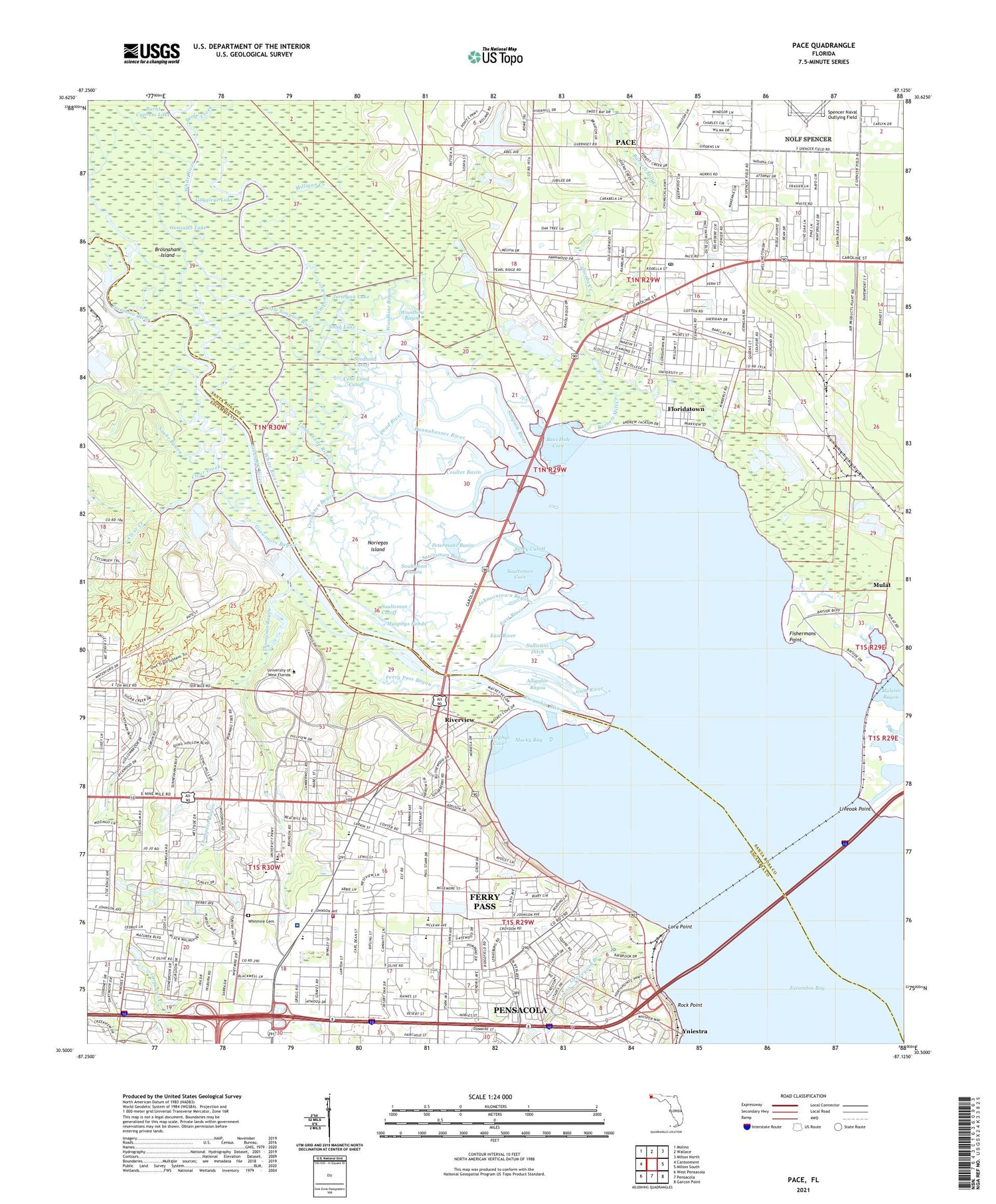
2024 topographic map quadrangle Pace in the state of Florida. Scale: 1:24000. Based on the newly updated USGS 7.5' US Topo map series, this map is in the following counties: Escambia, Santa Rosa. The map contains contour data, water features, and other items you are used to seeing on USGS maps, but also has updated roads and other features. This is the next generation of topographic maps. Printed on high-quality waterproof paper with UV fade-resistant inks.
Quads adjacent to this one:
West: Cantonment
Northwest: Molino
North: Wallace
Northeast: Milton North
East: Milton South
Southeast: Garcon Point
South: Pensacola
Southwest: West Pensacola
This map covers the same area as the classic USGS quad with code o30087e2.
Contains the following named places: Alligator Bayou, Bannahassee River, Barnett Mill Creek, Bass Hole Cove, Beale Creek, Beaver Creek, Bible Church, Boone Lake, Braden Ball Pond One, Brosnaham Island, Buchanan Heliport, Burnt Cypress Lake, Buzzards Lake, Cebe Land Cutoff, Charles Beeler Grant, Chemstrand Pier, Clear Creek, Coulter Basin, Creighton Bayou, Dead River, Eagle Nest, East River, Escambia Bay, Escambia Chapel, Escambia Railroad Station, Escambia River, Escambia River State Wildlife Management Area, Faith Church, Ferry Cutoff, Ferry Pass, Ferry Pass Bayou, Ferry Pass Census Designated Place, Ferry Pass Church, Ferry Pass Elementary School, Ferry Pass Middle School, Ferry Pass Volunteer Fire Department Station 7, First Baptist Church of Pace, Fishermans Point, Floridatown, Floridatown Census Designated Place, Goggleye Lake, Gonzalez Lake, Governors Bayou, Grace Church, Graveyard Branch, Gum River, Hillcrest Church, Jacobs Creek, James Wilkins Grant, Jernigan Lake, John C Pace Library, Johnsontown Bayou, Juan Inerarity Grant, Kinder Care Learning Center, Lakeview Center, Lawton Road Church, Little Simpson River, Little White River, Liveoak Point, Lora Point, Macky Bay, Metropolitan Church, Milligan Creek, Mulat Census Designated Place, Murphys Cove, Murphys Ponds, Nativity Church, Naval Air Station Ellyson Field, New Macedonia Church, Noriegas Island, Olive Church, Pace, Pace Census Designated Place, Pace High School, Pace Volunteer Fire Department Station 1, Petermans Basin, Riverview, Rock Point, Rocky Creek, S S Dixon Elementary School, Salvador Ramiez Grant, Santa Rosa County Sheriff's Office - District 3 Pace, Saultsman Bayou, Saultsman Cove, Saultsman Cutoff, Scenic Hills Church, Scenic Hills Country Club, Seedland Cutoff, Shinney Creek, Simpson River, Snag Lake, Snake Bayou, Sullivans Ditch, The Wye, The X, Thompson Bayou, University Church, University of West Florida, University of West Florida Police Department, West Florida Hospital, West Florida Regional Medical Center Heliport, White River, Whitmire Cemetery, Woodbine Bayou, Woodbine Springs Lake, Yniestra, ZIP Code: 32514