MyTopo
Garcon Point Florida US Topo Map
Couldn't load pickup availability
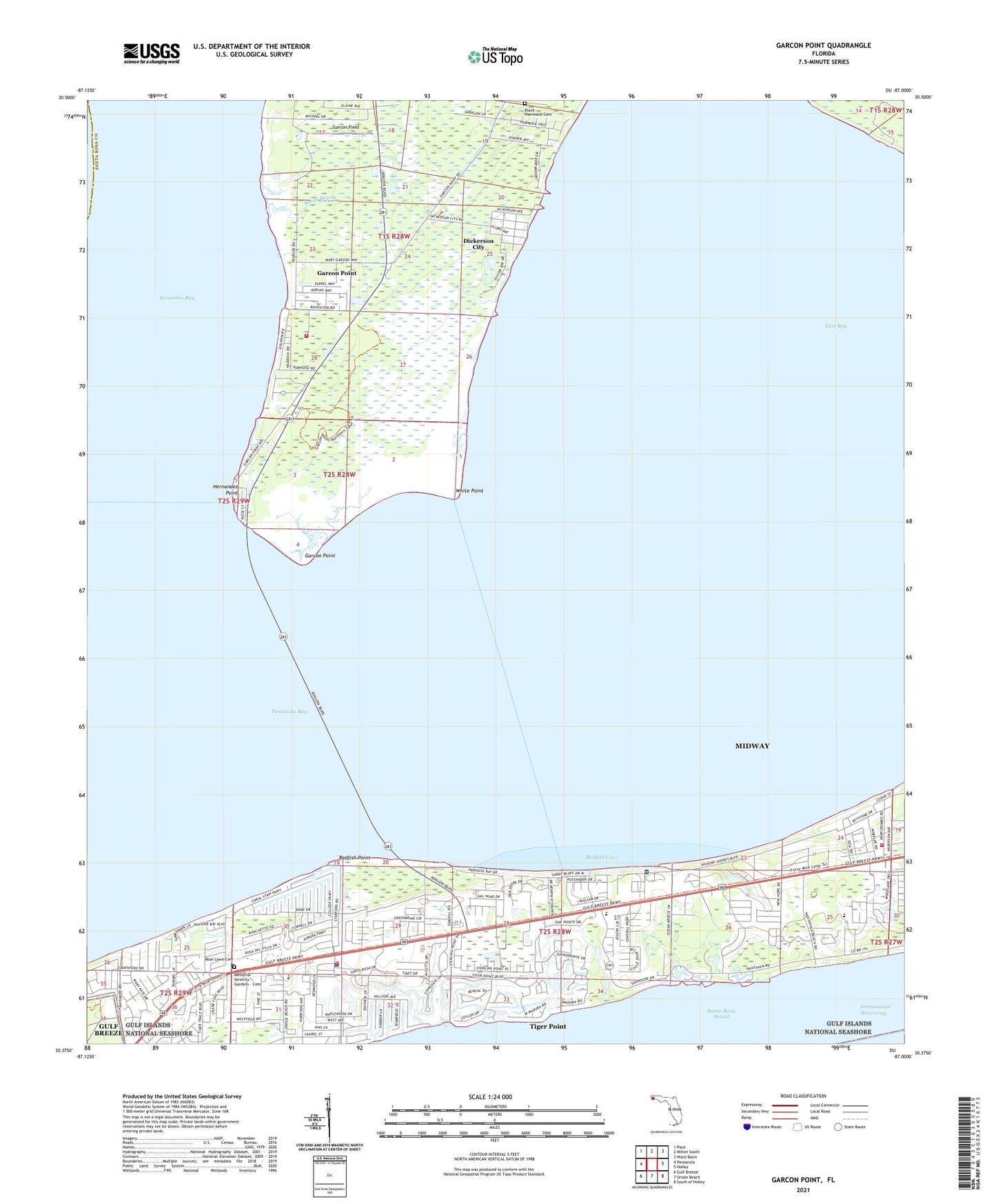
2024 topographic map quadrangle Garcon Point in the state of Florida. Scale: 1:24000. Based on the newly updated USGS 7.5' US Topo map series, this map is in the following counties: Santa Rosa, Escambia. The map contains contour data, water features, and other items you are used to seeing on USGS maps, but also has updated roads and other features. This is the next generation of topographic maps. Printed on high-quality waterproof paper with UV fade-resistant inks.
Quads adjacent to this one:
West: Pensacola
Northwest: Pace
North: Milton South
Northeast: Ward Basin
East: Holley
Southeast: South of Holley
South: Oriole Beach
Southwest: Gulf Breeze
This map covers the same area as the classic USGS quad with code o30087d1.
Contains the following named places: Avalon Mulat Volunteer Fire Department Substation 12, Basin Bayou, Black Hammock Cemetery, Dickerson City, Dickerson City Census Designated Place, East Bay, Garcon Field, Garcon Point, Garcon Point Census Designated Place, Hernandez Point, Memorial Serenity Gardens - Cemetery, Midway Census Designated Place, Midway Division, Midway Fire District Station 35, Midway Fire District Station 37, Redfish Cove, Redfish Point, Rose Lawn Cemetery, Saint Pauls Church, Santa Rosa County Sheriff's Office - District 1 Gulf Breeze, The Friary of Lakeview Center, Tiger Point, Tiger Point Census Designated Place, WBND-AM (Pensacola Beach), White Point, Wilson Memorial Church, WRNE-AM (Gulf Breeze), ZIP Code: 32563